Category:Drumburgh
Jump to navigation
Jump to search
village in United Kingdom  | |||||
| Upload media | |||||
| Instance of | |||||
|---|---|---|---|---|---|
| Location | Bowness, Allerdale, Cumbria, North West England, England | ||||
| Located in or next to body of water | |||||
 | |||||
Media in category "Drumburgh"
The following 40 files are in this category, out of 40 total.
-
 Bog pool - geograph.org.uk - 808972.jpg 640 × 480; 368 KB
-
 BP Kastell Drumburgh.png 1,392 × 1,435; 253 KB
-
 Chalybeate Well - geograph.org.uk - 5732.jpg 640 × 480; 116 KB
-
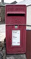 Close up, Elizabeth II postbox, Drumburgh - geograph.org.uk - 4974452.jpg 1,504 × 2,848; 796 KB
-
 Drumburgh - geograph.org.uk - 4204214.jpg 1,557 × 2,848; 1,021 KB
-
 Drumburgh looking east - geograph.org.uk - 2180577.jpg 1,024 × 768; 130 KB
-
 Drumburgh neighbourhood watch - geograph.org.uk - 913417.jpg 640 × 479; 372 KB
-
 Drumburgh station site geograph-3420443-by-Ben-Brooksbank.jpg 2,351 × 1,287; 3.83 MB
-
 Drumburgh village - geograph.org.uk - 3492245.jpg 2,592 × 1,944; 1.57 MB
-
 Eastern end of Drumburgh Village - geograph.org.uk - 912716.jpg 640 × 480; 272 KB
-
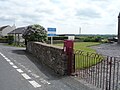 Elizabeth II postbox, Drumburgh - geograph.org.uk - 4974449.jpg 640 × 480; 74 KB
-
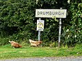
 Entering Drumburgh - geograph.org.uk - 2001461.jpg 1,200 × 1,600; 516 KB
-
 Entering Drumburgh - geograph.org.uk - 2884741.jpg 800 × 600; 94 KB
-
 Entering Drumburgh - geograph.org.uk - 4972253.jpg 640 × 480; 63 KB
-
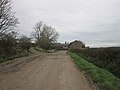
 Farm buildings, Drumburgh - geograph.org.uk - 4972252.jpg 640 × 466; 41 KB
-

-
 Hadrianswall Drumburgh.png 1,539 × 1,351; 352 KB
-
 House in Drumburgh - geograph.org.uk - 4974458.jpg 640 × 480; 67 KB
-
 Houses, Drumburgh - geograph.org.uk - 4972572.jpg 640 × 480; 64 KB
-
 Laal Bite, Drumburgh - geograph.org.uk - 933231.jpg 640 × 480; 72 KB
-
 Landscape - panoramio (8).jpg 3,648 × 2,736; 3.59 MB
-
 National Cycle Route 72, Drumburgh - geograph.org.uk - 4972576.jpg 640 × 480; 56 KB
-
 Römische Inschriften Drumburgh.png 389 × 732; 159 KB
-
 Sheep in Farmland - geograph.org.uk - 118261.jpg 640 × 480; 125 KB
-
 Walker House Farm, near Drumburgh - geograph.org.uk - 933225.jpg 640 × 480; 108 KB
-
 Walking east at Drumburgh - geograph.org.uk - 2884782.jpg 800 × 600; 83 KB
-
 Walking east towards Burgh by Sands - geograph.org.uk - 2884831.jpg 800 × 600; 81 KB
-
 Bridleway to Woods - geograph.org.uk - 118268.jpg 640 × 480; 157 KB
-
 Drumburgh - geograph.org.uk - 19293.jpg 480 × 640; 74 KB
-
 Drumburgh Moss National Nature Reserve - geograph.org.uk - 686732.jpg 640 × 477; 331 KB
-
 Eastonbridge Cottage - geograph.org.uk - 172134.jpg 640 × 480; 66 KB
-
 Grass Dyke - geograph.org.uk - 171865.jpg 640 × 480; 197 KB
-
 Highfield Farm - geograph.org.uk - 171866.jpg 640 × 480; 210 KB
-
 Line of former canal and railway - geograph.org.uk - 733416.jpg 640 × 480; 297 KB
-
 Livestock pen at Boustead Hill - geograph.org.uk - 206489.jpg 640 × 480; 76 KB
-
 Moss Cottage, Drumburgh - geograph.org.uk - 687403.jpg 640 × 480; 354 KB
-
 Muddy track - geograph.org.uk - 291902.jpg 640 × 480; 222 KB
-
 New Barns, Haverlands - geograph.org.uk - 118277.jpg 640 × 480; 111 KB
-
 Stream - geograph.org.uk - 118258.jpg 480 × 640; 127 KB
-
 Wormanby Farm - geograph.org.uk - 173638.jpg 640 × 480; 218 KB


.jpg)


