Category:Drymen
Jump to navigation
Jump to search
village in Stirling, Scotland, UK  | |||||
| Upload media | |||||
| Instance of | |||||
|---|---|---|---|---|---|
| Location |
| ||||
| Population |
| ||||
 | |||||
Deutsch: Drymen ( schottisch-gälisch: Druiminn) ist ein Dorf mit etwa 760 Einwohnern (Schätzung 2004) im Verwaltungsbezirk Stirling in Schottland. Es liegt westlich der Campsie Fells mit Blick auf den Ben Goyne im Osten und Loch Lomond im Westen. Der Queen Elizabeth Forest Park reicht bis an das Dorf. Das gesamte Gebiet ist Teil des Loch Lomond & Trossachs National Park, dem ersten Nationalpark Schottlands.
English: Drymen is a village in Stirling district in central Scotland. Drymen lies to the west of the Campsie Fells and enjoys views to Dumgoyne on the east and to Loch Lomond on the west. The Queen Elizabeth Forest reaches down to the village edge, and the whole area is part of the Loch Lomond and the Trossachs National Park (the first National Park in Scotland).
Gàidhlig: 'S e baile ann an Siorrachd Aonghais a tha ann an Druiminn (Beurla: Drymen). Tha am baile gu lèir suidhichte ann am Pàirc Nàiseanta Loch Laomainn agus nan Tròsaichean. 'S e seo na co-chomharran aige: 56° 3′ 53.86″ Tuath agus 4° 27′ 3.85″ Iar.
Polski: Drymen ( gael. Baile MoThatha) - rolnicza wieś w Szkocji, położona w pobliżu jeziora Loch Lomond, oraz wzgórza Conic Hill.
Simple English: Drymen is a village in Stirling district in central Scotland. Drymen lies to the west of the Campsie Fells and enjoys views to Dumgoyne on the east and to Loch Lomond on the west. The Queen Elizabeth Forest reaches down to the village edge, and the whole area is part of the Loch Lomond and the Trossachs National Park (the first National Park in Scotland).

Subcategories
This category has the following 5 subcategories, out of 5 total.
B
- Balfunning Estate (12 F)
- Buchanan Smithy (8 F)
G
- Garadhban Forest (8 F)
K
- Kilmaronock church (16 F)
Media in category "Drymen"
The following 87 files are in this category, out of 87 total.
-
 Approaching Drymen Bridge - geograph.org.uk - 3066804.jpg 640 × 397; 59 KB
-
 Badshalloch - geograph.org.uk - 4003055.jpg 640 × 480; 72 KB
-
 Birds - geograph.org.uk - 250369.jpg 640 × 478; 65 KB
-
 Campsite at Easter Drumquhassle Farm - geograph.org.uk - 1163467.jpg 640 × 480; 87 KB
-
 Catter Wood - geograph.org.uk - 1915404.jpg 640 × 480; 173 KB
-
 Charles Crescent, Drymen - geograph.org.uk - 828452.jpg 640 × 480; 73 KB
-
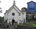 Church of Scotland, Drymen.jpg 640 × 511; 60 KB
-
 Druiminn (15307796683).jpg 5,184 × 3,323; 20.58 MB
-
 Drumbeg - geograph.org.uk - 9909.jpg 640 × 449; 77 KB
-
 Drymen Bridge - geograph.org.uk - 171158.jpg 640 × 480; 81 KB
-
 Drymen Bridge from the south - geograph.org.uk - 4419938.jpg 640 × 480; 68 KB
-
 Drymen Church Door - geograph.org.uk - 2909467.jpg 640 × 852; 851 KB
-
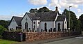 Drymen Kirk, Main Street, Stirling District.jpg 3,606 × 1,908; 1.27 MB
-
 Drymen Primary School - geograph.org.uk - 809097.jpg 640 × 481; 62 KB
-
 Drymen Village Hall - geograph.org.uk - 2910771.jpg 480 × 640; 493 KB
-
 Drymen Village Shop and Post Office - geograph.org.uk - 809095.jpg 640 × 481; 84 KB
-
 Drymen War Memorial Dedication - geograph.org.uk - 2909422.jpg 640 × 852; 937 KB
-
 Drymen War Memorial, West Dunbartonshire.jpg 3,519 × 2,151; 1.38 MB
-
 Drymen, Badshalloch Farm - geograph.org.uk - 190759.jpg 640 × 480; 63 KB
-
 Drymen, Road from Buchanan Old House - geograph.org.uk - 190748.jpg 640 × 480; 128 KB
-

-
 Front face of the Winnock - geograph.org.uk - 828466.jpg 640 × 480; 85 KB
-
 Gartmore Road leading towards Drymen - geograph.org.uk - 79080.jpg 640 × 480; 167 KB
-
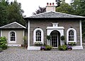 Gate Lodge - geograph.org.uk - 250459.jpg 640 × 466; 82 KB
-
 Hay meadow, Kilmarnock House - geograph.org.uk - 1915416.jpg 640 × 359; 70 KB
-
 It's great outdoors - geograph.org.uk - 250394.jpg 640 × 471; 60 KB
-
 National Cycle Route No. 7 - geograph.org.uk - 201539.jpg 640 × 480; 82 KB
-
 New housing at Oakwoods - geograph.org.uk - 3066796.jpg 640 × 435; 97 KB
-
 Old Gartmore Road - geograph.org.uk - 828462.jpg 640 × 480; 79 KB
-
 Stirling Road, Drymen - geograph.org.uk - 828444.jpg 640 × 480; 82 KB
-
 The Clachan, Drymen - geograph.org.uk - 828451.jpg 640 × 480; 68 KB
-
 The Clachan, Drymen.jpg 640 × 480; 100 KB
-
 The Square, Drymen - geograph.org.uk - 828475.jpg 640 × 480; 98 KB
-
 The Square, Drymen.jpg 640 × 215; 25 KB
-
 The West Highland Way near Drymen - geograph.org.uk - 108124.jpg 465 × 640; 186 KB
-
 The Winnock Hotel - geograph.org.uk - 828435.jpg 640 × 480; 67 KB
-
 The Winnock, Drymen - geograph.org.uk - 6110995.jpg 1,600 × 885; 307 KB
-

-
 West Highland Way in Garadhban Forest - geograph.org.uk - 79100.jpg 640 × 480; 152 KB
-
 West Highland Way Obstruction - geograph.org.uk - 152557.jpg 480 × 640; 162 KB
-
 Winnock Hotel Drymen - geograph.org.uk - 756745.jpg 640 × 437; 80 KB
-
 A glimpse of gorse through the trees - geograph.org.uk - 809068.jpg 640 × 480; 119 KB
-
 Balmaha Road from the Winnock - geograph.org.uk - 828472.jpg 640 × 480; 88 KB
-
 Bat a' charchel Scottish power tower - geograph.org.uk - 41316.jpg 396 × 600; 107 KB
-
 Bends in road - geograph.org.uk - 375392.jpg 640 × 480; 139 KB
-
 Braeside, Drymen - geograph.org.uk - 250330.jpg 640 × 479; 54 KB
-
 Bridge over the Endrick Water - geograph.org.uk - 280433.jpg 640 × 480; 106 KB
-
 Buchanan Arms, Drymen - geograph.org.uk - 250461.jpg 640 × 479; 68 KB
-
 Cairnlea - geograph.org.uk - 152572.jpg 640 × 480; 144 KB
-
 Clear felling near Green Burn - geograph.org.uk - 461142.jpg 640 × 480; 96 KB
-
 Croftamie, Shandon Farm - geograph.org.uk - 171155.jpg 640 × 480; 120 KB
-

-
 Drymen - geograph.org.uk - 250376.jpg 640 × 479; 58 KB
-
 Drymen - geograph.org.uk - 250489.jpg 640 × 479; 50 KB
-
 Drymen Church Hall - geograph.org.uk - 250393.jpg 640 × 479; 57 KB
-
 Drymen Church of Scotland interior - geograph.org.uk - 250390.jpg 640 × 467; 52 KB
-
 Drymen Pottery Inn - geograph.org.uk - 89079.jpg 640 × 480; 137 KB
-
 Drymen Village Hall - geograph.org.uk - 250396.jpg 640 × 479; 52 KB
-
 Drymen, Buchanan Golf Course - geograph.org.uk - 190519.jpg 640 × 480; 73 KB
-
 Drymen, Buchanan Golf Course - geograph.org.uk - 190520.jpg 640 × 480; 123 KB
-
 Drymen, Corrievern Kennels - geograph.org.uk - 190767.jpg 640 × 480; 104 KB
-
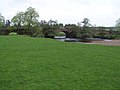
 Drymen, Endrick Water from the Bridge - geograph.org.uk - 171161.jpg 640 × 480; 143 KB
-
 Drymen, Tangier Shandon Farm - geograph.org.uk - 171163.jpg 640 × 480; 78 KB
-
 Drymen, The Buchanan Arms Hotel - geograph.org.uk - 89078.jpg 640 × 480; 110 KB
-
 Drymen, Viewpoint - geograph.org.uk - 171602.jpg 640 × 480; 54 KB
-
 Elmbank B and B, Drymen - geograph.org.uk - 250391.jpg 640 × 508; 68 KB
-
 Farm at Drymen - geograph.org.uk - 250451.jpg 640 × 479; 77 KB
-
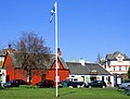 Flagpole,Drymen - geograph.org.uk - 435106.jpg 640 × 487; 118 KB
-
 Forest Felling Near Drymen - geograph.org.uk - 152563.jpg 640 × 480; 145 KB
-
 Low Water - geograph.org.uk - 435089.jpg 640 × 426; 90 KB
-
 Main Street, Drymen - geograph.org.uk - 250368.jpg 640 × 479; 66 KB
-
 Moor Park - geograph.org.uk - 201547.jpg 640 × 480; 71 KB
-
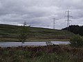 Muir Park Reservoir - geograph.org.uk - 201542.jpg 640 × 480; 67 KB
-
 Pub and Shop, Drymen - geograph.org.uk - 250336.jpg 640 × 427; 52 KB
-
 Road at Drymen - geograph.org.uk - 250454.jpg 640 × 479; 81 KB
-
 Road End at Lednabra - geograph.org.uk - 152570.jpg 480 × 640; 139 KB
-
 Rough moorland - geograph.org.uk - 201560.jpg 640 × 480; 124 KB
-
 Sheep grazing - geograph.org.uk - 201562.jpg 640 × 480; 57 KB
-
 Striking contrast at Drumhead Farm - geograph.org.uk - 79074.jpg 640 × 480; 126 KB
-
 The Winnock Hotel, Drymen - geograph.org.uk - 250332.jpg 640 × 479; 78 KB
-
 Track Leading to Corrie Farm - geograph.org.uk - 125806.jpg 640 × 480; 120 KB
-
 Track Leading to Turner - geograph.org.uk - 125803.jpg 640 × 480; 124 KB
-
 Turning back to woodland - geograph.org.uk - 254356.jpg 640 × 480; 126 KB
-
 View from Buchanan Arms - geograph.org.uk - 250366.jpg 640 × 479; 37 KB
-
 View from near Buchanan Arms - geograph.org.uk - 250365.jpg 640 × 479; 37 KB
-
 Warning. Maximum load 8 tonnes - geograph.org.uk - 79097.jpg 640 × 480; 175 KB
-
 Welcome to Drymen - geograph.org.uk - 250374.jpg 640 × 479; 84 KB


.jpg)


