Category:Dunrossness
Jump to navigation
Jump to search
| Object location | | View all coordinates using: OpenStreetMap |
|---|

parish in Shetland Islands  | |||||
| Upload media | |||||
| Instance of | |||||
|---|---|---|---|---|---|
| Location |
| ||||
| Population |
| ||||
| Area |
| ||||
 | |||||
Subcategories
This category has the following 11 subcategories, out of 11 total.
B
- Dunrossness Baptist Church (4 F)
- Bay of Okraquoy (3 F)
- Loch of Brow (6 F)
F
G
- Griskerry (1 F)
K
- Dunrossness Kirk (1 F)
L
- Loch of Clumlie (3 F)
M
- Mill Burn, Dunrossness (8 F)
N
P
- Pool of Virkie (80 F)
S
- Spiggie (10 F)
Media in category "Dunrossness"
The following 200 files are in this category, out of 791 total.
(previous page) (next page)-

-
 A view towards Scholland - geograph.org.uk - 4503599.jpg 640 × 480; 170 KB
-
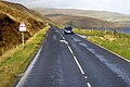
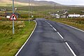
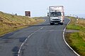
 A970 approaching Cunningsburgh - geograph.org.uk - 5928862.jpg 800 × 533; 637 KB
-
 A970 at Cunningsburgh - geograph.org.uk - 5928870.jpg 800 × 533; 465 KB
-
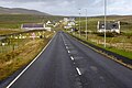
 A970 at Levenwick - geograph.org.uk - 5932091.jpg 800 × 533; 553 KB
-
 A970 between Quarff and Fladdabister - geograph.org.uk - 5928837.jpg 800 × 450; 558 KB
-
 A970 Bruce Memorial Hall, Virkie - geograph.org.uk - 5932921.jpg 800 × 533; 474 KB
-
 A970 Coastal Road near Channerwick - geograph.org.uk - 5930679.jpg 800 × 600; 528 KB
-

-
 A970 Crossing the Runway at Sumburgh - geograph.org.uk - 5932885.jpg 800 × 600; 488 KB
-
 A970 near Boddam - geograph.org.uk - 5933043.jpg 800 × 533; 485 KB
-
 A970 near Eastshore - geograph.org.uk - 5932913.jpg 800 × 533; 440 KB
-
 A970 near Levenwick - geograph.org.uk - 5932073.jpg 800 × 600; 620 KB
-
 A970 near Ringasta - geograph.org.uk - 5933037.jpg 800 × 600; 536 KB
-
 A970 near Sandwick - geograph.org.uk - 5929944.jpg 800 × 533; 468 KB
-
 A970 near Sandwick - geograph.org.uk - 5930010.jpg 800 × 600; 653 KB
-
 A970 near Southpunds - geograph.org.uk - 5932057.jpg 800 × 533; 591 KB
-
 A970 near the Ward of Scousburgh - geograph.org.uk - 5931749.jpg 800 × 533; 519 KB
-
 A970 near to Fladdabister - geograph.org.uk - 5928843.jpg 800 × 533; 680 KB
-
 A970 Northwards - geograph.org.uk - 5931746.jpg 800 × 533; 480 KB
-
 A970 Northwards - geograph.org.uk - 5932064.jpg 800 × 533; 652 KB
-
 A970 South of Channerwick - geograph.org.uk - 5930694.jpg 800 × 534; 494 KB
-
 A970, Boddam - geograph.org.uk - 5932639.jpg 800 × 533; 529 KB
-
 A970, Cunningsburgh - geograph.org.uk - 5928864.jpg 800 × 533; 618 KB
-
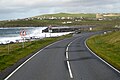 A970, Old Scatness Viewpoint - geograph.org.uk - 5932900.jpg 800 × 533; 480 KB
-
 A970, Scatness - geograph.org.uk - 5932893.jpg 800 × 600; 544 KB
-
 Abandoned Motor Car on the Moors, Shetland - geograph.org.uk - 5999945.jpg 2,750 × 1,821; 2.17 MB
-
 Abandoned road near Fladdabister - geograph.org.uk - 5037034.jpg 3,648 × 2,736; 4.21 MB
-
 Aberdeen ferry passing Troswickness - geograph.org.uk - 3459017.jpg 1,024 × 682; 123 KB
-
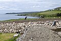
 Above the Bay of Okraquoy - geograph.org.uk - 3725814.jpg 1,200 × 770; 575 KB
-
 Across Red Geo - geograph.org.uk - 2636407.jpg 4,320 × 3,240; 4.51 MB
-

-
 Ancient Feature - geograph.org.uk - 2618293.jpg 4,320 × 3,240; 4.99 MB
-
 Ancient Feature - geograph.org.uk - 2618301.jpg 4,320 × 3,240; 5.46 MB
-
 Approaching Sandwick - geograph.org.uk - 6188265.jpg 800 × 600; 558 KB
-
 Approaching The Coall - geograph.org.uk - 2066141.jpg 2,560 × 1,920; 1.84 MB
-
 Arctic Tern (Sterna paradisaea), Pool of Virkie - geograph.org.uk - 5885756.jpg 1,488 × 993; 388 KB
-
 Armchair in bus shelter - geograph.org.uk - 2735755.jpg 640 × 480; 92 KB
-
 At the Ness of Hoswick - geograph.org.uk - 5132869.jpg 1,600 × 1,201; 703 KB
-
 Atinello IMG 5913 (9310141596).jpg 4,252 × 2,403; 3.15 MB
-
 Atinello IMG 5915 (9307363921).jpg 3,959 × 2,270; 2.88 MB
-
 Atinello IMG 5918 (9307370545).jpg 4,247 × 2,372; 3.09 MB
-
 Atinello IMG 5923 (9310162400).jpg 3,860 × 2,279; 3.11 MB
-
 Atinello IMG 5932 (9307349127).jpg 4,254 × 2,820; 4.39 MB
-
 B9122 near Bigton - geograph.org.uk - 5931556.jpg 800 × 600; 525 KB
-
 B9122 near Skelberry - geograph.org.uk - 5931725.jpg 800 × 533; 471 KB
-
 B9122 near to Northpunds - geograph.org.uk - 5930718.jpg 800 × 600; 582 KB
-

-
 B9122, Cloddiknowe - geograph.org.uk - 5931708.jpg 800 × 533; 446 KB
-
 B9122-B970 Junction at Boddam - geograph.org.uk - 5931734.jpg 800 × 600; 479 KB
-

-
 Bay of Fladdabister - geograph.org.uk - 5037021.jpg 3,648 × 2,736; 3.1 MB
-
 Bay of Scousburgh - geograph.org.uk - 6178898.jpg 1,600 × 1,067; 132 KB
-
 Beach at Sand Wick - geograph.org.uk - 5808932.jpg 1,024 × 564; 167 KB
-
 Beach at St Ninian's Isle - geograph.org.uk - 4642595.jpg 4,636 × 3,304; 2.8 MB
-
 Beadies - geograph.org.uk - 2056699.jpg 1,200 × 1,600; 291 KB
-
 Bedding Detail - geograph.org.uk - 2618817.jpg 4,320 × 3,240; 5.88 MB
-
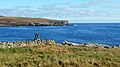
 Bigton Wick - geograph.org.uk - 5272814.jpg 1,280 × 851; 273 KB
-
 Bigton, from the St Ninian's Isle road - geograph.org.uk - 5813195.jpg 1,024 × 575; 167 KB
-
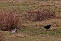 Birds in a field, Sandwick - geograph.org.uk - 5265573.jpg 1,024 × 684; 160 KB
-
 Blind Summit on the B9122 - geograph.org.uk - 5931545.jpg 800 × 600; 624 KB
-
 Blind summit... - geograph.org.uk - 2032815.jpg 1,600 × 1,200; 194 KB
-
 Blitzed Target Zone - geograph.org.uk - 2622204.jpg 4,320 × 3,240; 5.5 MB
-
 Boddam, A970 - geograph.org.uk - 5932643.jpg 800 × 533; 530 KB
-
 Brei Geo - geograph.org.uk - 2628495.jpg 4,320 × 3,240; 5.64 MB
-
 Bridge over Hoswick Burn - geograph.org.uk - 5929890.jpg 800 × 600; 718 KB
-
 Broad Geo of Smithfield - geograph.org.uk - 3560079.jpg 640 × 480; 295 KB
-
 Broch at Clevigarth - geograph.org.uk - 5150503.jpg 1,024 × 682; 200 KB
-
 Broch of Burraland - geograph.org.uk - 2415290.jpg 4,000 × 3,000; 4.81 MB
-
 Broch of Mousa - geograph.org.uk - 5929477.jpg 800 × 600; 595 KB
-
 Broken Brough - geograph.org.uk - 2617606.jpg 4,320 × 3,240; 5.77 MB
-
 Broken Brough tunnel - geograph.org.uk - 2617626.jpg 4,320 × 3,240; 5.4 MB
-

-
 Building haystacks, Gord - geograph.org.uk - 3586477.jpg 640 × 480; 258 KB
-
 Building on Garths Ness - geograph.org.uk - 1842299.jpg 800 × 534; 182 KB
-
 Buildings at the end of the No Ness road - geograph.org.uk - 5808978.jpg 1,024 × 573; 163 KB
-
 Bulwark Slipway - geograph.org.uk - 2632017.jpg 4,172 × 2,990; 3.77 MB
-
 Bungalow with a sea view - geograph.org.uk - 3973785.jpg 2,048 × 1,536; 611 KB
-

-
 Burn of Claver - geograph.org.uk - 2920568.jpg 2,304 × 3,072; 2.45 MB
-
 Burn of Claver - geograph.org.uk - 2920574.jpg 2,304 × 3,072; 2.52 MB
-
 Burn of Quendale - geograph.org.uk - 1842364.jpg 640 × 427; 66 KB
-
 Burn of Rerwick - geograph.org.uk - 3789358.jpg 640 × 480; 328 KB
-
 Burn of Setter at Swinister, Sandwick - geograph.org.uk - 5595473.jpg 1,024 × 576; 78 KB
-
 Burn of the Rait - geograph.org.uk - 2628646.jpg 4,320 × 3,240; 5.24 MB
-
 Burn of Wiltrow - geograph.org.uk - 3560201.jpg 640 × 480; 287 KB
-
 Burraland Old Settlement - geograph.org.uk - 2415358.jpg 4,000 × 3,000; 4.37 MB
-
 Bus Heading South on the A970 - geograph.org.uk - 5933035.jpg 800 × 533; 500 KB
-
 Bus Shelter and Post Box at Leebotten - geograph.org.uk - 5929798.jpg 800 × 533; 507 KB
-
 Bus Stop at Cunningsburgh - geograph.org.uk - 5928874.jpg 800 × 600; 612 KB
-
 Bus Stop at Cunningsburgh - geograph.org.uk - 5929439.jpg 800 × 533; 454 KB
-
 Bus Stop at Dale Park - geograph.org.uk - 5931722.jpg 800 × 533; 500 KB
-
 Bus Stop on the A970 at Cunningsburgh - geograph.org.uk - 5928875.jpg 800 × 533; 427 KB
-
 Bus Stop on the B9122 near Rerwick - geograph.org.uk - 5931562.jpg 800 × 533; 548 KB
-
 Butter Geo and coastal scenery, St. Ninian's Isle, Shetland - geograph.org.uk - 6293553.jpg 3,909 × 2,933; 2.41 MB
-
 Cairn at Scult of Laward - geograph.org.uk - 2036888.jpg 2,560 × 1,920; 1.74 MB
-

-
 Cairn on the Laward - geograph.org.uk - 2030147.jpg 768 × 1,024; 229 KB
-
 Cairns by the West Voe of Sumburgh - geograph.org.uk - 2035572.jpg 2,560 × 1,920; 1.71 MB
-
 Cave on Coall Head - geograph.org.uk - 2066156.jpg 1,920 × 2,560; 1.8 MB
-
 Caves at The Neapack - geograph.org.uk - 2057057.jpg 1,920 × 2,560; 1.72 MB
-
 Chain-guided path over the Ness of Burgi, Scatness, Shetland - geograph.org.uk - 6249582.jpg 4,000 × 3,000; 4.63 MB
-
 Chapel on the Hill IMG 4747 (21984652458).jpg 4,244 × 2,395; 2.92 MB
-
 Clavel and Rerwick - geograph.org.uk - 4205391.jpg 1,024 × 681; 169 KB
-
 Clavel from Rerwick - geograph.org.uk - 5917943.jpg 1,600 × 1,065; 833 KB
-
 Claypotts - geograph.org.uk - 2622296.jpg 4,320 × 3,240; 5.36 MB
-
 Clevigarth Broch - geograph.org.uk - 2618692.jpg 4,320 × 3,240; 5.51 MB
-
 Clevigarth Broch Cell - geograph.org.uk - 2618723.jpg 4,320 × 3,240; 5.73 MB
-
 Clevigarth from North Town, Exnaboe - geograph.org.uk - 5150496.jpg 1,024 × 682; 177 KB
-
 Clevigarth, north of Exnaboe - geograph.org.uk - 5148665.jpg 1,024 × 576; 100 KB
-
 Cliff edge crevasse - geograph.org.uk - 2618879.jpg 4,320 × 3,240; 5.51 MB
-
 Cliff-top wall - geograph.org.uk - 2416497.jpg 4,000 × 3,000; 4.75 MB
-
 Cliffs above Scarf Hole - geograph.org.uk - 3790234.jpg 640 × 480; 229 KB
-
 Cliffs and skerrie at Croo Geo - geograph.org.uk - 5808903.jpg 1,024 × 575; 163 KB
-
 Cliffs at The Nev, north of Fitful Head - geograph.org.uk - 5023118.jpg 2,592 × 1,944; 1.39 MB
-
 Cliffs below the car park at Sumburgh Head - geograph.org.uk - 5447180.jpg 1,024 × 682; 195 KB
-
 Clifftop at Noss, near Spiggie - geograph.org.uk - 1842554.jpg 800 × 534; 123 KB
-
 Clift Hills from Scalloway - geograph.org.uk - 2092570.jpg 2,560 × 1,920; 1.48 MB
-
 Clift Sound and the Clift Hills - geograph.org.uk - 1924187.jpg 800 × 534; 192 KB
-
 Close-up view of Sumburgh Head's famous summer residents - geograph.org.uk - 6249682.jpg 4,000 × 3,000; 4.85 MB
-
 Coastal path at Bu Taing, Boddam - geograph.org.uk - 5148696.jpg 1,024 × 576; 145 KB
-
 Coastal Path towards Sumburgh Head - geograph.org.uk - 5919167.jpg 800 × 600; 554 KB
-
 Coastal Sheep Farm near Mail - geograph.org.uk - 5929444.jpg 800 × 600; 791 KB
-
 Coastal View - geograph.org.uk - 3564406.jpg 2,560 × 1,920; 2.84 MB
-
 Coastal Walk - geograph.org.uk - 5037557.jpg 3,648 × 2,736; 3.57 MB
-
 Coastguard helicopter over fields at Sandwick - geograph.org.uk - 5254388.jpg 1,024 × 682; 141 KB
-
 Coastline of No Ness - geograph.org.uk - 2700818.jpg 1,333 × 1,000; 1.2 MB
-
 Communications array - geograph.org.uk - 5037968.jpg 3,648 × 2,736; 3.89 MB
-

-
 Concrete base - geograph.org.uk - 5037612.jpg 3,648 × 2,736; 4.29 MB
-
 Concrete gun base - geograph.org.uk - 5038006.jpg 3,648 × 2,736; 3.97 MB
-
 Confluence on the Red Burn, Shetland - geograph.org.uk - 5824489.jpg 2,750 × 1,821; 2.63 MB
-
 Cootch Kettle - geograph.org.uk - 5287996.jpg 1,200 × 1,600; 629 KB
-
 Cootch Kettle - geograph.org.uk - 5288004.jpg 1,600 × 1,200; 569 KB
-
 Cootch Kettle - geograph.org.uk - 5288015.jpg 1,200 × 1,600; 573 KB
-
 Corbie Geo - geograph.org.uk - 5288856.jpg 1,600 × 1,200; 542 KB
-
 Corbie Geo, Fora Ness - geograph.org.uk - 1998643.jpg 2,112 × 2,816; 996 KB
-
 Croft House Museum, Southvoe, Boddam - geograph.org.uk - 5849300.jpg 8,476 × 2,384; 7.59 MB
-
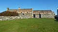 Crofthouse Museum, Boddam - geograph.org.uk - 5148688.jpg 1,024 × 576; 154 KB
-
 Crooellmires - geograph.org.uk - 2622318.jpg 4,320 × 3,240; 4.69 MB
-
 Cunningsburgh, A970 - geograph.org.uk - 5929453.jpg 800 × 450; 451 KB
-
 Dairy Cow by Aithsetter - geograph.org.uk - 2078358.jpg 2,560 × 1,920; 1.84 MB
-
 Dalsetter Broch - geograph.org.uk - 2622478.jpg 4,320 × 3,240; 5.24 MB
-
 Dalsetter erratic - geograph.org.uk - 2619886.jpg 4,320 × 3,240; 5.35 MB
-
 Dam and Sluices, Quendale Mill - geograph.org.uk - 5932711.jpg 800 × 600; 673 KB
-

-
 Deep Geo - geograph.org.uk - 3122147.jpg 683 × 1,024; 296 KB
-
 Delightful Ruin - geograph.org.uk - 2628612.jpg 4,320 × 3,240; 5.2 MB
-
 Delivery Van on the A970 near Sandwick - geograph.org.uk - 5929937.jpg 800 × 533; 457 KB
-
 Derelict Building at Quendale Farm - geograph.org.uk - 5932699.jpg 800 × 601; 511 KB
-
 Designated Drop Off - geograph.org.uk - 5452029.jpg 3,551 × 2,410; 1.71 MB
-
 Displaced threshold - geograph.org.uk - 3974919.jpg 2,048 × 1,536; 1.52 MB
-
 Down from Sumburgh Head - geograph.org.uk - 5272512.jpg 1,280 × 851; 318 KB
-
 Drooping Point - geograph.org.uk - 2628506.jpg 4,320 × 3,240; 5.66 MB
-
 Dry stone wall - geograph.org.uk - 6179043.jpg 1,600 × 1,067; 366 KB
-
 Drying Kiln - geograph.org.uk - 2628626.jpg 4,320 × 3,240; 5.68 MB
-
 Drying the hay at Gord Farm - geograph.org.uk - 5023181.jpg 2,592 × 1,944; 1.83 MB
-
 Dunna Chuck Bruck - geograph.org.uk - 2035098.jpg 2,560 × 1,920; 2 MB
-
 Dunna Chuck Bruck - geograph.org.uk - 3122071.jpg 683 × 1,024; 288 KB
-
 Dunrossness Baptist Church - geograph.org.uk - 5932667.jpg 800 × 533; 436 KB
-
 Dunrossness Primary School, Boddam, from the air - geograph.org.uk - 5264946.jpg 1,024 × 682; 268 KB
-
 Dunrossness, postbox № ZE2 29 - geograph.org.uk - 2652009.jpg 480 × 640; 84 KB
-
 Dunrossness, the post office - geograph.org.uk - 3736672.jpg 640 × 480; 42 KB
-
 Dusk at Stove by Sandwick - geograph.org.uk - 5133600.jpg 1,600 × 1,203; 512 KB
-
 Dyke-end Geo - geograph.org.uk - 2620994.jpg 4,320 × 3,240; 5.2 MB
-
 Dyke-end Geo basement - geograph.org.uk - 2621025.jpg 4,320 × 3,240; 5.15 MB
-
 East shore of Clift Sound - geograph.org.uk - 5733350.jpg 751 × 1,024; 190 KB
-
 Eastshore Foreshore - geograph.org.uk - 1985788.jpg 2,560 × 1,920; 1.74 MB
-
 Eastshore, Virkie, from Sumburgh Airport - geograph.org.uk - 5455800.jpg 1,024 × 650; 115 KB
-
 End of the Main Road, Grutness - geograph.org.uk - 5448339.jpg 3,667 × 2,220; 1.16 MB
-
 End of the road - geograph.org.uk - 5037590.jpg 3,648 × 2,736; 4.19 MB
-
 Enlightening Landscape - geograph.org.uk - 2628553.jpg 3,732 × 2,718; 3.05 MB
-
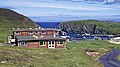
 Entrance to Hoswick Visitor Centre - geograph.org.uk - 6179048.jpg 1,600 × 1,016; 179 KB
-
 Entrance to WW2 air raid shelter - geograph.org.uk - 2735766.jpg 640 × 480; 76 KB
-
 Erne's Ward - geograph.org.uk - 3560135.jpg 480 × 640; 96 KB
-
 Erne's Ward - geograph.org.uk - 3560142.jpg 640 × 480; 277 KB
-
 Fair Isle Bird Observatory, 1974 - geograph.org.uk - 6029154.jpg 1,600 × 900; 703 KB
-
 Farm Buildings at Skelberry - geograph.org.uk - 5931730.jpg 800 × 533; 551 KB
-
 Farmland near Bigton - geograph.org.uk - 5931558.jpg 800 × 600; 606 KB
-
 Female eider with ducklings - geograph.org.uk - 6179207.jpg 1,200 × 1,800; 490 KB
-
 Fields at Aithsetter - geograph.org.uk - 2078362.jpg 2,560 × 1,920; 1.87 MB
-
 Fields at North Town, Exnaboe - geograph.org.uk - 5148656.jpg 1,024 × 576; 118 KB
-
 Fields at the Wart, Sandwick - geograph.org.uk - 5254331.jpg 1,600 × 1,063; 418 KB
-
 Fields west of Bigton - geograph.org.uk - 5023430.jpg 2,592 × 1,944; 1.71 MB
-
 Fields, Huesbreck - geograph.org.uk - 3458995.jpg 1,024 × 683; 139 KB
-
 Fire Wall - geograph.org.uk - 2622189.jpg 2,525 × 1,787; 1.98 MB
-
 Firing Point - geograph.org.uk - 2626912.jpg 4,320 × 3,240; 5.45 MB
-
 Fisherman's hut - geograph.org.uk - 2619842.jpg 4,320 × 3,240; 5.59 MB
-
 Flags at the Lighthouse - geograph.org.uk - 5451782.jpg 3,037 × 2,286; 1.25 MB
-
 Fleck - geograph.org.uk - 727894.jpg 640 × 426; 58 KB
-
 Flowery field, South Voe - geograph.org.uk - 3560194.jpg 640 × 480; 318 KB
-
 Fora Ness, Dunrossness - geograph.org.uk - 1780274.jpg 1,600 × 1,208; 305 KB
-
 Fort on the Ness of Burgi, Scatness, Shetland - geograph.org.uk - 6249585.jpg 4,000 × 3,000; 4.69 MB
-
 From Sumburgh Head to Foula - geograph.org.uk - 5152370.jpg 1,024 × 682; 110 KB
-
 Fulmars - Sumburgh Head - geograph.org.uk - 5272656.jpg 1,280 × 851; 246 KB
-
 Fulmars - Sumburgh Head - geograph.org.uk - 5272666.jpg 1,280 × 851; 267 KB
-
 Garths Ness - geograph.org.uk - 5272755.jpg 1,280 × 851; 326 KB
-
 Garths Ness from the air - geograph.org.uk - 5264645.jpg 1,024 × 877; 175 KB
-
 Garths Ness from the air - geograph.org.uk - 5277925.jpg 1,024 × 682; 124 KB
-
 Gate on Coastal Path to Sumburgh Head - geograph.org.uk - 5919173.jpg 800 × 600; 742 KB


,_Pool_of_Virkie_-_geograph.org.uk_-_5885756.jpg)


.jpg)
.jpg)
.jpg)
.jpg)
.jpg)


.jpg)


.jpg)


