Category:Dunswell, East Riding of Yorkshire
Jump to navigation
Jump to search
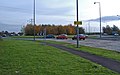
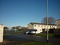
English: Dunswell is a village in the civil parish of Woodmansey in the East Riding of Yorkshire, England in an area known as Holderness. It is situated approximately 4 miles (6.4 km) north of the city of Hull and 3.5 miles (5.6 km) south east of the market town of Beverley. It lies on the A1174 road and west of the River Hull.
village in United Kingdom  | |||||
| Upload media | |||||
| Instance of | |||||
|---|---|---|---|---|---|
| Location | Woodmansey, East Riding of Yorkshire, Yorkshire and the Humber, England | ||||
 | |||||
Subcategories
This category has the following 6 subcategories, out of 6 total.
D
- Dunswell Lane, Dunswell (7 F)
- Dunswell War Memorial (3 F)
S
- Skidby Carr Lane (15 F)
Media in category "Dunswell, East Riding of Yorkshire"
The following 144 files are in this category, out of 144 total.
-
 "The Coach and Horses" at Dunswell (geograph 4506539).jpg 4,435 × 3,558; 3.77 MB
-
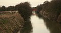
 A farm bridge over Barmston Drain near Dunswell (geograph 2205866).jpg 800 × 600; 263 KB
-

-
 A field off Beverley Road, East Yorkshire (geograph 3675841).jpg 800 × 600; 142 KB
-
 A field off Raich Carter Way, East Yorkshire (geograph 3238267).jpg 800 × 600; 100 KB
-
 A path leading to Beverley Road (geograph 3675914).jpg 800 × 600; 150 KB
-
 A path leading to Beverley Road (geograph 3675920).jpg 800 × 600; 153 KB
-
 A path leading to Beverley Road (geograph 3675927).jpg 800 × 600; 150 KB
-
 A path leading to Beverley Road (geograph 3675934).jpg 800 × 600; 143 KB
-
 A path leading to Beverley Road (geograph 3675938).jpg 800 × 600; 154 KB
-
 A path leading to Beverley Road (geograph 3675941).jpg 800 × 600; 149 KB
-
 A path leading to Beverley Road (geograph 3675947).jpg 800 × 600; 158 KB
-
 A path leading to the River Hull (geograph 3675836).jpg 800 × 600; 164 KB
-
 A small boat on the river Hull - geograph.org.uk - 769069.jpg 640 × 448; 219 KB
-
 A unnamed bungalow on the A1174 (geograph 2023082).jpg 800 × 600; 252 KB
-
 A walk along the River Hull No10 (geograph 1998069).jpg 800 × 600; 243 KB
-
 A walk along the River Hull No11 (geograph 1998074).jpg 800 × 600; 227 KB
-
 A walk along the River Hull No5 (geograph 1998035).jpg 800 × 600; 261 KB
-
 A walk along the River Hull No6 (geograph 1998045).jpg 800 × 600; 252 KB
-
 A walk along the River Hull No8 (geograph 1998059).jpg 800 × 600; 265 KB
-
 A walk along the River Hull No9 (geograph 1998063).jpg 800 × 600; 249 KB
-
 Across the River Hull towards new housing development at Kingswood (geograph 5307723).jpg 5,376 × 3,024; 2.13 MB
-
 Beverley & Barmston Drain (geograph 5235653).jpg 1,200 × 799; 338 KB
-
 Beverley & Barmston Drain at Dunswell (geograph 5235661).jpg 1,200 × 799; 449 KB
-
 Beverley & Barmston Drain at Dunswell (geograph 5235694).jpg 1,200 × 799; 346 KB
-
 Beverley and Barmston Drain - geograph.org.uk - 707565.jpg 640 × 350; 104 KB
-
 Beverley and Barmston Drain - geograph.org.uk - 707578.jpg 640 × 427; 132 KB
-
 Beverley Bypass - geograph.org.uk - 63726.jpg 640 × 480; 113 KB
-
 Beverley Road enters East Yorkshire (geograph 3675973).jpg 800 × 600; 157 KB
-
 Beverley Road, Dunswell (geograph 5235469).jpg 1,200 × 799; 304 KB
-
 Beverley Road, Dunswell (geograph 6104300).jpg 800 × 494; 78 KB
-
 Bungalow on Beverley Road (A1174) (geograph 4349890).jpg 640 × 480; 83 KB
-
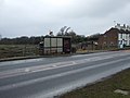
 Bus stop and shelter on Hull Road (A1174) (geograph 4355267).jpg 640 × 480; 55 KB
-
 Bus stop on Beverley Road (A1174) (geograph 4349874).jpg 640 × 480; 67 KB
-
 Bus stop on Beverley Road (A1174) (geograph 4349883).jpg 640 × 480; 52 KB
-
 Bus stop on Beverley Road (A1174) (geograph 4351237).jpg 640 × 480; 61 KB
-
 Bus stop on the A1174, Dunswell (geograph 4353978).jpg 640 × 480; 50 KB
-
 Close up, Ings Lane, Dunswell (geograph 6084273).jpg 2,015 × 3,138; 1.5 MB
-
 Counter Dike - geograph.org.uk - 259134.jpg 456 × 640; 149 KB
-
 Cycle path beside Beverley Road (A1079) (geograph 4351216).jpg 640 × 480; 78 KB
-
 Cycle path beside Raich Carter Way (A1033) (geograph 4349871).jpg 640 × 386; 51 KB
-
 Cycle track beside Raich Carter Way (geograph 4353906).jpg 640 × 480; 55 KB
-
 Cycle track beside the A1174 (geograph 4353972).jpg 640 × 480; 63 KB
-
 Dene Close, Dunwell (geograph 4351227).jpg 640 × 480; 50 KB
-
 Dunswell - panoramio.jpg 1,000 × 666; 461 KB
-
 Dunswell IMG 7188 - panoramio.jpg 1,100 × 733; 604 KB
-
 Dunswell Lane - geograph.org.uk - 49259.jpg 480 × 640; 162 KB
-
 Dunswell Lane, Dunswell (geograph 5235537).jpg 1,200 × 799; 244 KB
-
 Dunswell lane, max algae - panoramio.jpg 1,000 × 711; 372 KB
-
 Dunswell Primary School (geograph 4349882).jpg 640 × 480; 70 KB
-
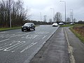
 Dunswell roundabout - geograph.org.uk - 603072.jpg 640 × 402; 148 KB
-
 Dunswell, 1880-1900.jpg 500 × 378; 83 KB
-
 Dunswell, Swans - panoramio.jpg 799 × 1,200; 314 KB
-
 Dunswell002.jpg 4,304 × 6,655; 13.31 MB
-
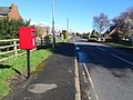
 Elizabeth II postbox on Ings Lane, Dunswell (geograph 6084270).jpg 4,693 × 3,342; 4.88 MB
-
 Entering Dunswell (geograph 4351220).jpg 640 × 480; 69 KB
-
 Entering the East Riding of Yorkshire (geograph 3238229).jpg 800 × 600; 119 KB
-
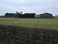
 Farm buildings near Dunswell, East Yorkshire (geograph 3745339).jpg 1,024 × 681; 215 KB
-
 Farm buildings, White House Farm, Dunswell (geograph 6104303).jpg 640 × 467; 69 KB
-
 Farmland and pylon, Hull Bank Farm (geograph 4352712).jpg 640 × 480; 49 KB
-
 Farmland, Dunswell (geograph 4353975).jpg 640 × 480; 61 KB
-
 Farmland, Dunswell - geograph.org.uk - 1527913.jpg 640 × 480; 50 KB
-
 Footpath marking the city boundary (geograph 4727260).jpg 1,024 × 768; 180 KB
-
 Grazing, Dunswell (geograph 4353982).jpg 640 × 480; 53 KB
-
 Green Lane south of Dunswell - geograph.org.uk - 868238.jpg 640 × 480; 232 KB
-
 Homethorpe, Orchard Park Estate, Hull (geograph 3250715).jpg 800 × 600; 216 KB
-
 House on Ings Lane, Dunswell (geograph 6084275).jpg 3,499 × 3,409; 3.89 MB
-
 Houses on Beverley Road, Dunswell (geograph 6084274).jpg 4,596 × 3,157; 4.08 MB
-
 Hull Bank Farm (geograph 4353911).jpg 640 × 480; 62 KB
-
 Hull Bank Farm, south of Dunswell - geograph.org.uk - 259122.jpg 485 × 640; 135 KB
-

-
 Hull Corporation smallholdings (geograph 4404016).jpg 1,024 × 768; 164 KB
-
 Hull Tec Orchard Park Campus - geograph.org.uk - 908122.jpg 640 × 437; 83 KB
-
 Ings Lane, Dunswell (geograph 6084278).jpg 5,184 × 3,888; 6.52 MB
-
 K6 telephone box on Beverley Road, Dunswell (geograph 6104306).jpg 800 × 612; 120 KB
-
 Lay by on A1079 (geograph 5099097).jpg 4,608 × 3,456; 4.1 MB
-
 Milestone Bridge, south of Dunswell - geograph.org.uk - 259129.jpg 640 × 474; 124 KB
-
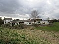 Mobile homes behind Entick House (geograph 4403741).jpg 1,024 × 768; 182 KB
-
 New housing development at The Ings, Kingswood Estate (geograph 5307725).jpg 5,376 × 3,024; 1.67 MB
-
 New Ings Sports Field, Orchard Park - geograph.org.uk - 908087.jpg 640 × 446; 65 KB
-
 Orchard Park playing fields, Hull - geograph.org.uk - 662038.jpg 640 × 438; 192 KB
-
 Orchard Park Sports Arena - geograph.org.uk - 908219.jpg 640 × 477; 127 KB
-
 Paddocks off Beverley Road (geograph 4404010).jpg 1,024 × 768; 183 KB
-
 Path along the River Hull towards Kingswood (geograph 5955199).jpg 1,600 × 1,064; 704 KB
-
 Path by the Hull (geograph 2758760).jpg 640 × 480; 78 KB
-
 Path leading to Skidby Carr Lane (geograph 5235668).jpg 1,200 × 799; 396 KB
-
 Path leading to Skidby Carr Lane (geograph 5235674).jpg 1,200 × 799; 531 KB
-
 Playing fields on Dane Park Road, Hull (geograph 2175495).jpg 800 × 600; 244 KB
-
 Ponies near Dunswell (geograph 6031177).jpg 1,024 × 899; 782 KB
-
 Power lines cross the A1079 (geograph 5099073).jpg 2,601 × 3,525; 3.3 MB
-
 Pylon beside the River Hull - geograph.org.uk - 1156328.jpg 480 × 640; 72 KB
-
 Raich Carter Way (geograph 3072446).jpg 1,024 × 753; 144 KB
-
 Raich Carter Way towards Beverley Road (geograph 3675822).jpg 800 × 600; 161 KB
-
 Railway Bridge, Dunswell - geograph.org.uk - 667245.jpg 640 × 474; 97 KB
-
 River Hull (geograph 2758790).jpg 640 × 443; 58 KB
-
 River Hull and Entick House (geograph 2985532).jpg 3,264 × 2,448; 1.65 MB
-
 River Hull and Hull Bank Farm (geograph 2985582).jpg 3,264 × 2,448; 1.62 MB
-
 River Hull and traffic on the A1033 (geograph 2985592).jpg 3,264 × 2,448; 1.65 MB
-
 River Hull at Kingswood (geograph 6007167).jpg 1,024 × 768; 189 KB
-
 River Hull at Skidby Landing (geograph 5307724).jpg 5,376 × 3,024; 2.4 MB
-
 River Hull floodbank footpath heading north (geograph 2985550).jpg 3,264 × 2,448; 2.15 MB
-
 River Hull looking towards Hull Bank Farm (geograph 5307722).jpg 5,360 × 2,996; 2.26 MB
-
 River Hull near Dunswell (geograph 6007170).jpg 1,024 × 768; 165 KB
-
 River Hull near Dunswell.jpg 480 × 640; 125 KB
-
 River Hull near Grey Legs (geograph 2757925).jpg 640 × 441; 63 KB
-
 River Hull near Kingswood (geograph 6007204).jpg 1,024 × 768; 228 KB
-
 River Hull near South Field (geograph 2758810).jpg 640 × 480; 57 KB
-
 River Hull near Woodmansey - geograph.org.uk - 630187.jpg 640 × 472; 175 KB
-
 River Hull, Dunswell - geograph.org.uk - 630022.jpg 457 × 640; 187 KB
-
 River Hull, Kingswood - geograph.org.uk - 1527919.jpg 640 × 480; 45 KB
-
 River Hull, near Kingswood (geograph 6027248).jpg 1,024 × 704; 834 KB
-
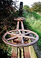
 Rust in peace - geograph.org.uk - 662033.jpg 486 × 640; 167 KB
-
 School House (geograph 5235460).jpg 1,200 × 799; 371 KB
-
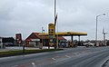 Service station on Beverley Road (A1174) (geograph 4351224).jpg 640 × 395; 41 KB
-
 Service station on Beverley Road, Dunswell (geograph 6104299).jpg 800 × 470; 71 KB
-
 Service Station, A1174 - geograph.org.uk - 1527916.jpg 640 × 480; 43 KB
-
 Sicey Lane and drain (geograph 4404013).jpg 1,024 × 768; 160 KB
-
 Sir Henry Cooper School Hull.jpg 640 × 480; 117 KB
-
 Skidby Carr Farm (geograph 5236361).jpg 1,200 × 799; 319 KB
-
 Skidby Carr Farm off Dunswell Lane (geograph 5236378).jpg 1,200 × 799; 322 KB
-
 Skidby Carr Farmhouse (geograph 5236369).jpg 1,200 × 799; 262 KB
-
 St Faiths Church Dunswell.jpg 640 × 480; 206 KB
-
 Sunny day on the A1079 (geograph 6092480).jpg 1,024 × 735; 145 KB
-
 The first house in Dunswell - geograph.org.uk - 828687.jpg 640 × 456; 189 KB
-
 The Hull Tec building on Danepark Road, Hull (geograph 3251300).jpg 800 × 600; 261 KB
-
 The Old Post Office (geograph 5235541).jpg 1,200 × 799; 241 KB
-
 The River Hull - geograph.org.uk - 1156326.jpg 480 × 640; 45 KB
-
 The River Hull at Skidby Landing (geograph 4403715).jpg 1,024 × 768; 170 KB
-
 The River Hull Bank - geograph.org.uk - 1156324.jpg 640 × 480; 136 KB
-
 The River Hull east of Dunswell (geograph 4403743).jpg 1,024 × 768; 173 KB
-
 The River Hull, Kingswood, Hull (geograph 6091787).jpg 800 × 600; 131 KB
-
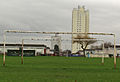
 The River Hull, pylon and new housing (geograph 4403765).jpg 1,024 × 768; 131 KB
-
 The River Hull, pylons and threatening sky (geograph 4403769).jpg 1,024 × 768; 149 KB
-
 The riverside path along the River Hull (geograph 3736429).jpg 1,024 × 681; 316 KB
-
 The riverside path along the River Hull (geograph 3736436).jpg 1,024 × 681; 286 KB
-
 The riverside path towards Wawne (geograph 3745335).jpg 1,024 × 681; 302 KB
-

-
 Towards Kingswood - geograph.org.uk - 778353.jpg 640 × 350; 128 KB
-
 Track to Hull Bank Farm - geograph.org.uk - 1527917.jpg 640 × 480; 80 KB
-
 Track, Dunswell - geograph.org.uk - 1527912.jpg 640 × 480; 91 KB
-
 View across Skidby Carr (geograph 4405440).jpg 1,024 × 768; 159 KB
-
 View along Hulls northern boundary at Ings Bridge (geograph 5307720).jpg 5,376 × 3,024; 3.28 MB
-
 Western Drain passing commercial greenhouses (geograph 4374667).jpg 4,598 × 3,444; 6.01 MB
-
 White telephone box on Beverley Road (A1174) (geograph 4351230).jpg 640 × 480; 61 KB
.jpg)
.jpg)
.jpg)
.jpg)
.jpg)
.jpg)
.jpg)
.jpg)
.jpg)
.jpg)
.jpg)
.jpg)
.jpg)

.jpg)
.jpg)
.jpg)
.jpg)
.jpg)
.jpg)
.jpg)
.jpg)
.jpg)
.jpg)
.jpg)


.jpg)
.jpg)
.jpg)
_(geograph_4349890).jpg)
_(geograph_4355267).jpg)
_(geograph_4349874).jpg)
_(geograph_4349883).jpg)
_(geograph_4351237).jpg)
.jpg)
.jpg)

_(geograph_4351216).jpg)
_(geograph_4349871).jpg)
.jpg)
.jpg)
.jpg)


.jpg)

.jpg)


.jpg)
.jpg)
.jpg)
.jpg)
.jpg)
.jpg)
.jpg)

.jpg)
.jpg)

.jpg)
.jpg)
.jpg)
.jpg)


.jpg)

.jpg)
.jpg)
.jpg)

.jpg)
.jpg)


.jpg)
.jpg)
.jpg)
.jpg)
.jpg)
.jpg)
.jpg)
.jpg)

.jpg)
.jpg)

.jpg)
.jpg)
.jpg)
.jpg)
.jpg)
.jpg)
.jpg)
.jpg)
.jpg)

.jpg)
.jpg)
.jpg)


.jpg)

.jpg)
_(geograph_4351224).jpg)
.jpg)

.jpg)

.jpg)
.jpg)
.jpg)

.jpg)

.jpg)
.jpg)

.jpg)

.jpg)
.jpg)
.jpg)
.jpg)
.jpg)
.jpg)
.jpg)
.jpg)


.jpg)
.jpg)
.jpg)
_(geograph_4351230).jpg)