Category:Earth photography during STS-66
Jump to navigation
Jump to search
English: Photographs of Earth taken during STS-66
Media in category "Earth photography during STS-66"
The following 200 files are in this category, out of 231 total.
(previous page) (next page)-
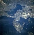
 Ambrakian Gulf - Satellite Image Named - DE.jpg 4,030 × 4,030; 6.03 MB
-
 Amu darya delta.jpg 5,248 × 4,096; 15.12 MB
-
 EFS highres STS066 STS066-101-39.JPG 4,030 × 4,030; 14.71 MB
-
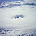
 FileTyphoon Zelda STS-66 1994-11-05 0216z.jpg 448 × 453; 140 KB
-
 Ganges River Delta, Bangladesh, India.jpg 1,400 × 1,370; 805 KB
-
 Golfe Ambracique Satellite.JPG 809 × 823; 205 KB
-
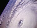
 Hurricane Florence 1994-11-07 STS-66.jpg 442 × 449; 164 KB
-
 Hurricane Florence STS-66 1994-11-07 1440z.jpg 582 × 446; 180 KB
-
 Hurricane Florence STS-66 1994-11-07 1441z (2).jpg 582 × 446; 142 KB
-
 Hurricane Florence STS-66 1994-11-07 1441z.jpg 582 × 446; 123 KB
-
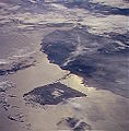
 Kantubek.jpg 867 × 620; 146 KB
-
 Malaspina Glacier from space.jpg 1,000 × 667; 172 KB
-
 Paraguana Peninsula STS066-124-8.JPG 448 × 456; 28 KB
-

-

-

-

-

-

-

-

-

-

-

-

-

-

-

-

-

-

-

-

-

-

-

-

-

-

-

-

-

-

-

-

-

-

-

-

-

-

-

-

-

-

-

-

-

-

-

-

-

-

-

-

-

-

-

-

-

-

-

-

-

-

-

-

-

-

-

-

-

-

-

-

-

-

-

-

-

-

-

-

-

-

-

-

-

-

-

-

-

-

-

-

-

-

-

-

-

-

-

-

-

-

-

-

-

-

-

-

-

-

-

-

-

-

-

-

-

-

-

-

-

-

-

-

-

-

-

-

-

-

-

-

-

-

-

-
 STS066-153-176.jpg 640 × 480; 35 KB
-

-

-

-

-

-

-

-
-

-

-

-

-

-

-

-

-

-

-

-

-

-

-

-

-

-

-

-

-

-

-

-

-

-

-

-

-

-

-

-

-

-

-

-
 STS066-89-69 - Image of Taiwan Northern Half.jpg 5,294 × 5,294; 5.68 MB
-

-

-

-

-

-

-


.jpg)


