Category:East Howe
Jump to navigation
Jump to search
area of Bournemouth, England  | |||||
| Upload media | |||||
| Instance of | |||||
|---|---|---|---|---|---|
| Location | Bournemouth, Christchurch and Poole, Dorset, South West England, England | ||||
 | |||||
Media in category "East Howe"
The following 138 files are in this category, out of 138 total.
-
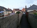
 Bluebird Walk, East Howe - geograph.org.uk - 2461133.jpg 640 × 480; 91 KB
-
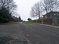
 Bournemouth , Kinson Road Roundabout - geograph.org.uk - 1745657.jpg 3,264 × 2,448; 3.25 MB
-
 Bournemouth , Kinson Road Roundabout - geograph.org.uk - 1746230.jpg 3,264 × 2,448; 3.61 MB
-
 Cove Road, Bournemouth - geograph.org.uk - 2117175.jpg 640 × 480; 89 KB
-
 Dawn Close, Bournemouth - geograph.org.uk - 2117166.jpg 640 × 480; 96 KB
-
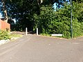
 East Howe Youth Centre - geograph.org.uk - 1730628.jpg 640 × 504; 99 KB
-

-

-
 East Howe, bottom of Puck's Dell - geograph.org.uk - 1340501.jpg 480 × 640; 114 KB
-
 East Howe, Bournemouth - geograph.org.uk - 149550.jpg 640 × 481; 104 KB
-
 East Howe, building work - geograph.org.uk - 1499110.jpg 640 × 480; 70 KB
-

-
-

-
-

-
-
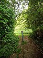
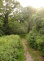
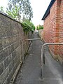
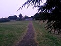
 East Howe, footpath - geograph.org.uk - 1730512.jpg 640 × 480; 132 KB
-
-

-

-

-

-

-

-

-

-

-

-

-

-

-

-

-
 East Howe, footpath E56 heads uphill - geograph.org.uk - 5036334.jpg 480 × 640; 164 KB
-

-
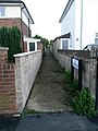
 East Howe, footpath U20 to Acres Road - geograph.org.uk - 5028491.jpg 640 × 480; 107 KB
-

-

-

-

-

-

-

-

-

-

-
 East Howe, graffiti on footpath U38 - geograph.org.uk - 5014237.jpg 640 × 480; 161 KB
-
 East Howe, high school - geograph.org.uk - 1730494.jpg 640 × 480; 71 KB
-
 East Howe, Hillview Road - geograph.org.uk - 1499100.jpg 640 × 480; 66 KB
-
 East Howe, Kingsleigh Primary School - geograph.org.uk - 4985514.jpg 640 × 480; 57 KB
-
 East Howe, large oak in Puck's Dell - geograph.org.uk - 1340502.jpg 480 × 640; 129 KB
-

-

-

-

-
-
 East Howe, Methodist church - geograph.org.uk - 870135.jpg 640 × 480; 70 KB
-

-
 East Howe, on footpath E35 - geograph.org.uk - 5305178.jpg 480 × 640; 90 KB
-
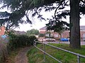
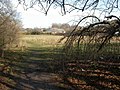 East Howe, open space - geograph.org.uk - 1730503.jpg 640 × 480; 122 KB
-

-

-
 East Howe, primary school - geograph.org.uk - 1730486.jpg 640 × 480; 63 KB
-

-
 East Howe, Puck's Dell - geograph.org.uk - 1340491.jpg 640 × 480; 90 KB
-
-
 East Howe, school site - geograph.org.uk - 1730476.jpg 640 × 480; 88 KB
-
-

-
-
 East Howe, top end of Puck's Dell - geograph.org.uk - 1340493.jpg 640 × 480; 97 KB
-
 East Howe, Wonderholm Parade - geograph.org.uk - 5028484.jpg 640 × 480; 102 KB
-

-

-

-
-

-

-

-

-
 Houses on Columbia Rd - geograph.org.uk - 6071509.jpg 640 × 427; 170 KB
-
 Kingsbere Avenue - geograph.org.uk - 2428961.jpg 640 × 480; 77 KB
-
 Learning Lane, Ensbury Park - geograph.org.uk - 2461124.jpg 640 × 480; 115 KB
-
 Moorside Close, Bournemouth - geograph.org.uk - 2117132.jpg 640 × 480; 92 KB
-
 Moorside Road, Bournemouth - geograph.org.uk - 2117139.jpg 640 × 480; 64 KB
-
 St Marks Road, Bournemouth - geograph.org.uk - 2117136.jpg 640 × 480; 96 KB
-
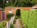
 The Thatched House, East Howe - geograph.org.uk - 1075729.jpg 640 × 480; 95 KB
-
-
-

-

-

-

-

-

-

-

-

-

-

-

-
-

-
 West Howe, footpath U21 from Acres Road - geograph.org.uk - 5028504.jpg 640 × 480; 141 KB
-

-

-

-

-

-

-

-

-

-

-
 West Howe, footpath U25 to Moorside Road - geograph.org.uk - 5013010.jpg 480 × 640; 130 KB
-

-

-

-

-

-

-

-

-
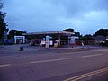
 West Howe, Kinson Baths - geograph.org.uk - 926028.jpg 640 × 480; 83 KB
-
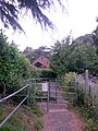 West Howe, kissing gate on footpath E56 - geograph.org.uk - 5036332.jpg 480 × 640; 170 KB
-

-

-
 West Howe, northern end of Youth Walk - geograph.org.uk - 5013015.jpg 480 × 640; 159 KB
-

-

-

-

-

-
 West Howe, the top of Moorside Close - geograph.org.uk - 5279399.jpg 640 × 480; 73 KB
-
 West Howe, upwards on footpath U25 - geograph.org.uk - 5279425.jpg 640 × 480; 64 KB
-

-
 West Howe, where Kinson Baths used to be - geograph.org.uk - 5011272.jpg 640 × 480; 153 KB


