Category:East Providence, Rhode Island
Vai alla navigazione
Vai alla ricerca
comune statunitense della Rhode Island    | |||||
| Carica un file multimediale | |||||
| Istanza di | |||||
|---|---|---|---|---|---|
| Luogo | contea di Providence, Rhode Island, Stati Uniti d'America | ||||
| Capo del governo |
| ||||
| Data di fondazione o creazione |
| ||||
| Popolazione |
| ||||
| Superficie |
| ||||
| Altezza sul mare |
| ||||
| sito web ufficiale | |||||
 | |||||
Sottocategorie
Questa categoria contiene le 13 sottocategorie indicate di seguito, su un totale di 13.
B
- Bold Point Park (12 F)
C
- Crescent Park Carousel (10 F)
D
E
G
- Green Jacket Shoal (19 F)
H
- Henderson Bridge (Rhode Island) (10 F)
O
- Omega Pond Railroad Bridge (3 F)
P
- Pomham Rocks Light (6 F)
R
S
- Squantum Club (7 F)
File nella categoria "East Providence, Rhode Island"
Questa categoria contiene 37 file, indicati di seguito, su un totale di 37.
-
 Abandoned railroad bridge over Watchemoket Cove, August 2016.jpg 2 592 × 1 944; 1,27 MB
-
-

-
 Bodo de Leite Parade in East Providence, Rhode Island.jpg 3 600 × 2 512; 2,91 MB
-
 Boston and Providence Railroad milestone in East Providence, December 2021.jpg 4 032 × 3 024; 5,76 MB
-
 Bridgham Farm-2.jpg 2 000 × 1 333; 1,63 MB
-
 Bridgham Farm.jpg 2 000 × 1 333; 862 KB
-
 E Providence RI lg.PNG 527 × 811; 25 KB
-
 East Prov. Water.jpg 2 816 × 2 112; 1,16 MB
-
 East Providence Seekonk I-195 Aerial (25669072448).jpg 1 600 × 2 400; 2,21 MB
-
 Eaton walk-though.jpg 3 008 × 2 000; 1,47 MB
-
 Eugene-Kingman-"After the Storm"-121-CMS-5A-14.jpg 3 832 × 2 751; 4,69 MB
-
 Eugene-Kingman-"East Providence"-121-CMS-5A-16.jpg 3 320 × 2 721; 3,96 MB
-
 Eugene-Kingman-"The Hurricane"-121-CMS-5A-17.jpg 3 490 × 2 731; 4,34 MB
-
 Flag of East Providence, Rhode Island.jpg 3 000 × 3 000; 1,62 MB
-
 Flag of East Providence, Rhode Island.svg 512 × 341; 31 KB
-
 Interstate 195 looking east during bridge closure.jpg 3 600 × 2 700; 2,66 MB
-
 Interstate 195 looking west during bridge closure.jpg 3 600 × 2 706; 3,55 MB
-
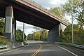
 IWAY Bridge 2022.jpg 5 184 × 3 456; 6,63 MB
-
 Lakeside Cemetery East Providence RI-2.jpg 2 000 × 1 333; 1,17 MB
-
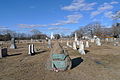
 Lakeside Cemetery East Providence RI.jpg 2 000 × 1 333; 1,07 MB
-
 Newman Cemetery East Providence RI 2012.JPG 3 776 × 2 520; 3,91 MB
-
 Newman Cemetery in East Providence RI 2012.JPG 3 776 × 2 520; 4,17 MB
-
 Park (213671725).jpeg 2 035 × 2 048; 1,85 MB
-
 Phillipsdale National Register Historic District.jpg 2 200 × 1 010; 1,15 MB
-

-

-
 Providence Illustrated, Pomham Club.jpg 3 436 × 2 767; 784 KB
-
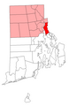
 Rhode Island Municipalities East Providence Highlighted.png 396 × 584; 33 KB
-
 RI 114 south at RI 103 US 6.jpg 183 × 373; 22 KB
-
 Road Closed on I-195 westbound.jpg 3 600 × 2 400; 2,88 MB
-
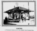 Rumford station 1903.png 1 012 × 859; 552 KB
-
 Seal of East Providence, Rhode Island.jpg 3 000 × 2 000; 2,44 MB
-
 Tockwotton front.jpg 960 × 720; 246 KB
-
 Waterfront Drive.JPG 3 008 × 2 000; 1,45 MB
-
 West 6 103.jpg 163 × 353; 8 KB
-
 WwIImemorialineastprovidenceri .jpg 2 592 × 1 944; 1,68 MB

_on_Spiraea_alba_(white_meadowsweet),_East_Providence,_RI_(41890536140).jpg)
,_Banded_Longhorn_Beetle_(Typocerus_velutinus)_on_Spiraea_alba_(white_meadowsweet),_East_Providence,_RI_(41890535600).jpg)


.jpg)


.jpeg)

_(14783999385).jpg)


