Category:East Ruston
Jump to navigation
Jump to search
English: East Ruston is a village and a civil parish in the English county of Norfolk. The village is East of the town of North Walsham.The nearest railway station is at North Walsham for the Bittern Line which runs between Cromer and Norwich. The nearest airport is Norwich International Airport.
village in the United Kingdom  | |||||
| Upload media | |||||
| Instance of | |||||
|---|---|---|---|---|---|
| Location | North Norfolk, Norfolk, East of England, England | ||||
| Population |
| ||||
| Area |
| ||||
 | |||||
Subcategories
This category has the following 10 subcategories, out of 10 total.
B
E
- East Ruston Old Vicarage Garden (35 F)
F
- Footpaths in East Ruston (12 F)
H
- Hundred Stream, East Ruston (4 F)
M
N
S
Media in category "East Ruston"
The following 81 files are in this category, out of 81 total.
-
 A glimpse of Chapel Road from Weavers Way - geograph.org.uk - 6733117.jpg 1,024 × 768; 287 KB
-
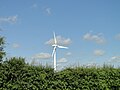 A new wind turbine on the horizon - geograph.org.uk - 4558194.jpg 1,024 × 768; 288 KB
-
 Angling Club sign - geograph.org.uk - 6733230.jpg 1,024 × 768; 391 KB
-
 B1159 to Walcott - geograph.org.uk - 6706892.jpg 1,024 × 768; 158 KB
-
 B1159 to Walcott - geograph.org.uk - 6706909.jpg 1,024 × 768; 245 KB
-
 B1159 towards Stalham - geograph.org.uk - 6706890.jpg 1,024 × 768; 175 KB
-
 Church of St Mary, East Ruston, Norfolk - geograph.org.uk - 6458232.jpg 5,184 × 3,888; 5.43 MB
-
 Church of St. Mary graveyard - geograph.org.uk - 6706897.jpg 1,024 × 768; 347 KB
-
 Cross country view from Weavers Way - geograph.org.uk - 6733103.jpg 1,024 × 768; 182 KB
-
 Dense vegetation - geograph.org.uk - 785934.jpg 480 × 640; 185 KB
-
 Ditch separating North from South Fen - geograph.org.uk - 3917066.jpg 640 × 480; 224 KB
-
 Drain from Mown Fen - geograph.org.uk - 5971993.jpg 1,600 × 1,200; 564 KB
-
 Drain towards North Walsham-Dilham Canal - geograph.org.uk - 6190519.jpg 1,600 × 1,067; 576 KB
-
 Drainage ditch in South Fen - geograph.org.uk - 3917063.jpg 640 × 480; 235 KB
-
 East on Chapel Road - geograph.org.uk - 6734159.jpg 1,024 × 768; 231 KB
-
 East Ruston Allotment - geograph.org.uk - 785909.jpg 640 × 480; 170 KB
-
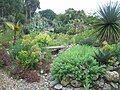
 East Ruston Gardens, Norfolk (21392019305).jpg 4,313 × 3,032; 2.75 MB
-
 East Ruston Vicarage Gardens - geograph.org.uk - 6194141.jpg 480 × 640; 115 KB
-
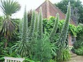
 East Ruston Vicarage Gardens - geograph.org.uk - 6195011.jpg 640 × 480; 75 KB
-
 East Ruston Vicarage Gardens - geograph.org.uk - 6195014.jpg 640 × 480; 115 KB
-
 East Ruston Vicarage Gardens - geograph.org.uk - 6195019.jpg 640 × 480; 123 KB
-
 East Ruston village sign - geograph.org.uk - 6674232.jpg 1,824 × 1,824; 1.15 MB
-
 East Ruston village sign - geograph.org.uk - 6674235.jpg 4,608 × 3,072; 5.21 MB
-
 East Ruston WW1 ^ 2 Memorial - geograph.org.uk - 5970522.jpg 1,064 × 1,600; 758 KB
-
 East Ruston WW1 ^ 2 Memorial - geograph.org.uk - 5970523.jpg 1,600 × 1,195; 795 KB
-
 East Ruston WW1 ^ 2 Memorial - geograph.org.uk - 5970524.jpg 1,059 × 1,600; 760 KB
-
 East Ruston WW1 ^ 2 Memorial - geograph.org.uk - 5970525.jpg 1,600 × 1,303; 873 KB
-
 East Ruston WW1 ^ 2 Memorial - geograph.org.uk - 5970527.jpg 1,235 × 1,600; 770 KB
-
 East Ruston's Poor Allotment property - geograph.org.uk - 4558090.jpg 1,024 × 768; 597 KB
-
 East Ruston's Poor Allotment property - geograph.org.uk - 4558091.jpg 1,024 × 768; 584 KB
-
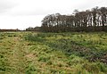
 Footpath in South Fen - geograph.org.uk - 3917059.jpg 640 × 480; 208 KB
-
 Footpath in South Fen - geograph.org.uk - 3917068.jpg 640 × 480; 183 KB
-
 Footpath skirting the Common - geograph.org.uk - 1050541.jpg 640 × 443; 101 KB
-
 Gates on Weavers Way - geograph.org.uk - 6733091.jpg 1,024 × 768; 303 KB
-
 Gates to Angling Club Lakes - geograph.org.uk - 6733238.jpg 1,024 × 768; 435 KB
-
 Grove House - geograph.org.uk - 785862.jpg 640 × 438; 112 KB
-
 Hedge growing along a ditch in South Fen - geograph.org.uk - 3917061.jpg 640 × 480; 183 KB
-
 Houses on Fox Hill from Old School Road - geograph.org.uk - 4558161.jpg 1,024 × 768; 433 KB
-
 Hundred Foot Drain - geograph.org.uk - 6733250.jpg 1,024 × 768; 360 KB
-
 Hydrant on the roadside verge - geograph.org.uk - 4558100.jpg 1,024 × 768; 312 KB
-
 Lake in East Ruston Allotment - geograph.org.uk - 785913.jpg 480 × 640; 155 KB
-
 Looking over gate towards Weavers Way entrance - geograph.org.uk - 6733220.jpg 1,024 × 768; 357 KB
-
 Looking West to Church of St. Mary - geograph.org.uk - 6706899.jpg 1,024 × 768; 257 KB
-
 Mysterious mound - geograph.org.uk - 785828.jpg 640 × 480; 180 KB
-
 Mysterious mound - geograph.org.uk - 785832.jpg 480 × 640; 164 KB
-
 Mysterious mound - geograph.org.uk - 785850.jpg 640 × 449; 174 KB
-
 On the Weaver's Way, northwest of Stalham - geograph.org.uk - 3286307.jpg 1,024 × 768; 292 KB
-
 Pastures in South Fen - geograph.org.uk - 3917067.jpg 640 × 480; 208 KB
-
 Path into South Fen - geograph.org.uk - 5972004.jpg 1,600 × 1,200; 384 KB
-
 Path through cattle pasture - geograph.org.uk - 1050508.jpg 640 × 441; 93 KB
-
 Path to East Ruston Allotment - geograph.org.uk - 785904.jpg 480 × 640; 173 KB
-

-
 Pond by Church Farm - geograph.org.uk - 3956327.jpg 640 × 480; 178 KB
-
 Postbox on Vicarage Road - geograph.org.uk - 5968950.jpg 1,600 × 1,064; 545 KB
-
 Public footpath - geograph.org.uk - 785888.jpg 480 × 640; 179 KB
-
 Rushes in South Fen pasture - geograph.org.uk - 3917069.jpg 640 × 438; 189 KB
-
 Sculptures in a garden on Drabb's lane - geograph.org.uk - 4558099.jpg 1,024 × 768; 437 KB
-
 Sign in Church porch - geograph.org.uk - 6706893.jpg 1,024 × 768; 158 KB
-
 South Fen - geograph.org.uk - 3917004.jpg 640 × 480; 83 KB
-
 South Fen from Weavers' Way - geograph.org.uk - 5972012.jpg 1,600 × 1,149; 352 KB
-
 South Fen, East Ruston - geograph.org.uk - 3917008.jpg 640 × 480; 109 KB
-
 Southeast on the Weavers Way - geograph.org.uk - 812105.jpg 640 × 480; 180 KB
-
 St. Mary East Ruston Church - geograph.org.uk - 6706884.jpg 1,024 × 768; 332 KB
-

-
 The gates at East Ruston church - geograph.org.uk - 4558199.jpg 1,024 × 768; 343 KB
-
 Thinning out - geograph.org.uk - 785925.jpg 640 × 480; 198 KB
-
 Tidy stacks - geograph.org.uk - 785937.jpg 480 × 640; 187 KB
-
 Trackway between South Fen and Broad Fen - geograph.org.uk - 3917006.jpg 640 × 480; 110 KB
-
 View across pasture in South Fen - geograph.org.uk - 3917062.jpg 640 × 480; 204 KB
-
 View across South Fen - geograph.org.uk - 521992.jpg 640 × 480; 70 KB
-
 View across stubble - geograph.org.uk - 1050376.jpg 640 × 399; 109 KB
-
 View across the lake - geograph.org.uk - 785930.jpg 640 × 480; 134 KB
-
 View from graveyard of Church of St. Mary - geograph.org.uk - 6706907.jpg 1,024 × 768; 330 KB
-
 View northeast - geograph.org.uk - 785911.jpg 480 × 640; 145 KB
-
 View through trees on Back Road - geograph.org.uk - 564345.jpg 480 × 640; 76 KB
-
 Weavers Way towards East Ruston - geograph.org.uk - 812109.jpg 480 × 640; 193 KB
-
 Weavers' Way following old railway line - geograph.org.uk - 5972008.jpg 1,600 × 1,200; 533 KB
-
 Weavers' Way following old railway line - geograph.org.uk - 6190506.jpg 1,600 × 1,067; 698 KB
-
 Weavers' Way past East Ruston - geograph.org.uk - 5972010.jpg 1,600 × 1,200; 351 KB
-
 West on Chapel Road - geograph.org.uk - 6734157.jpg 1,024 × 768; 240 KB
-
 Wheat field - geograph.org.uk - 6195021.jpg 640 × 480; 44 KB


.jpg)


