Category:Eastnor, Herefordshire
Jump to navigation
Jump to search
village in Herefordshire, England, UK | |||||
| Upload media | |||||
| Instance of | |||||
|---|---|---|---|---|---|
| Location | Herefordshire, West Midlands, England | ||||
 | |||||

Cymraeg: Pentref yn Swydd Henffordd, Gorllewin Canolbarth Lloegr, Lloegr ydy Eastnor, Herefordshire. (→Eastnor, Swydd Henffordd)
Polski: Eastnor – wieś w Anglii, w hrabstwie Herefordshire. Leży 23 km na wschód od miasta Hereford i 167 km na zachód od Londynu. (→Eastnor (Herefordshire))
Subcategories
This category has the following 12 subcategories, out of 12 total.
B
- Bronsil Castle (4 F)
C
- Clencher's Mill (24 F)
- Clencher's Mill Ford (8 F)
- Clutter's Cave, Malvern hills (15 F)
E
J
O
- Old Post Office, Eastnor (5 F)
S
T
Media in category "Eastnor, Herefordshire"
The following 200 files are in this category, out of 412 total.
(previous page) (next page)-

-
 A carpet of bluebells - geograph.org.uk - 5767128.jpg 1,024 × 680; 431 KB
-
 A Christmas Eve walk - geograph.org.uk - 6007497.jpg 1,024 × 683; 203 KB
-
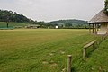
 A cricket match at Eastnor - geograph.org.uk - 5115976.jpg 1,024 × 768; 188 KB
-
 A heron over the Malvern Hills - geograph.org.uk - 1931471.jpg 640 × 426; 54 KB
-
 A passing shower - geograph.org.uk - 5764728.jpg 1,024 × 680; 164 KB
-
 A view from the boundary - geograph.org.uk - 4952183.jpg 1,600 × 1,064; 414 KB
-
 A438 - view toward White House Farm - geograph.org.uk - 2321015.jpg 640 × 480; 52 KB
-
 A438 at Eastnor - geograph.org.uk - 2321089.jpg 640 × 480; 51 KB
-
 A438 at Eastnor, 1 - geograph.org.uk - 5008225.jpg 800 × 451; 129 KB
-
 A438 at Eastnor, 2 - geograph.org.uk - 5008229.jpg 1,600 × 901; 748 KB
-
 A438 entering Eastnor from the north - geograph.org.uk - 6040971.jpg 3,968 × 2,413; 2.67 MB
-
 A438 near Eastnor Castle - geograph.org.uk - 2321093.jpg 640 × 480; 43 KB
-
 A438, Eastnor - geograph.org.uk - 2285928.jpg 640 × 430; 83 KB
-
 A449 approaching the A438 junction - geograph.org.uk - 2321010.jpg 640 × 480; 65 KB
-
 A449 at Eastnor Hill - geograph.org.uk - 2321033.jpg 640 × 480; 62 KB
-
 A449 at Wayend Street - geograph.org.uk - 2321097.jpg 640 × 480; 60 KB
-
 A449 towards Malvern - geograph.org.uk - 5046085.jpg 1,024 × 620; 134 KB
-
-
 Air shaft - geograph.org.uk - 3986055.jpg 1,024 × 706; 746 KB
-
 All we need is... L O V E - geograph.org.uk - 6040361.jpg 4,288 × 3,216; 3.53 MB
-
 Amusing roadsign near Eastnor - geograph.org.uk - 4088903.jpg 3,000 × 4,000; 3.62 MB
-
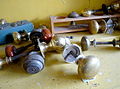 Antique door knobs - geograph.org.uk - 1293717.jpg 640 × 476; 78 KB
-
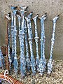 Any old iron - geograph.org.uk - 1294497.jpg 480 × 640; 171 KB
-
 Arched passage - geograph.org.uk - 5114782.jpg 768 × 1,024; 165 KB
-
 Assessing the possibilities - geograph.org.uk - 1294471.jpg 640 × 451; 127 KB
-
 At Eastnor, Herefordshire - geograph.org.uk - 4944559.jpg 640 × 480; 88 KB
-
 Autumn gold - geograph.org.uk - 6316775.jpg 1,024 × 768; 310 KB
-
 Avenue of trees, Eastnor - geograph.org.uk - 1023948.jpg 426 × 640; 128 KB
-
 Barn in Eastnor Castle Estate - geograph.org.uk - 4088910.jpg 4,000 × 3,000; 3.98 MB
-
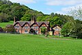
 Barns at Hill Farm - geograph.org.uk - 1599011.jpg 640 × 480; 99 KB
-
 Berrow Wood, Berth Hill and beyond - geograph.org.uk - 4268437.jpg 1,024 × 651; 516 KB
-
 Bluebells at Castle Coppice - geograph.org.uk - 915923.jpg 640 × 480; 149 KB
-

-

-
 Buds on a beech tree - geograph.org.uk - 5731466.jpg 680 × 1,024; 138 KB
-
 Castle Coppice - geograph.org.uk - 1977421.jpg 4,272 × 2,394; 5.8 MB
-
 Castle Coppice - geograph.org.uk - 1977514.jpg 4,272 × 2,848; 4.34 MB
-
 Castle Coppice - geograph.org.uk - 2744917.jpg 640 × 360; 209 KB
-
 Castle Copse Cottage - geograph.org.uk - 1960430.jpg 3,236 × 2,067; 5.95 MB
-
 Catkins on a tree - geograph.org.uk - 6057217.jpg 1,024 × 768; 256 KB
-
 Catkins on a tree - geograph.org.uk - 6057221.jpg 768 × 1,024; 251 KB
-
 Clambering up out of Birchen Wood - geograph.org.uk - 2750676.jpg 4,000 × 3,000; 5.04 MB
-
 Climbing Eastnor Hill 1974 - geograph.org.uk - 2805225.jpg 640 × 417; 85 KB
-
 Clouds above the Cotswold Hills - geograph.org.uk - 6115412.jpg 1,024 × 768; 136 KB
-

-
 Cottages at Wayend - geograph.org.uk - 649709.jpg 640 × 480; 84 KB
-
 Cow Parsley, Anthriscus sylvestris - geograph.org.uk - 5008290.jpg 1,599 × 1,600; 1.31 MB
-
 Craft session for children at Lakefest - geograph.org.uk - 6041271.jpg 4,288 × 3,216; 3.66 MB
-
 Deer Gates, Eastnor Deer Park - geograph.org.uk - 1974246.jpg 4,272 × 2,848; 6.68 MB
-
 Detail on a dead tree trunk - geograph.org.uk - 5678645.jpg 1,024 × 768; 323 KB
-
 Duck Pond - geograph.org.uk - 3986066.jpg 1,600 × 1,067; 1.82 MB
-
 Earthworks on the Malvern Hills - geograph.org.uk - 4208412.jpg 800 × 531; 91 KB
-

-
 Eastnor Cricket Field - geograph.org.uk - 1023339.jpg 640 × 426; 66 KB
-
 Eastnor Cricket ground - geograph.org.uk - 4944589.jpg 640 × 480; 61 KB
-
 Eastnor Cricket ground - geograph.org.uk - 4944606.jpg 640 × 480; 73 KB
-
 Eastnor cricket ground - geograph.org.uk - 818588.jpg 640 × 426; 71 KB
-
 Eastnor Estate road - geograph.org.uk - 2750288.jpg 640 × 408; 283 KB
-
 Eastnor Estate road - geograph.org.uk - 3573624.jpg 640 × 360; 104 KB
-
 Eastnor Farm (geograph 6637548).jpg 1,024 × 768; 323 KB
-
 Eastnor farm - geograph.org.uk - 1593906.jpg 640 × 480; 112 KB
-
 Eastnor Farm orchard - geograph.org.uk - 1593935.jpg 640 × 480; 81 KB
-
 Eastnor Hill - geograph.org.uk - 1593930.jpg 640 × 480; 78 KB
-
 Eastnor Home Farm - geograph.org.uk - 4952140.jpg 1,600 × 1,064; 534 KB
-
 Eastnor Lodge (geograph 6894673).jpg 1,600 × 1,200; 537 KB
-
 Eastnor Pottery - geograph.org.uk - 1593925.jpg 640 × 480; 85 KB
-
 Eastnor village green - geograph.org.uk - 2869526.jpg 1,024 × 768; 139 KB
-
 Eastnor Wood - geograph.org.uk - 2744945.jpg 640 × 360; 232 KB
-
 Entering Eastnor - geograph.org.uk - 1367714.jpg 640 × 480; 172 KB
-
 Entering Eastnor, A438 - geograph.org.uk - 2285924.jpg 640 × 432; 48 KB
-
 Entering Worcestershire, A438 - geograph.org.uk - 2285934.jpg 640 × 405; 74 KB
-
 Entrance to a reclamation yard - geograph.org.uk - 1294488.jpg 640 × 480; 94 KB
-
 Exposed imported limestone, Iron-Age camp - geograph.org.uk - 1956768.jpg 3,309 × 2,223; 6.25 MB
-
 Fairoaks Farm - geograph.org.uk - 5764732.jpg 800 × 531; 142 KB
-
 Farm track across Eastnor Hill - 1 - geograph.org.uk - 1599335.jpg 640 × 480; 113 KB
-
 Farm track across Eastnor Hill - 2 - geograph.org.uk - 1599346.jpg 640 × 480; 133 KB
-
 Farm Track near Clencher's Mill Wood - geograph.org.uk - 1596377.jpg 640 × 480; 113 KB
-
 Farmland and Massington Farm - geograph.org.uk - 1717117.jpg 640 × 426; 74 KB
-
 Farmland at Eastnor - geograph.org.uk - 1022854.jpg 640 × 426; 70 KB
-
 Farmland east of Ledbury - geograph.org.uk - 1293865.jpg 640 × 480; 208 KB
-
 Farmland near Eastnor - geograph.org.uk - 1023915.jpg 640 × 426; 52 KB
-
 Farmland near Massington Farm - geograph.org.uk - 1717160.jpg 640 × 426; 68 KB
-
 Farmland near Ockeridge Farm - geograph.org.uk - 1025268.jpg 640 × 426; 87 KB
-

-
 Farmland to the north of Eastnor - geograph.org.uk - 5340067.jpg 1,024 × 768; 301 KB
-
 Field, Clencher's Mill - geograph.org.uk - 2744937.jpg 640 × 360; 252 KB
-
 Fields near Eastnor - geograph.org.uk - 4088919.jpg 4,000 × 3,000; 3.18 MB
-
 Fields near White House Farm - geograph.org.uk - 3620669.jpg 640 × 427; 63 KB
-
 Flock of sheep near Clencher's Mill Wood - geograph.org.uk - 1596388.jpg 640 × 480; 126 KB
-
 Footbridge on the edge of Eastnor Park - geograph.org.uk - 5008244.jpg 1,600 × 901; 773 KB
-
 Footpath direction marker - geograph.org.uk - 5763363.jpg 1,024 × 576; 233 KB
-
 Footpath sign for the Geopark Way at Eastnor - geograph.org.uk - 6040395.jpg 4,288 × 3,216; 4.02 MB
-
 Footpath to Wayend Street - geograph.org.uk - 5999175.jpg 1,024 × 768; 248 KB
-
 Fowlet Farm and Eastnor Castle - geograph.org.uk - 1628709.jpg 426 × 640; 100 KB
-
 Fowlett Farm and Eastnor Castle - geograph.org.uk - 5639374.jpg 1,024 × 768; 285 KB
-
 Gap in the woods - geograph.org.uk - 1595256.jpg 640 × 480; 113 KB
-
 Gate in Gullet Wood - geograph.org.uk - 5533913.jpg 1,024 × 768; 317 KB
-
 Gateway at Dead Woman's Thorn - geograph.org.uk - 1599314.jpg 640 × 480; 160 KB
-
 Gateway to Woolpits Farm - geograph.org.uk - 1595286.jpg 640 × 480; 124 KB
-
 Glamping tents at Lakefest - geograph.org.uk - 6040324.jpg 4,288 × 3,216; 3.52 MB
-
 Golden Gates Lodge - geograph.org.uk - 6040377.jpg 4,288 × 3,216; 3.34 MB
-
 Grass field near Clencher's Mill - geograph.org.uk - 5999179.jpg 1,024 × 768; 173 KB
-
 Hawthorn blossom - geograph.org.uk - 5340070.jpg 1,024 × 768; 220 KB
-
 Hazel catkins - geograph.org.uk - 5679225.jpg 680 × 1,024; 150 KB
-
 Headland track - geograph.org.uk - 1719813.jpg 640 × 426; 107 KB
-
 Healthy ash foliage - geograph.org.uk - 5008297.jpg 1,600 × 1,200; 964 KB
-
 Herefordshire Beacon from the south - geograph.org.uk - 4786783.jpg 1,600 × 1,200; 257 KB
-
 Herefordshire road sign, Hollybush - geograph.org.uk - 3628877.jpg 640 × 360; 103 KB
-

-
 Hillside north of Eastnor - geograph.org.uk - 6040967.jpg 4,288 × 3,216; 4.12 MB
-
 Hollow-way from Walm's Well - geograph.org.uk - 3950725.jpg 1,024 × 683; 871 KB
-
 Hollybush Quarry - geograph.org.uk - 1977655.jpg 4,272 × 2,848; 7 MB
-
 Home Farm, Eastnor - geograph.org.uk - 5904580.jpg 1,024 × 768; 178 KB
-
 Houses overlooking the Malvern Hills - geograph.org.uk - 1720235.jpg 426 × 640; 61 KB
-
 Into the mist - geograph.org.uk - 3181730.jpg 640 × 480; 74 KB
-
 Isolated tree near Gold Hill Farm - geograph.org.uk - 5998451.jpg 1,024 × 768; 158 KB
-
 Land Rovers in News Wood, Eastnor - geograph.org.uk - 1134113.jpg 640 × 427; 342 KB
-
 Lane to White House Farm - geograph.org.uk - 1294482.jpg 640 × 454; 102 KB
-
 Lichen, Eastnor - geograph.org.uk - 1134248.jpg 640 × 623; 357 KB
-
 Lodge and entrance - geograph.org.uk - 895381.jpg 640 × 480; 130 KB
-
 Longdon Marsh in flood - geograph.org.uk - 3238622.jpg 640 × 377; 185 KB
-
 Looking down to the car park - geograph.org.uk - 5890578.jpg 640 × 480; 80 KB
-
 Looking north from Eastnor Obelisk - geograph.org.uk - 6041268.jpg 4,832 × 1,264; 919 KB
-
 Lots of pots - geograph.org.uk - 1293889.jpg 640 × 480; 240 KB
-
 Maize stubble - geograph.org.uk - 2167727.jpg 4,272 × 2,848; 5.05 MB
-
 May Hill - geograph.org.uk - 4268695.jpg 1,024 × 568; 367 KB
-
 Mayhill Wood - geograph.org.uk - 1593963.jpg 640 × 480; 131 KB
-
 Meadow at Dead Woman's Thorn - geograph.org.uk - 1599117.jpg 640 × 480; 115 KB
-
 Meeting of tracks - geograph.org.uk - 3708457.jpg 640 × 480; 242 KB
-
 Milestone - Tewkesbury 9 - geograph.org.uk - 4375012.jpg 640 × 480; 117 KB
-
 Milestone, Hollybush pass, The Malverns - geograph.org.uk - 3320185.jpg 640 × 503; 384 KB
-
 Muddy gateway near Dead Woman's Thorn - geograph.org.uk - 1599085.jpg 640 × 480; 147 KB
-
 Netherton Cottages, Eastnor - geograph.org.uk - 3299921.jpg 640 × 427; 249 KB
-
 Netherton Farm (geograph 7389144).jpg 1,600 × 900; 750 KB
-
 Netherton Farm - geograph.org.uk - 1135960.jpg 640 × 427; 241 KB
-
 Netherton Farm and woodland - geograph.org.uk - 6320836.jpg 1,024 × 683; 250 KB
-
 Netherton Farm, Eastnor - geograph.org.uk - 3299925.jpg 640 × 427; 307 KB
-
 News Wood - geograph.org.uk - 2186927.jpg 4,272 × 2,542; 6.13 MB
-
 News Wood - geograph.org.uk - 893792.jpg 640 × 318; 41 KB
-
 Northern end of Eastnor Hill - geograph.org.uk - 2744995.jpg 640 × 343; 186 KB
-
 Oakeridge Farm - geograph.org.uk - 6265362.jpg 1,024 × 768; 224 KB
-
 Oakridge Farm - geograph.org.uk - 4207915.jpg 800 × 531; 102 KB
-
 Oakridge Farm, Colwall Green, Herefordshire - geograph.org.uk - 4953858.jpg 1,600 × 1,200; 363 KB
-
 Ockeridge Farm - geograph.org.uk - 5926072.jpg 1,024 × 768; 248 KB
-
 Ockeridge Farm - geograph.org.uk - 5979533.jpg 1,024 × 683; 178 KB
-
 Ockeridge Farm - geograph.org.uk - 6170876.jpg 1,024 × 768; 223 KB
-
 Ockeridge Farm - geograph.org.uk - 6186192.jpg 1,024 × 768; 176 KB
-
 Ockeridge Farm - geograph.org.uk - 6227794.jpg 1,024 × 768; 251 KB
-
 Ockeridge Farm - geograph.org.uk - 6257107.jpg 1,024 × 768; 226 KB
-
 Ockeridge Farm - geograph.org.uk - 6290663.jpg 1,024 × 768; 194 KB
-
 Ockeridge Farm and Herefordshire countryside - geograph.org.uk - 6227799.jpg 1,024 × 768; 258 KB
-
 Ockeridge Farm and Herefordshire countryside - geograph.org.uk - 6320832.jpg 1,024 × 683; 235 KB
-
 Oldcastle Farm - geograph.org.uk - 907404.jpg 640 × 480; 85 KB
-
 Orchard full of pheasants - geograph.org.uk - 5904574.jpg 1,024 × 768; 248 KB
-
 Ordnance Survey Cut Mark - geograph.org.uk - 4375022.jpg 480 × 640; 87 KB
-
 Overlooking Gullet Wood - geograph.org.uk - 1356907.jpg 640 × 480; 99 KB
-
 Paddock at Eastnor - geograph.org.uk - 4944542.jpg 640 × 480; 78 KB
-
 Panorama from Eastnor Obelisk - geograph.org.uk - 6041267.jpg 4,640 × 1,248; 1.09 MB
-
 Park Lodge - geograph.org.uk - 649835.jpg 640 × 480; 97 KB
-
 Path and silver birch trees - geograph.org.uk - 6057214.jpg 1,024 × 768; 352 KB
-
 Path approaching Clutter's Cave - geograph.org.uk - 5616160.jpg 1,024 × 683; 278 KB
-
 Path approaching Clutter's Cave - geograph.org.uk - 6026316.jpg 1,024 × 768; 237 KB
-
 Path junction in Gullet Wood - geograph.org.uk - 4088863.jpg 4,000 × 3,000; 5.04 MB
-
 Path through Gullet Wood - geograph.org.uk - 4088860.jpg 3,000 × 4,000; 5.04 MB
-
 Path through Gullet Wood - geograph.org.uk - 5092734.jpg 1,600 × 1,200; 849 KB
-
 Path to Peacock Villa - geograph.org.uk - 907171.jpg 640 × 480; 93 KB
-
 Path, Raggedstone Common - geograph.org.uk - 2744914.jpg 640 × 360; 278 KB
-
 Pendocks Grove - geograph.org.uk - 3510612.jpg 640 × 360; 68 KB
-
 People ignoring the warnings - geograph.org.uk - 5768134.jpg 1,024 × 680; 330 KB
-
 Picture-winged Fly. Tephrid . Tephritis formosa.. - Flickr - gailhampshire.jpg 2,776 × 2,440; 589 KB
-
 Potsssssssss 1 - geograph.org.uk - 1293874.jpg 640 × 480; 245 KB
-
 Potsssssssss 2 - geograph.org.uk - 1293884.jpg 640 × 640; 359 KB
-
 Prepared field near Eastnor - geograph.org.uk - 5999168.jpg 1,024 × 768; 192 KB
-
 Prepared field with pheasants near Eastnor - geograph.org.uk - 5904679.jpg 1,024 × 768; 202 KB
-
 Private Road on the Eastnor Estate - geograph.org.uk - 4952704.jpg 1,600 × 1,200; 611 KB
-
 Public footpath at Hatfield Coppice - geograph.org.uk - 907410.jpg 640 × 480; 105 KB
-
 Public footpath near Hatfield Coppice - geograph.org.uk - 907389.jpg 640 × 480; 91 KB
-
 Public footpath to Dead Woman's Thorn - geograph.org.uk - 1599320.jpg 640 × 480; 130 KB
-
 Public footpath to Evendine - geograph.org.uk - 907324.jpg 640 × 480; 78 KB
-
 Pussy willow catkins - geograph.org.uk - 6086580.jpg 1,024 × 768; 144 KB
-
 Railway bridge and White House Farm - geograph.org.uk - 2167733.jpg 4,272 × 2,848; 4.41 MB
-
 Rams on Eastnor estate - geograph.org.uk - 6040404.jpg 4,288 × 3,216; 3.51 MB
-
 Rape field near White House Farm - geograph.org.uk - 3986379.jpg 1,024 × 683; 666 KB
-
 Reflective path, Eastnor - geograph.org.uk - 1134194.jpg 640 × 427; 334 KB
-
 Road junction to Eastnor Castle - geograph.org.uk - 649727.jpg 640 × 480; 63 KB
-
 Road through White House Farm - geograph.org.uk - 4088926.jpg 4,000 × 3,000; 3.38 MB
-
 Road under Midsummer Hill - geograph.org.uk - 3573638.jpg 640 × 360; 106 KB
-
 Roadside cottages near Hollybush - geograph.org.uk - 2321109.jpg 640 × 480; 68 KB
-

-
 Semi-detached cottages (geograph 6945994).jpg 1,600 × 1,200; 795 KB
-
 Shadows on a footbridge - geograph.org.uk - 747850.jpg 480 × 640; 203 KB
-
 Shed near The Ridgeway - geograph.org.uk - 650040.jpg 640 × 480; 117 KB
-
 Sheep and lamb - geograph.org.uk - 6180228.jpg 1,024 × 768; 377 KB
-
 Sheep at Netherpaths Farm - geograph.org.uk - 845478.jpg 640 × 480; 82 KB
-
 Sheep in clover - geograph.org.uk - 893782.jpg 640 × 480; 102 KB
-
 Sheep pasture near Massington Farm - geograph.org.uk - 650053.jpg 640 × 480; 82 KB
-
 Sheep pastures at Woolpits Farm - geograph.org.uk - 1596384.jpg 640 × 480; 177 KB
-
 Shire Ditch running north - geograph.org.uk - 2668439.jpg 1,306 × 979; 329 KB
-
 Shower approaching Woolpits Farm - geograph.org.uk - 1596364.jpg 640 × 480; 70 KB


.jpg)


.jpg)


.jpg)


.jpg)


