Category:Eastnor, Herefordshire
Jump to navigation
Jump to search
village in Herefordshire, England, UK | |||||
| Upload media | |||||
| Instance of | |||||
|---|---|---|---|---|---|
| Location | Herefordshire, West Midlands, England | ||||
| Population |
| ||||
 | |||||

Cymraeg: Pentref yn Swydd Henffordd, Gorllewin Canolbarth Lloegr, Lloegr ydy Eastnor, Herefordshire. (→Eastnor, Swydd Henffordd)
Polski: Eastnor – wieś w Anglii, w hrabstwie Herefordshire. Leży 23 km na wschód od miasta Hereford i 167 km na zachód od Londynu. (→Eastnor (Herefordshire))
Subcategories
This category has the following 12 subcategories, out of 12 total.
B
- Bronsil Castle (4 F)
C
- Clencher's Mill (24 F)
- Clencher's Mill Ford (8 F)
- Clutter's Cave, Malvern hills (15 F)
E
J
O
- Old Post Office, Eastnor (5 F)
S
T
Media in category "Eastnor, Herefordshire"
The following 200 files are in this category, out of 653 total.
(previous page) (next page)-

-
 A carpet of bluebells - geograph.org.uk - 5767128.jpg 1,024 × 680; 431 KB
-
 A Christmas Eve walk - geograph.org.uk - 6007497.jpg 1,024 × 683; 203 KB
-
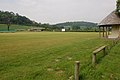
 A cricket match at Eastnor - geograph.org.uk - 5115976.jpg 1,024 × 768; 188 KB
-
 A heron over the Malvern Hills - geograph.org.uk - 1931471.jpg 640 × 426; 54 KB
-
 A passing shower - geograph.org.uk - 5764728.jpg 1,024 × 680; 164 KB
-
 A view from the boundary - geograph.org.uk - 4952183.jpg 1,600 × 1,064; 414 KB
-
 A438 - view toward White House Farm - geograph.org.uk - 2321015.jpg 640 × 480; 52 KB
-
 A438 at Eastnor - geograph.org.uk - 2321089.jpg 640 × 480; 51 KB
-
 A438 at Eastnor, 1 - geograph.org.uk - 5008225.jpg 800 × 451; 129 KB
-
 A438 at Eastnor, 2 - geograph.org.uk - 5008229.jpg 1,600 × 901; 748 KB
-
 A438 entering Eastnor from the north - geograph.org.uk - 6040971.jpg 3,968 × 2,413; 2.67 MB
-
 A438 near Eastnor Castle - geograph.org.uk - 2321093.jpg 640 × 480; 43 KB
-
 A438, Eastnor - geograph.org.uk - 2285928.jpg 640 × 430; 83 KB
-
 A449 approaching the A438 junction - geograph.org.uk - 2321010.jpg 640 × 480; 65 KB
-
 A449 at Eastnor Hill - geograph.org.uk - 2321033.jpg 640 × 480; 62 KB
-
 A449 at Wayend Street - geograph.org.uk - 2321097.jpg 640 × 480; 60 KB
-
 A449 towards Malvern - geograph.org.uk - 5046085.jpg 1,024 × 620; 134 KB
-
-
 Air shaft - geograph.org.uk - 3986055.jpg 1,024 × 706; 746 KB
-
 All we need is... L O V E - geograph.org.uk - 6040361.jpg 4,288 × 3,216; 3.53 MB
-
 Amusing roadsign near Eastnor - geograph.org.uk - 4088903.jpg 3,000 × 4,000; 3.62 MB
-
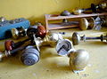 Antique door knobs - geograph.org.uk - 1293717.jpg 640 × 476; 78 KB
-
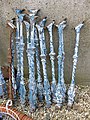 Any old iron - geograph.org.uk - 1294497.jpg 480 × 640; 171 KB
-
 Arched passage - geograph.org.uk - 5114782.jpg 768 × 1,024; 165 KB
-
 Assessing the possibilities - geograph.org.uk - 1294471.jpg 640 × 451; 127 KB
-
 At Eastnor, Herefordshire - geograph.org.uk - 4944559.jpg 640 × 480; 88 KB
-
 Autumn gold - geograph.org.uk - 6316775.jpg 1,024 × 768; 310 KB
-
 Avenue of trees, Eastnor - geograph.org.uk - 1023948.jpg 426 × 640; 128 KB
-
 Barn in Eastnor Castle Estate - geograph.org.uk - 4088910.jpg 4,000 × 3,000; 3.98 MB
-
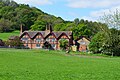
 Barns at Hill Farm - geograph.org.uk - 1599011.jpg 640 × 480; 99 KB
-
 Berrow Wood, Berth Hill and beyond - geograph.org.uk - 4268437.jpg 1,024 × 651; 516 KB
-

-

-
 British Camp Reservoir - geograph.org.uk - 6637422.jpg 1,920 × 1,080; 1.02 MB
-
 British Camp Reservoir, Malverns - geograph.org.uk - 6408946.jpg 5,184 × 2,920; 5.1 MB
-
 Broad Down (Viewed from Millennium Hill) - geograph.org.uk - 6637415.jpg 1,920 × 1,080; 1.02 MB
-
 Broad Down - geograph.org.uk - 6637289.jpg 1,920 × 1,080; 891 KB
-
 Broad Down - geograph.org.uk - 6637444.jpg 1,920 × 1,080; 996 KB
-
 Bronsil Castle (Centre-west tower and wall) - geograph.org.uk - 6632352.jpg 3,648 × 2,736; 4.66 MB
-
 Bronsil Castle (Centre-west tower) - geograph.org.uk - 6632113.jpg 3,648 × 2,736; 5.15 MB
-
 Bronsil Castle (Centre-west tower) - geograph.org.uk - 6632334.jpg 3,648 × 2,736; 5.27 MB
-
 Bronsil Castle (Courtyard) - geograph.org.uk - 6632328.jpg 3,648 × 2,736; 4.93 MB
-
 Bronsil Castle (Footbridge) - geograph.org.uk - 6632059.jpg 1,920 × 1,080; 1.03 MB
-
 Bronsil Castle (Footbridge) - geograph.org.uk - 6632064.jpg 1,920 × 1,080; 1.06 MB
-
 Bronsil Castle (Footbridge) - geograph.org.uk - 6632356.jpg 3,648 × 2,736; 4.97 MB
-
 Bronsil Castle (Moat) - geograph.org.uk - 6632068.jpg 3,648 × 2,736; 4.9 MB
-
 Bronsil Castle (Moat) - geograph.org.uk - 6632309.jpg 3,648 × 2,736; 5.14 MB
-
 Bronsil Castle (Moat) - geograph.org.uk - 6632344.jpg 3,648 × 2,736; 4.43 MB
-
 Bronsil Castle (North tower) - geograph.org.uk - 6632131.jpg 3,648 × 2,736; 4.78 MB
-
 Bronsil Castle (North-east tower) - geograph.org.uk - 6632209.jpg 3,648 × 2,736; 5.24 MB
-
 Bronsil Castle (North-east tower) - geograph.org.uk - 6632313.jpg 3,648 × 2,736; 5.11 MB
-
 Bronsil Castle (North-east wall) - geograph.org.uk - 6632178.jpg 3,648 × 2,736; 4.82 MB
-
 Bronsil Castle - geograph.org.uk - 6632372.jpg 1,920 × 1,080; 1.07 MB
-
 Buds on a beech tree - geograph.org.uk - 5731466.jpg 680 × 1,024; 138 KB
-
 Castle Coppice - geograph.org.uk - 1977421.jpg 4,272 × 2,394; 5.8 MB
-
 Castle Coppice - geograph.org.uk - 1977514.jpg 4,272 × 2,848; 4.34 MB
-
 Castle Coppice - geograph.org.uk - 2744917.jpg 640 × 360; 209 KB
-
 Castle Copse Cottage (Hollybush) - geograph.org.uk - 6620026.jpg 3,648 × 2,736; 4.86 MB
-
 Castle Copse Cottage (Hollybush) - geograph.org.uk - 6620032.jpg 3,648 × 2,736; 4.58 MB
-
 Castle Copse Cottage - geograph.org.uk - 1960430.jpg 3,236 × 2,067; 5.95 MB
-
 Cat by Eastnor Obelisk - geograph.org.uk - 6619873.jpg 3,648 × 2,736; 4.81 MB
-
 Cat by Eastnor Obelisk - geograph.org.uk - 6619874.jpg 3,648 × 2,736; 4.72 MB
-
 Catkins on a tree - geograph.org.uk - 6057217.jpg 1,024 × 768; 256 KB
-
 Catkins on a tree - geograph.org.uk - 6057221.jpg 768 × 1,024; 251 KB
-
 Clambering up out of Birchen Wood - geograph.org.uk - 2750676.jpg 4,000 × 3,000; 5.04 MB
-
 Climbing Eastnor Hill 1974 - geograph.org.uk - 2805225.jpg 640 × 417; 85 KB
-
 Clouds above the Cotswold Hills - geograph.org.uk - 6115412.jpg 1,024 × 768; 136 KB
-

-
 Common pheasant by Bronsil Castle - geograph.org.uk - 6631913.jpg 1,920 × 1,080; 1.07 MB
-
 Common pheasant on the path to Midsummer Hill - geograph.org.uk - 6617400.jpg 2,415 × 1,440; 1.32 MB
-
 Common pheasant on the path to Midsummer Hill - geograph.org.uk - 6617405.jpg 2,327 × 1,288; 1.1 MB
-
 Cottages at Wayend - geograph.org.uk - 649709.jpg 640 × 480; 84 KB
-
 Cow Parsley, Anthriscus sylvestris - geograph.org.uk - 5008290.jpg 1,599 × 1,600; 1.31 MB
-
 Craft session for children at Lakefest - geograph.org.uk - 6041271.jpg 4,288 × 3,216; 3.66 MB
-
 Cricket pavilion at Eastnor - geograph.org.uk - 6637553.jpg 1,024 × 768; 204 KB
-
 Crow on Swinyard Hill - geograph.org.uk - 6634546.jpg 1,920 × 1,080; 1,001 KB
-
 Crow on Swinyard Hill - geograph.org.uk - 6634548.jpg 1,920 × 1,080; 1.07 MB
-
 Deer Gates, Eastnor Deer Park - geograph.org.uk - 1974246.jpg 4,272 × 2,848; 6.68 MB
-
 Descent of Ragged Stone Hill - geograph.org.uk - 6625575.jpg 2,560 × 1,440; 1.73 MB
-
 Detail on a dead tree trunk - geograph.org.uk - 5678645.jpg 1,024 × 768; 323 KB
-
 Direction marker on Swinyard Hill - geograph.org.uk - 6634533.jpg 1,920 × 1,080; 1.04 MB
-
 Direction marker on Swinyard Hill - geograph.org.uk - 6634540.jpg 1,920 × 1,080; 1.06 MB
-
 Direction marker to Hangman's Hill and Broad Down - geograph.org.uk - 6634829.jpg 1,920 × 1,080; 1.05 MB
-
 Duck Pond - geograph.org.uk - 3986066.jpg 1,600 × 1,067; 1.82 MB
-
 Ducks swimming in the moat at Bronsil Castle - geograph.org.uk - 6632278.jpg 1,920 × 1,080; 733 KB
-
 Ducks swimming in the moat at Bronsil Castle - geograph.org.uk - 6632290.jpg 1,920 × 1,080; 1.01 MB
-
 Dutch barn - geograph.org.uk - 6696552.jpg 1,024 × 683; 254 KB
-
 Earthworks on the Malvern Hills - geograph.org.uk - 4208412.jpg 800 × 531; 91 KB
-

-
 Eastnor Castle (Viewed from Chase End Hill) - geograph.org.uk - 6599229.jpg 2,521 × 1,418; 623 KB
-
 Eastnor Castle (Viewed from Eastnor Obelisk) - geograph.org.uk - 6619996.jpg 2,560 × 1,440; 1.45 MB
-
 Eastnor Castle (Viewed from Midsummer Hill) - geograph.org.uk - 6616344.jpg 2,390 × 1,346; 578 KB
-
 Eastnor Castle - geograph.org.uk - 6637545.jpg 1,024 × 768; 268 KB
-
 Eastnor Castle - geograph.org.uk - 6670999.jpg 1,024 × 768; 258 KB
-
 Eastnor Castle - geograph.org.uk - 6696564.jpg 1,024 × 768; 265 KB
-
 Eastnor Castle and Obelisk (Viewed from Midsummer Hill) - geograph.org.uk - 6617152.jpg 2,560 × 1,440; 1.72 MB
-
 Eastnor Castle and Obelisk (Viewed from Midsummer Hill) - geograph.org.uk - 6617366.jpg 2,560 × 1,440; 1.72 MB
-
 Eastnor church - geograph.org.uk - 6637551.jpg 1,024 × 768; 289 KB
-
 Eastnor church - geograph.org.uk - 6697323.jpg 1,024 × 768; 286 KB
-
 Eastnor Cricket Field - geograph.org.uk - 1023339.jpg 640 × 426; 66 KB
-
 Eastnor Cricket ground - geograph.org.uk - 4944589.jpg 640 × 480; 61 KB
-
 Eastnor Cricket ground - geograph.org.uk - 4944606.jpg 640 × 480; 73 KB
-
 Eastnor cricket ground - geograph.org.uk - 818588.jpg 640 × 426; 71 KB
-
 Eastnor Deer Park - geograph.org.uk - 6631863.jpg 1,920 × 1,080; 1.04 MB
-
 Eastnor Estate road - geograph.org.uk - 2750288.jpg 640 × 408; 283 KB
-
 Eastnor Estate road - geograph.org.uk - 3573624.jpg 640 × 360; 104 KB
-
 Eastnor Farm (geograph 6637548).jpg 1,024 × 768; 323 KB
-
 Eastnor farm - geograph.org.uk - 1593906.jpg 640 × 480; 112 KB
-
 Eastnor Farm orchard - geograph.org.uk - 1593935.jpg 640 × 480; 81 KB
-
 Eastnor Hill - geograph.org.uk - 1593930.jpg 640 × 480; 78 KB
-
 Eastnor Home Farm - geograph.org.uk - 4952140.jpg 1,600 × 1,064; 534 KB
-
 Eastnor Lodge (geograph 6894673).jpg 1,600 × 1,200; 537 KB
-
 Eastnor Obelisk (East) - geograph.org.uk - 6619980.jpg 3,648 × 2,432; 3.32 MB
-
 Eastnor Obelisk (North) - geograph.org.uk - 6620012.jpg 3,648 × 2,736; 3.58 MB
-
 Eastnor Obelisk (South) - geograph.org.uk - 6619998.jpg 3,648 × 2,736; 4.02 MB
-
 Eastnor Obelisk (Viewed from Chase End Hill) - geograph.org.uk - 6599198.jpg 1,687 × 948; 349 KB
-
 Eastnor Obelisk (Viewed from Hangman's Hill) - geograph.org.uk - 6637331.jpg 1,920 × 1,080; 949 KB
-
 Eastnor Obelisk (Viewed from Midsummer Hill) - geograph.org.uk - 6616324.jpg 3,648 × 2,432; 4.01 MB
-
 Eastnor Obelisk (Viewed from Midsummer Hill) - geograph.org.uk - 6616350.jpg 3,648 × 2,432; 3.36 MB
-
 Eastnor Obelisk (Viewed from Ragged Stone Hill) - geograph.org.uk - 6625519.jpg 3,648 × 2,736; 4 MB
-
 Eastnor Obelisk (Viewed from Ragged Stone Hill) - geograph.org.uk - 6625590.jpg 2,560 × 1,440; 1.49 MB
-
 Eastnor Obelisk (Viewed from Swinyard Hill) - geograph.org.uk - 6634033.jpg 1,870 × 1,052; 331 KB
-
 Eastnor Obelisk (Viewed from Swinyard Hill) - geograph.org.uk - 6634034.jpg 1,920 × 1,080; 1.06 MB
-
 Eastnor Obelisk (Viewed from the Geopark Way ^ Hollybush) - geograph.org.uk - 6619864.jpg 3,648 × 2,432; 4.21 MB
-
 Eastnor Obelisk (West) - geograph.org.uk - 6620007.jpg 3,648 × 2,736; 3.93 MB
-
 Eastnor Obelisk - geograph.org.uk - 6619890.jpg 3,648 × 2,736; 4.82 MB
-
 Eastnor Obelisk - geograph.org.uk - 6619918.jpg 3,648 × 2,736; 4.77 MB
-
 Eastnor Obelisk - geograph.org.uk - 6619975.jpg 3,648 × 2,432; 3.15 MB
-
 Eastnor Obelisk and Castle Copse Cottage (Hollybush) - geograph.org.uk - 6619867.jpg 2,560 × 1,440; 1.81 MB
-
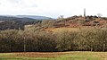
 Eastnor Obelisk and May Hill - geograph.org.uk - 6373325.jpg 1,024 × 577; 77 KB
-
 Eastnor Park - Obelisk - geograph.org.uk - 6657302.jpg 3,864 × 5,152; 5.89 MB
-
 Eastnor Pottery - geograph.org.uk - 1593925.jpg 640 × 480; 85 KB
-
 Eastnor village green - geograph.org.uk - 2869526.jpg 1,024 × 768; 139 KB
-
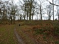
 Eastnor Wood - geograph.org.uk - 2744945.jpg 640 × 360; 232 KB
-
 Entering Eastnor - geograph.org.uk - 1367714.jpg 640 × 480; 172 KB
-
 Entering Eastnor, A438 - geograph.org.uk - 2285924.jpg 640 × 432; 48 KB
-
 Entering Worcestershire, A438 - geograph.org.uk - 2285934.jpg 640 × 405; 74 KB
-
 Entrance to a reclamation yard - geograph.org.uk - 1294488.jpg 640 × 480; 94 KB
-
 Exposed imported limestone, Iron-Age camp - geograph.org.uk - 1956768.jpg 3,309 × 2,223; 6.25 MB
-
 Fairoaks Farm - geograph.org.uk - 5764732.jpg 800 × 531; 142 KB
-
 Farm track across Eastnor Hill - 1 - geograph.org.uk - 1599335.jpg 640 × 480; 113 KB
-
 Farm track across Eastnor Hill - 2 - geograph.org.uk - 1599346.jpg 640 × 480; 133 KB
-
 Farm Track near Clencher's Mill Wood - geograph.org.uk - 1596377.jpg 640 × 480; 113 KB
-
 Farmland and Massington Farm - geograph.org.uk - 1717117.jpg 640 × 426; 74 KB
-
 Farmland at Eastnor - geograph.org.uk - 1022854.jpg 640 × 426; 70 KB
-
 Farmland at Gold Hill Farm - geograph.org.uk - 6697337.jpg 1,024 × 683; 221 KB
-
 Farmland east of Ledbury - geograph.org.uk - 1293865.jpg 640 × 480; 208 KB
-
 Farmland entrance - geograph.org.uk - 6697342.jpg 683 × 1,024; 260 KB
-
 Farmland near Eastnor - geograph.org.uk - 1023915.jpg 640 × 426; 52 KB
-
 Farmland near Massington Farm - geograph.org.uk - 1717160.jpg 640 × 426; 68 KB
-
 Farmland near Ockeridge Farm - geograph.org.uk - 1025268.jpg 640 × 426; 87 KB
-

-
 Farmland to the north of Eastnor - geograph.org.uk - 5340067.jpg 1,024 × 768; 301 KB
-
 Fence at Gullet Quarry - geograph.org.uk - 6634021.jpg 1,920 × 1,080; 1 MB
-
 Field, Clencher's Mill - geograph.org.uk - 2744937.jpg 640 × 360; 252 KB
-
 Fields near Eastnor - geograph.org.uk - 4088919.jpg 4,000 × 3,000; 3.18 MB
-
 Fields near White House Farm - geograph.org.uk - 3620669.jpg 640 × 427; 63 KB
-
 Flock of sheep near Clencher's Mill Wood - geograph.org.uk - 1596388.jpg 640 × 480; 126 KB
-
 Footbridge on the edge of Eastnor Park - geograph.org.uk - 5008244.jpg 1,600 × 901; 773 KB
-
 Footpath direction marker - geograph.org.uk - 5763363.jpg 1,024 × 576; 233 KB
-
 Footpath marker on the Malvern Hills - geograph.org.uk - 6752525.jpg 1,024 × 768; 216 KB
-
 Footpath sign for the Geopark Way at Eastnor - geograph.org.uk - 6040395.jpg 4,288 × 3,216; 4.02 MB
-
 Footpath to Wayend Street - geograph.org.uk - 5999175.jpg 1,024 × 768; 248 KB
-
 Fowlet Farm and Eastnor Castle - geograph.org.uk - 1628709.jpg 426 × 640; 100 KB
-
 Fowlett Farm and Eastnor Castle - geograph.org.uk - 5639374.jpg 1,024 × 768; 285 KB
-
 Foxglove detail - geograph.org.uk - 6507682.jpg 768 × 1,024; 190 KB
-
 Foxgloves - geograph.org.uk - 6511811.jpg 768 × 1,024; 329 KB
-
 Foxgloves on Ragged Stone Hill - geograph.org.uk - 6507663.jpg 1,024 × 768; 316 KB
-
 Gap in the woods - geograph.org.uk - 1595256.jpg 640 × 480; 113 KB
-
 Garden Cottage (Bronsil) - geograph.org.uk - 6632322.jpg 3,648 × 2,736; 4.89 MB
-
 Garden Cottage (Bronsil) - geograph.org.uk - 6632332.jpg 3,648 × 2,736; 4.87 MB
-
 Gate at Ragged Stone Hill - geograph.org.uk - 6625512.jpg 3,648 × 2,736; 4.49 MB
-
 Gate in Gullet Wood - geograph.org.uk - 5533913.jpg 1,024 × 768; 317 KB
-
 Gateway at Dead Woman's Thorn - geograph.org.uk - 1599314.jpg 640 × 480; 160 KB
-
 Gateway to Woolpits Farm - geograph.org.uk - 1595286.jpg 640 × 480; 124 KB
-
 Glamping tents at Lakefest - geograph.org.uk - 6040324.jpg 4,288 × 3,216; 3.52 MB
-
 Gold Hill Farm - geograph.org.uk - 6671001.jpg 1,024 × 683; 183 KB
-
 Gold Hill Farm - geograph.org.uk - 6697334.jpg 1,024 × 683; 208 KB
-
 Gold Hill Farm, Eastnor - geograph.org.uk - 6637561.jpg 1,024 × 683; 204 KB
-
 Golden Gates Lodge - geograph.org.uk - 6040377.jpg 4,288 × 3,216; 3.34 MB
-
 Grass field near Clencher's Mill - geograph.org.uk - 5999179.jpg 1,024 × 768; 173 KB
-
 Hangman's Hill - Clutter's Cave - geograph.org.uk - 6657321.jpg 5,152 × 3,864; 7.7 MB
-
 Hangman's Hill - Clutter's Cave - geograph.org.uk - 6657326.jpg 5,152 × 3,864; 6.4 MB
-
 Hangman's Hill - geograph.org.uk - 6634837.jpg 1,920 × 1,080; 1.04 MB
-
 Hangman's Hill - geograph.org.uk - 6637296.jpg 1,920 × 1,080; 1.01 MB
-
 Hangman's Hill - geograph.org.uk - 6637298.jpg 1,920 × 1,080; 1.01 MB
-
 Hawthorn and mistletoe - geograph.org.uk - 6478863.jpg 1,024 × 768; 458 KB
-
 Hawthorn blossom - geograph.org.uk - 5340070.jpg 1,024 × 768; 220 KB
-
 Hawthorn on Hangman's Hill - geograph.org.uk - 6478849.jpg 768 × 1,024; 312 KB
-
 Hazel catkins - geograph.org.uk - 5679225.jpg 680 × 1,024; 150 KB
-
 Headland track - geograph.org.uk - 1719813.jpg 640 × 426; 107 KB
-
 Healthy ash foliage - geograph.org.uk - 5008297.jpg 1,600 × 1,200; 964 KB
-
 Helicopter over Pink Cottage - geograph.org.uk - 6634275.jpg 1,920 × 1,080; 1,014 KB
-
 Helicopter over the Malvern Hills - geograph.org.uk - 6634405.jpg 1,920 × 1,080; 1.05 MB
-
 Helicopter over the Malvern Hills - geograph.org.uk - 6634408.jpg 1,920 × 1,080; 1.01 MB
-
 Helicopter over the Malvern Hills - geograph.org.uk - 6634435.jpg 1,920 × 1,080; 960 KB
-
 Helicopter over the Malvern Hills - geograph.org.uk - 6634456.jpg 1,920 × 1,080; 1.08 MB
-
 Herefordshire Beacon - Iron Age Ramparts - geograph.org.uk - 6657274.jpg 5,152 × 3,864; 7.63 MB
-
 Herefordshire Beacon - Iron Age Ramparts - geograph.org.uk - 6657287.jpg 5,128 × 2,987; 6.43 MB


_-_geograph.org.uk_-_6637415.jpg)


_-_geograph.org.uk_-_6632352.jpg)
_-_geograph.org.uk_-_6632113.jpg)
_-_geograph.org.uk_-_6632334.jpg)
_-_geograph.org.uk_-_6632328.jpg)
_-_geograph.org.uk_-_6632059.jpg)
_-_geograph.org.uk_-_6632064.jpg)
_-_geograph.org.uk_-_6632356.jpg)
_-_geograph.org.uk_-_6632068.jpg)
_-_geograph.org.uk_-_6632309.jpg)
_-_geograph.org.uk_-_6632344.jpg)
_-_geograph.org.uk_-_6632131.jpg)
_-_geograph.org.uk_-_6632209.jpg)
_-_geograph.org.uk_-_6632313.jpg)
_-_geograph.org.uk_-_6632178.jpg)


_-_geograph.org.uk_-_6620026.jpg)
_-_geograph.org.uk_-_6620032.jpg)


_-_geograph.org.uk_-_6599229.jpg)
_-_geograph.org.uk_-_6619996.jpg)
_-_geograph.org.uk_-_6616344.jpg)


_-_geograph.org.uk_-_6617152.jpg)
_-_geograph.org.uk_-_6617366.jpg)


.jpg)


.jpg)
_-_geograph.org.uk_-_6619980.jpg)
_-_geograph.org.uk_-_6620012.jpg)
_-_geograph.org.uk_-_6619998.jpg)
_-_geograph.org.uk_-_6599198.jpg)
_-_geograph.org.uk_-_6637331.jpg)
_-_geograph.org.uk_-_6616324.jpg)
_-_geograph.org.uk_-_6616350.jpg)
_-_geograph.org.uk_-_6625519.jpg)
_-_geograph.org.uk_-_6625590.jpg)
_-_geograph.org.uk_-_6634033.jpg)
_-_geograph.org.uk_-_6634034.jpg)
_-_geograph.org.uk_-_6619864.jpg)
_-_geograph.org.uk_-_6620007.jpg)


_-_geograph.org.uk_-_6619867.jpg)


_-_geograph.org.uk_-_6632322.jpg)
_-_geograph.org.uk_-_6632332.jpg)


