Category:Election maps of Fife
Jump to navigation
Jump to search
Council areas (municipalities) of Scotland: Aberdeen · Aberdeenshire · Angus · Dundee · East Lothian · East Renfrewshire · Edinburgh · Fife · Glasgow · North Lanarkshire · Outer Hebrides · Orkney Islands · Shetland Islands · West Lothian
Media in category "Election maps of Fife"
The following 18 files are in this category, out of 18 total.
-
 Fife Regional Council election, 1982.svg 870 × 576; 470 KB
-
 Fife Regional Council election, 1986.svg 870 × 576; 470 KB
-
 Fife Regional Council election, 1990.svg 870 × 576; 470 KB
-
 Fife Regional Council election, 1994.svg 870 × 576; 425 KB
-
 Fife Council election, 1995.svg 870 × 576; 524 KB
-
 Fife Council election, 1999.svg 870 × 576; 669 KB
-
 Fife Council election, 2007.svg 1,425 × 1,152; 1.49 MB
-
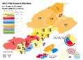
 2007 Fife Council Election Results Map.svg 1,400 × 1,000; 1.07 MB
-
 Fife Council election, 2012.svg 1,425 × 1,152; 1.49 MB
-
 2012 Fife Council Election Results Map.svg 1,400 × 1,000; 1.07 MB
-
 2017 Fife Council Election Results Map.svg 1,400 × 1,000; 931 KB
-
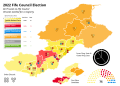 2022 Fife Council Election Results Map.svg 1,400 × 1,000; 943 KB
-
 Fife Council election, 2003.svg 870 × 576; 669 KB
-
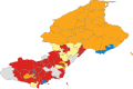
 Fife Council election, 2017.svg 1,425 × 1,152; 1.38 MB
-
 North-East Fife District Council election, 1980.svg 605 × 358; 283 KB
-
 North-East Fife District Council election, 1984.svg 605 × 358; 283 KB
-
 North-East Fife District Council election, 1988.svg 605 × 358; 285 KB
-
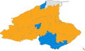 North-East Fife District Council election, 1992.svg 605 × 358; 285 KB


