Category:Election maps of Himachal Pradesh
Jump to navigation
Jump to search
States of India: Andhra Pradesh · Arunachal Pradesh · Assam · Bihar · Chhattisgarh · Goa · Gujarat · Haryana · Himachal Pradesh · Jharkhand · Karnataka · Kerala · Madhya Pradesh · Maharashtra · Manipur · Meghalaya · Mizoram · Nagaland · Odisha · Punjab · Rajasthan · Sikkim · Tamil Nadu · Telangana · Tripura · Uttar Pradesh · Uttarakhand · West Bengal
Union territories: Andaman and Nicobar Islands · Delhi · Jammu and Kashmir · Puducherry
Former states of India: Jammu and Kashmir ·
Former union territories:
Union territories: Andaman and Nicobar Islands · Delhi · Jammu and Kashmir · Puducherry
Former states of India: Jammu and Kashmir ·
Former union territories:
Media in category "Election maps of Himachal Pradesh"
The following 8 files are in this category, out of 8 total.
-
 2009 election.png 796 × 790; 19 KB
-
 2014 election.png 796 × 790; 18 KB
-
 Himachal Loksabha Seats.gif 619 × 625; 73 KB
-
 Himachal NDA Seat Sharing.png 800 × 806; 71 KB
-
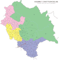
 Himachal Pradesh Assembly election 2022 map.svg 743 × 741; 1.21 MB
-
 Himachal Pradesh left front 2022.png 5,000 × 4,986; 1.01 MB
-
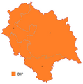
 Himachal Pradesh Lok Sabha election result 2019.png 720 × 723; 76 KB
-
 Wahlkreise zur Vidhan Sabha von Himachal Pradesh.svg 743 × 741; 1.28 MB


