Category:Elevation models
Jump to navigation
Jump to search
Subcategories
This category has only the following subcategory.
D
Media in category "Elevation models"
The following 36 files are in this category, out of 36 total.
-
 3 Arc Second (2).png 3,188 × 1,712; 3.45 MB
-
 3 Arc Second (3).png 3,216 × 1,896; 3.62 MB
-
 3 Arc Second (4).png 3,100 × 1,732; 5.02 MB
-
 3 Arc Second (5).png 3,404 × 1,704; 5.13 MB
-
 3 Arc Second (6).png 3,404 × 1,804; 5.2 MB
-
 3 Arc Second (7).png 3,168 × 1,836; 4.41 MB
-
 3 Arc Second (8).png 2,024 × 1,352; 1.67 MB
-
 3 Arc Second (9).png 1,782 × 1,431; 2.06 MB
-
 3 Arc Second - 5665294111.jpg 1,024 × 852; 92 KB
-
 3 Arc Second Rendered in 3D.png 6,101 × 1,902; 10.83 MB
-
 3 Arc Second.png 3,500 × 2,928; 6.38 MB
-
 9 Arc Second (2).png 3,088 × 1,748; 5.45 MB
-
 9 Arc Second.png 2,388 × 1,200; 2.9 MB
-
 Barkly Tableland region shown on NT elevation model.png 1,434 × 2,424; 1.12 MB
-
 Developing Support for ESRI Shapefiles.png 2,157 × 1,643; 7.95 MB
-
 Digital Elevation Model of our Earth.png 1,952 × 1,897; 5.18 MB
-
 Elevation Model (6051867321).jpg 2,736 × 3,648; 2.16 MB
-
 Elevation model of Puy de Dome area.stl 5,120 × 2,880; 25.38 MB
-
 Elevation Model.jpg 768 × 1,024; 353 KB
-
 Etna TAS2002209.jpg 1,152 × 870; 447 KB
-
 Global Digital Elevation Model.jpg 4,320 × 2,160; 1.08 MB
-
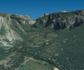
 Grand Canyon @ 1 Arc Second.png 1,896 × 951; 1.28 MB
-
 Honolulu 1 Arc Second.png 2,048 × 1,251; 1.66 MB
-
 Hyderabad Elevation Model.png 2,756 × 1,948; 2.72 MB
-
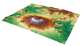
 Imnam Dam Landsat image elevation model.png 998 × 706; 1,018 KB
-
 Incomplete - Adding Satellite Imagery.png 3,464 × 1,692; 7.81 MB
-
 Mapa Linha Beira Alta - Diario Illustrado 3307 1882.jpg 2,429 × 1,943; 2.65 MB
-
 Mountain Elevation Comparison.png 10,300 × 500; 3.83 MB
-
 Mt. Okmok @ 2 Arc Second.png 1,860 × 772; 458 KB
-
 New England @ 1 Arc Second.png 2,004 × 732; 1.19 MB
-
 Primitive Support for ESRI Shapefiles.png 2,157 × 1,643; 7.96 MB
-
 Tolomosa River and Dam - digital elevation model.JPG 778 × 374; 26 KB
-
 Trinity Alps - Northern California @ 1 Arc Second.png 1,896 × 960; 1.75 MB
-
 United States Digital Elevation Model.png 3,500 × 1,543; 6.28 MB
-
 Vorkbatym.jpg 500 × 331; 92 KB
-
 World Bedrock Digital Elevation Model.png 2,000 × 1,000; 4.5 MB
.png)
.png)
.png)
.png)
.png)
.png)
.png)
.png)


.png)


.jpg)


