Category:Elgol
Jump to navigation
Jump to search
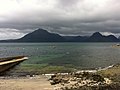
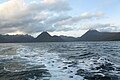
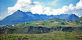
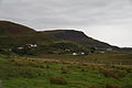
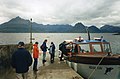
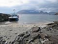
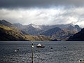
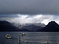
English: Elgol ( Scottish Gaelic: Ealaghol) is a village on the shores of Loch Scavaig towards the end of the Strathaird peninsula in the Isle of Skye, in the Scottish Highlands.
Gàidhlig: 'S e baile beag a tha ann an Ealaghol ( Beurla: Elgol). Tha e suidhichte faisg air Loch Scavaig anns an Eilean Sgitheanach. Tha timcheall air 150 duine a' fuireach ann.
Nederlands: Elgol ( Schots-Gaelisch: Ealaghol) is een dorp in de Schotse lieutenancy Ross and Cromarty in het raadsgebied Highland op het eiland Skye.
village on the Strathaird peninsula of the Isle of Skye, Highland, Scotland, UK  | |||||
| Upload media | |||||
| Instance of | |||||
|---|---|---|---|---|---|
| Location |
| ||||
 | |||||
Media in category "Elgol"
The following 200 files are in this category, out of 301 total.
(previous page) (next page)-
 "Investor" - geograph.org.uk - 1172002.jpg 480 × 640; 50 KB
-
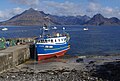
 'Bella Jane' at Elgol Pier - geograph.org.uk - 4027833.jpg 640 × 426; 376 KB
-
 (Another) Prince Charlie's Cave - geograph.org.uk - 4029781.jpg 480 × 640; 106 KB
-
 A Large Dyke - geograph.org.uk - 5408955.jpg 427 × 640; 333 KB
-

-
 A wet day in Elgol - geograph.org.uk - 2732813.jpg 1,024 × 768; 95 KB
-
 Above Elgol jetty - geograph.org.uk - 2323483.jpg 1,024 × 768; 392 KB
-
 All aboard for Elgol - geograph.org.uk - 878506.jpg 427 × 640; 64 KB
-
 And another^ - geograph.org.uk - 1334216.jpg 640 × 480; 70 KB
-
 And So We Say Farewell (27846416037).jpg 6,000 × 2,267; 9.14 MB
-
 Approaching the Bad Step - geograph.org.uk - 853798.jpg 640 × 402; 81 KB
-
 Armeria Maritima - geograph.org.uk - 816878.jpg 640 × 432; 124 KB
-
 Back to the jetty. - geograph.org.uk - 933852.jpg 640 × 427; 64 KB
-
 Beach at Elgol - geograph.org.uk - 1171997.jpg 640 × 480; 79 KB
-
 Beach at Elgol - geograph.org.uk - 2323490.jpg 1,024 × 768; 424 KB
-
-
 Bella Jane at Elgol pier - geograph.org.uk - 2497608.jpg 2,000 × 1,500; 564 KB
-
 Bike, Elgol - geograph.org.uk - 1362889.jpg 640 × 410; 58 KB
-
 Black Cuillin Beach (Unsplash).jpg 5,006 × 3,066; 2.3 MB
-
 Boat trip returning to Elgol - geograph.org.uk - 3521733.jpg 750 × 563; 80 KB
-
 Boat trip sales office at Elgol - geograph.org.uk - 4007724.jpg 640 × 480; 204 KB
-
 Boats anchored at Elgol - geograph.org.uk - 3693078.jpg 1,152 × 768; 423 KB
-
 Boats by Elgol slipway - geograph.org.uk - 3693077.jpg 1,152 × 768; 417 KB
-
 Boats in Port na Cullaidh - geograph.org.uk - 3692636.jpg 1,152 × 768; 412 KB
-
 Bouldery Beach - geograph.org.uk - 5409031.jpg 640 × 427; 368 KB
-
 Bouldery Beach - geograph.org.uk - 5409038.jpg 640 × 427; 323 KB
-
 CCTV at Elgol Jetty - geograph.org.uk - 879962.jpg 640 × 425; 193 KB
-
 Cliff overhang, Elgol, Skye - geograph.org.uk - 223678.jpg 640 × 427; 141 KB
-
 Cliffs, Elgol - geograph.org.uk - 1405122.jpg 480 × 640; 105 KB
-
 Clouds over the Cuillins - geograph.org.uk - 4021350.jpg 2,592 × 1,936; 1.73 MB
-
 Creels at Elgol (geograph 2323503).jpg 1,024 × 768; 707 KB
-
 Crossing the Bad Step - geograph.org.uk - 829277.jpg 414 × 640; 87 KB
-
 Cuillin Backdrop - geograph.org.uk - 1241175.jpg 640 × 429; 75 KB
-
 Cuillin Hills from Elgol - 1990 - geograph.org.uk - 4288325.jpg 1,500 × 1,025; 733 KB
-
 Cullaidh Shale Sill.jpg 640 × 427; 421 KB
-
 Cullins (7304616704).jpg 4,288 × 2,848; 1.47 MB
-
 Ealaghol sealladh farsaing (An t-Eilean Sgitheanach).jpg 3,807 × 2,855; 2.03 MB
-
 Ealaghol tràigh (An t-Eilean Sgitheanach).jpg 4,032 × 3,024; 3.47 MB
-
 Edge of Forestry - geograph.org.uk - 229556.jpg 640 × 480; 103 KB
-
 Eigg and Rum - geograph.org.uk - 407656.jpg 640 × 427; 58 KB
-
 Eilean Reamhar - geograph.org.uk - 4028205.jpg 640 × 416; 312 KB
-
 Eilean Reamhar from the motor boat from Elgol - geograph.org.uk - 1914109.jpg 2,110 × 1,187; 490 KB
-
 Elgol - Ealaghol 01.jpg 3,888 × 2,592; 2.99 MB
-
 Elgol - Ealaghol 02.jpg 3,888 × 2,592; 2.93 MB
-
 Elgol - Ealaghol 03.jpg 3,888 × 2,592; 2.88 MB
-
 Elgol - Ealaghol 04.jpg 3,888 × 2,592; 2.81 MB
-
 Elgol - Ealaghol 05.jpg 3,888 × 2,592; 5.22 MB
-
 Elgol - Ealaghol 06.jpg 3,888 × 2,592; 5.74 MB
-
 Elgol - Ealaghol 07.jpg 3,888 × 2,592; 5.56 MB
-
 Elgol - Ealaghol 08.jpg 3,888 × 2,592; 5.12 MB
-
 Elgol - Ealaghol 09.jpg 3,888 × 2,592; 5.76 MB
-
 Elgol - Ealaghol 10.jpg 3,888 × 2,592; 5.62 MB
-
 Elgol - Ealaghol 11.jpg 3,888 × 2,592; 5.93 MB
-
 Elgol - Ealaghol 12.jpg 3,888 × 2,592; 4.78 MB
-
 Elgol - Ealaghol 13.jpg 3,888 × 2,592; 4.82 MB
-
 Elgol - Ealaghol 14.jpg 3,888 × 2,592; 4.71 MB
-
 Elgol - Ealaghol 15.jpg 3,888 × 2,592; 5.09 MB
-
 Elgol - Ealaghol 16.jpg 3,888 × 2,592; 4.4 MB
-
 Elgol - Ealaghol 17.jpg 3,888 × 2,592; 4.98 MB
-
 Elgol - Ealaghol 18.jpg 3,888 × 2,592; 4.72 MB
-
 Elgol - Ealaghol 19.jpg 3,888 × 2,592; 4.75 MB
-
 Elgol - Ealaghol 20.jpg 3,888 × 2,592; 5.57 MB
-
 Elgol - Ealaghol 21.jpg 3,888 × 2,592; 5.85 MB
-
 Elgol - Ealaghol 22.jpg 3,888 × 2,592; 6.21 MB
-
 Elgol - Ealaghol 23.jpg 3,888 × 2,592; 5.89 MB
-
 Elgol - Ealaghol 24.jpg 3,888 × 2,592; 5.64 MB
-
 Elgol - Ealaghol 25.jpg 3,888 × 2,592; 5.63 MB
-
 Elgol - Ealaghol 26.jpg 3,888 × 2,592; 6.35 MB
-
 Elgol - Ealaghol 27.jpg 3,888 × 2,592; 6.17 MB
-
 Elgol - Ealaghol 28.jpg 3,888 × 2,592; 6.33 MB
-
 Elgol - Ealaghol 29.jpg 3,888 × 2,592; 5.44 MB
-
 Elgol - Ealaghol 30.jpg 3,888 × 2,592; 5.51 MB
-
 Elgol - Ealaghol 31.jpg 3,888 × 2,592; 5.2 MB
-
 Elgol - Ealaghol 32.jpg 3,888 × 2,592; 5.01 MB
-
 Elgol - Ealaghol 33.jpg 3,888 × 2,592; 5.33 MB
-
 Elgol - Ealaghol 34.jpg 3,888 × 2,592; 5.48 MB
-
 Elgol - Ealaghol 35.jpg 3,888 × 2,592; 4.16 MB
-
 Elgol - Ealaghol 36.jpg 3,888 × 2,592; 3.9 MB
-
 Elgol - Ealaghol 37.jpg 3,888 × 2,592; 3.72 MB
-
 Elgol - Ealaghol 38.jpg 3,888 × 2,592; 4.1 MB
-
 Elgol - Ealaghol 39.jpg 3,888 × 2,592; 4.89 MB
-
 Elgol - Ealaghol 40.jpg 3,888 × 2,592; 4.4 MB
-
 Elgol - Ealaghol 41.jpg 3,888 × 2,592; 4.76 MB
-
 Elgol - Ealaghol 43.jpg 3,888 × 2,592; 4.46 MB
-
 Elgol - Ealaghol 44.jpg 3,888 × 2,592; 4.73 MB
-
 Elgol - Ealaghol 45.jpg 3,888 × 2,592; 3.94 MB
-
 Elgol - Ealaghol 46.jpg 3,888 × 2,592; 4.32 MB
-
 Elgol - Ealaghol 47.jpg 3,888 × 2,592; 3.95 MB
-
 Elgol - Ealaghol 48.jpg 3,888 × 2,592; 4.15 MB
-
 Elgol - Ealaghol 49.jpg 3,888 × 2,592; 11.59 MB
-
 Elgol - field on the side of Ben Cleat - geograph.org.uk - 808077.jpg 640 × 432; 152 KB
-
 Elgol - geograph.org.uk - 1077059.jpg 640 × 480; 27 KB
-
 Elgol - geograph.org.uk - 2323468.jpg 1,024 × 768; 426 KB
-
 Elgol - geograph.org.uk - 4027830.jpg 640 × 407; 379 KB
-
 Elgol - prohibitions - geograph.org.uk - 808042.jpg 640 × 428; 142 KB
-
 Elgol 01 (26407597519).jpg 5,472 × 3,078; 16.92 MB
-
 Elgol 02 (38127926926).jpg 5,472 × 3,078; 20.11 MB
-
 Elgol 03 (37473713954).jpg 5,455 × 3,067; 15.81 MB
-
 Elgol 04 (37473731074).jpg 5,472 × 3,648; 17.47 MB
-
 Elgol 05 (37473746904).jpg 5,468 × 3,074; 15.31 MB
-
 Elgol 06 (26407674359).jpg 5,472 × 3,648; 14.16 MB
-
 Elgol 07 (38127990626).jpg 5,465 × 3,073; 14.29 MB
-
 Elgol 08 (38128005656).jpg 5,469 × 3,075; 15.86 MB
-
 Elgol 09 (24331898318).jpg 5,468 × 3,074; 13.93 MB
-
 Elgol 10 (38184257441).jpg 5,457 × 3,068; 13.67 MB
-
 Elgol 11 (38152184952).jpg 5,471 × 3,076; 15.61 MB
-
 Elgol banner Cuillins from Pier.JPG 2,800 × 400; 559 KB
-
 Elgol Bay, August 2019.jpg 5,435 × 3,623; 13.8 MB
-
 Elgol beach - geograph.org.uk - 1381692.jpg 1,000 × 658; 240 KB
-
 Elgol Beach - geograph.org.uk - 1614522.jpg 640 × 271; 58 KB
-
 Elgol beach - geograph.org.uk - 391555.jpg 640 × 480; 89 KB
-
 Elgol Beach - geograph.org.uk - 4028229.jpg 640 × 412; 376 KB
-
 Elgol Beach in the Rain - geograph.org.uk - 994008.jpg 640 × 437; 89 KB
-

-
 Elgol Church of Scotland - geograph.org.uk - 1069384.jpg 640 × 480; 86 KB
-
 Elgol Community Shop - geograph.org.uk - 4021334.jpg 2,592 × 1,936; 2.02 MB
-
 Elgol Cuillin Hills geograph-3215406-by-Ben-Brooksbank.jpg 1,050 × 519; 562 KB
-
 Elgol Cuillin.jpg 560 × 373; 35 KB
-
 Elgol fishing boats at anchor. - panoramio.jpg 3,264 × 2,448; 2.61 MB
-
 Elgol Hall - geograph.org.uk - 4021327.jpg 2,592 × 1,936; 1.75 MB
-
 Elgol Hall.jpg 640 × 482; 76 KB
-
 Elgol Harbour (7346366976).jpg 4,092 × 2,718; 946 KB
-
 Elgol Harbour - geograph.org.uk - 2184487.jpg 640 × 480; 38 KB
-
 Elgol harbour boat trips schedules.jpg 690 × 870; 212 KB
-
 Elgol Hillside - geograph.org.uk - 1199371.jpg 628 × 640; 121 KB
-
 Elgol in summer 2012 (1).JPG 4,752 × 3,168; 4.32 MB
-
 Elgol in summer 2012 (2).JPG 4,752 × 3,168; 4.31 MB
-
 Elgol in summer 2012 (3).JPG 4,752 × 3,168; 4.84 MB
-
 Elgol in summer 2012 (4).JPG 4,752 × 3,168; 3.67 MB
-
 Elgol in summer 2012 (5).JPG 4,752 × 3,168; 4.26 MB
-
 Elgol Jetty - geograph.org.uk - 106990.jpg 640 × 480; 59 KB
-
 Elgol Jetty - geograph.org.uk - 2391375.jpg 1,024 × 683; 184 KB
-
 Elgol Jetty - geograph.org.uk - 2468082.jpg 1,024 × 768; 153 KB
-
 Elgol Jetty - geograph.org.uk - 3004894.jpg 640 × 420; 223 KB
-
 Elgol Jetty - geograph.org.uk - 3265375.jpg 1,580 × 1,172; 1,022 KB
-
 Elgol Jetty - geograph.org.uk - 4173364.jpg 4,759 × 2,920; 3.18 MB
-
 Elgol jetty and Loch Scavaig - geograph.org.uk - 49828.jpg 640 × 423; 61 KB
-
 Elgol Primary School - geograph.org.uk - 904381.jpg 640 × 427; 141 KB
-
 Elgol Sandstone - geograph.org.uk - 5408918.jpg 427 × 640; 394 KB
-
 Elgol Sandstone - geograph.org.uk - 5408947.jpg 640 × 427; 326 KB
-
 Elgol School - geograph.org.uk - 750256.jpg 640 × 427; 113 KB
-
 Elgol School, Isle of Skye, Scotland - geograph.org.uk - 1531644.jpg 640 × 355; 150 KB
-
 Elgol Shore - geograph.org.uk - 3102565.jpg 3,456 × 2,304; 4.08 MB
-
 Elgol shore - geograph.org.uk - 3102582.jpg 3,456 × 2,304; 4.19 MB
-
 Elgol shoreline - geograph.org.uk - 3693075.jpg 1,152 × 768; 403 KB
-
 Elgol shoreline and the Cuillin - geograph.org.uk - 891418.jpg 640 × 418; 147 KB
-
 Elgol Shoreline, Isle of Skye, Scotland. - geograph.org.uk - 1525184.jpg 640 × 481; 118 KB
-
 Elgol trig point - geograph.org.uk - 891624.jpg 640 × 480; 173 KB
-
 Elgol village - geograph.org.uk - 4557377.jpg 640 × 480; 408 KB
-
 Elgol, Awaiting modernisation - geograph.org.uk - 808078.jpg 640 × 428; 240 KB
-
 Elgol, Isle of Skye, Highland - geograph.org.uk - 2028761.jpg 1,024 × 768; 206 KB
-
 Elgol, United Kingdom (Unsplash 5D72aIYhwh8).jpg 5,472 × 3,648; 1.27 MB
-
 Elgol, United Kingdom (Unsplash N100-5Rc1ao).jpg 5,642 × 3,761; 10.17 MB
-
 Elgol. Island Of Skye - geograph.org.uk - 102371.jpg 640 × 433; 160 KB
-
 Elgol01LB.jpg 3,264 × 2,448; 2.47 MB
-
 Elgol02LB.jpg 3,264 × 2,448; 2.96 MB
-
 Eventide. - panoramio.jpg 3,264 × 2,448; 2.56 MB
-
 Fishing boat at Elgol - geograph.org.uk - 5781903.jpg 1,280 × 862; 524 KB
-
 Fishing Boats at Elgol Jetty - geograph.org.uk - 733204.jpg 640 × 420; 96 KB
-
 Foreshore at Ealaghol - geograph.org.uk - 2467343.jpg 4,320 × 3,240; 3.43 MB
-
 Foreshore at Ealaghol - geograph.org.uk - 2467401.jpg 4,320 × 3,240; 2.52 MB
-

-
 Glasnakille Road End - geograph.org.uk - 156246.jpg 640 × 480; 64 KB
-
 Harbour of Light. - panoramio.jpg 3,264 × 2,448; 2.77 MB
-
 Honeycomb Rock at Elgol - geograph.org.uk - 400296.jpg 425 × 640; 383 KB
-
 Honeycomb Weathering - geograph.org.uk - 4028235.jpg 640 × 427; 442 KB
-
 House by the beach, Elgol - geograph.org.uk - 3693071.jpg 1,152 × 768; 559 KB
-
 House in Elgol - geograph.org.uk - 4020013.jpg 3,648 × 2,736; 6.23 MB
-
 Igneous Dyke - geograph.org.uk - 5408926.jpg 427 × 640; 399 KB
-
 In the burn at Elgol - geograph.org.uk - 963068.jpg 640 × 480; 143 KB
-
 Jetty at Elgol - geograph.org.uk - 1231573.jpg 640 × 480; 283 KB
-
 Jetty at Elgol - geograph.org.uk - 922626.jpg 640 × 480; 74 KB
-
-
 Kilmarie Burial Ground - geograph.org.uk - 157210.jpg 640 × 480; 135 KB
-
 Last resting place, Elgol - geograph.org.uk - 136321.jpg 542 × 395; 39 KB
-
 Loch Coruisk Black Cuillin.JPG 3,648 × 2,432; 4.38 MB
-
 Loch Scavaig - geograph.org.uk - 4616131.jpg 640 × 480; 52 KB
-
 Loch Scavaig - geograph.org.uk - 4675649.jpg 640 × 480; 174 KB
-
 Loch Scavaig - geograph.org.uk - 4675653.jpg 640 × 480; 150 KB
-
 Loch Scavaig - geograph.org.uk - 4675656.jpg 640 × 480; 109 KB
-
 Loch Scavaig and the Cuillin - geograph.org.uk - 3864424.jpg 640 × 480; 46 KB
-
 Loch Scavaig and The Cuillin from Elgol - geograph.org.uk - 2323444.jpg 2,304 × 1,728; 3.32 MB
-
 Loch Scavaig from Elgol - geograph.org.uk - 3102558.jpg 3,456 × 2,304; 4.38 MB
-
 Loch Scavaig from Elgol - geograph.org.uk - 5400802.jpg 640 × 480; 78 KB
-

-
 Loch Scavaig shore at Elgol - geograph.org.uk - 3864421.jpg 640 × 429; 48 KB
-
 Loch Slapin - geograph.org.uk - 288331.jpg 640 × 449; 71 KB
-
 Looking from the shoreline at Elgol - geograph.org.uk - 2588497.jpg 1,600 × 1,048; 287 KB
-
 Looking over to the Cuillin - Flickr - Graham Grinner Lewis.jpg 3,648 × 2,736; 2.62 MB
-
 Lower Elgol - geograph.org.uk - 922637.jpg 640 × 480; 52 KB
-
 Milestone on B8083 - geograph.org.uk - 1469116.jpg 480 × 640; 70 KB
-
 Multiple Rock Types - geograph.org.uk - 5409020.jpg 640 × 427; 330 KB
-
 Municipitality center in Elgol in summer 2012 (4).JPG 4,752 × 3,168; 4.13 MB
-
 Negotiating The 'Bad Step' - geograph.org.uk - 4008205.jpg 640 × 480; 298 KB
-
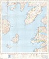 Ordnance Survey One-Inch Sheet 34 South Skye and Arisaig, Published 1957.jpg 8,210 × 9,880; 7.19 MB
-
 Ordnance Survey One-Inch Sheet 35 Sound of Sleat, Published 1947.jpg 8,186 × 10,443; 9.59 MB
-
 Panorama in the Village of Elgol 1.JPG 2,592 × 1,728; 1.72 MB
-
 Panorama in the Village of Elgol 2.JPG 2,592 × 1,728; 1.78 MB
-
 Panorama in the Village of Elgol 3.JPG 2,592 × 1,728; 1.8 MB
-
 Panorama in the Village of Elgol 4.JPG 2,592 × 1,728; 2.3 MB


_Prince_Charlie%27s_Cave_-_geograph.org.uk_-_4029781.jpg)


.jpg)


.jpg)


.jpg)
.jpg)
.jpg)


.jpg)
.jpg)
.jpg)
.jpg)
.jpg)
.jpg)
.jpg)
.jpg)
.jpg)
.jpg)
.jpg)


.jpg)


.JPG)
.JPG)
.JPG)
.JPG)
.JPG)


.jpg)
.jpg)


.JPG)


.jpg)