Category:Etchinghill, Kent
Jump to navigation
Jump to search
village in Kent, United Kingdom  | |||||
| Upload media | |||||
| Instance of | |||||
|---|---|---|---|---|---|
| Location | Lyminge, Folkestone and Hythe, Kent, South East England, England | ||||
 | |||||
Media in category "Etchinghill, Kent"
The following 26 files are in this category, out of 26 total.
-
 Barn on farmland near Etchinghill - geograph.org.uk - 966066.jpg 640 × 480; 156 KB
-
 Entrance to Shearins Leas Farm - geograph.org.uk - 989571.jpg 640 × 480; 280 KB
-
 Etchinghill - geograph.org.uk - 368602.jpg 640 × 462; 70 KB
-

-
 Former chapel, Etchinghill.jpg 577 × 640; 50 KB
-

-
 Houses on Westfield Lane from The Beeches - geograph.org.uk - 975403.jpg 640 × 480; 199 KB
-

-

-
 New housing on the S of Etchinghill - geograph.org.uk - 975405.jpg 640 × 480; 211 KB
-

-
 Shearins Leas Farm - geograph.org.uk - 989569.jpg 640 × 480; 194 KB
-
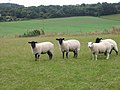 Spot the odd one out^ - geograph.org.uk - 966073.jpg 640 × 480; 181 KB
-
 Teddars Leas Road - geograph.org.uk - 989581.jpg 640 × 480; 240 KB
-

-
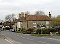
 The New Inn, Etchinghill - geograph.org.uk - 991911.jpg 640 × 480; 150 KB
-
 Tolsford 1.jpg 600 × 886; 196 KB
-

-
 View across farmland towards Newbarn - geograph.org.uk - 966069.jpg 640 × 480; 203 KB
-
 View across the North Downs - geograph.org.uk - 966075.jpg 640 × 480; 168 KB
-
 View along Canterbury Road, Etchinghill - geograph.org.uk - 991909.jpg 640 × 480; 176 KB
-

-

-

-

-
 Hills behind Beachborough House - geograph.org.uk - 429086.jpg 640 × 480; 188 KB


