Category:Etteridge
Jump to navigation
Jump to search
human settlement in Highland, Scotland, UK | |||||
| Upload media | |||||
| Instance of | |||||
|---|---|---|---|---|---|
| Location |
| ||||
 | |||||
English: Etteridge is a small remote hamlet, situated close to Loch Etteridge in Inverness-shire, Scottish Highlands and is in the Scottish council area of Highland.
Media in category "Etteridge"
The following 77 files are in this category, out of 77 total.
-
 An Torr summit - geograph.org.uk - 518340.jpg 640 × 480; 148 KB
-
 Birch trees in Glen Truim - geograph.org.uk - 559980.jpg 640 × 480; 101 KB
-
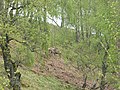 Deer, Glen Truim - geograph.org.uk - 531951.jpg 640 × 480; 117 KB
-
 Glen Truim - geograph.org.uk - 432524.jpg 640 × 457; 71 KB
-
 Glen Truim - geograph.org.uk - 559984.jpg 640 × 480; 102 KB
-
 Highland Railway - geograph.org.uk - 531915.jpg 640 × 480; 84 KB
-
 Hillside in Glen Truim - geograph.org.uk - 559986.jpg 640 × 480; 78 KB
-
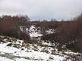 Kettlehole terrain, Coille Phoineis - geograph.org.uk - 658420.jpg 640 × 480; 78 KB
-

-
 Milestone on the Old A9 - geograph.org.uk - 47668.jpg 640 × 480; 80 KB
-
 Milton Burn - geograph.org.uk - 658356.jpg 640 × 480; 74 KB
-

-
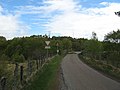
 Phones Road - geograph.org.uk - 658578.jpg 640 × 480; 86 KB
-
 Plantation Mapped as Raliabeag - geograph.org.uk - 37352.jpg 640 × 480; 76 KB
-
 Railway bridge, Glen Truim - geograph.org.uk - 531914.jpg 640 × 480; 60 KB
-
 The River Truim below Crubenbeg - geograph.org.uk - 476920.jpg 480 × 640; 120 KB
-
 Woodland, Glen Truim House - geograph.org.uk - 432533.jpg 640 × 480; 92 KB
-
 A new forest - geograph.org.uk - 658410.jpg 640 × 359; 70 KB
-
 A young pine wood - geograph.org.uk - 658563.jpg 640 × 480; 67 KB
-
 A9 - geograph.org.uk - 658588.jpg 640 × 480; 74 KB
-
 Allt a' Choire Leith - geograph.org.uk - 808260.jpg 480 × 640; 99 KB
-
 Allt a' Mhoraire - geograph.org.uk - 808035.jpg 480 × 640; 89 KB
-
 Allt Bhrodainn - geograph.org.uk - 552561.jpg 640 × 480; 106 KB
-
 Allt Gharbh Ghaig - geograph.org.uk - 817786.jpg 640 × 359; 65 KB
-

-
 Allt Loch an Dùin - geograph.org.uk - 1418238.jpg 640 × 480; 71 KB
-
 Alluvial fan, Allt a' Mhoraire - geograph.org.uk - 817751.jpg 640 × 480; 78 KB
-
 Biallidbeg - geograph.org.uk - 247377.jpg 640 × 480; 65 KB
-
 Biallidbeg Cemetery - geograph.org.uk - 247374.jpg 640 × 480; 97 KB
-
 Biallidbeg cottage - geograph.org.uk - 247367.jpg 480 × 640; 111 KB
-
 Birch woods, Glen Fernisdale - geograph.org.uk - 433220.jpg 640 × 480; 93 KB
-
 Boundary stone - geograph.org.uk - 658405.jpg 480 × 640; 122 KB
-
 Bridge over the Truim - geograph.org.uk - 531956.jpg 640 × 480; 83 KB
-
 Burial Ground - geograph.org.uk - 223437.jpg 640 × 480; 98 KB
-
 Cairn on Ordan Shios - geograph.org.uk - 37363.jpg 640 × 480; 68 KB
-

-
 Coille Phoineis - geograph.org.uk - 658399.jpg 480 × 640; 116 KB
-
 Coire Madagan Mor - geograph.org.uk - 552552.jpg 640 × 480; 95 KB
-
 Craig Ruadh - geograph.org.uk - 247384.jpg 640 × 480; 112 KB
-
 Creag Ruadh - geograph.org.uk - 223408.jpg 640 × 480; 116 KB
-
 Fèith Mhòr - geograph.org.uk - 658391.jpg 640 × 480; 87 KB
-
 Gaick Lodge - geograph.org.uk - 346390.jpg 640 × 480; 78 KB
-
 Gate near Biallidbeg - geograph.org.uk - 650340.jpg 600 × 450; 103 KB
-
 Hillside northwest of Loch Bhrodainn - geograph.org.uk - 552565.jpg 640 × 480; 119 KB
-
 Jock Spot's - geograph.org.uk - 24125.jpg 640 × 480; 233 KB
-
 Larch Trees, Fernisdale - geograph.org.uk - 778374.jpg 640 × 427; 127 KB
-
 Loch an t-Seilich - geograph.org.uk - 346381.jpg 640 × 480; 64 KB
-
 Loch, Phones - geograph.org.uk - 658558.jpg 640 × 480; 87 KB
-
 Lochain Uvie - geograph.org.uk - 650350.jpg 600 × 450; 78 KB
-

-
 Lochan Uvie - geograph.org.uk - 247393.jpg 640 × 480; 113 KB
-
 Lochan Uvie - geograph.org.uk - 3922.jpg 640 × 286; 41 KB
-

-

-

-

-
 Looking west from Sgor Dearg - geograph.org.uk - 552557.jpg 640 × 480; 101 KB
-
 Lower spur of Cruban Beag - geograph.org.uk - 24138.jpg 640 × 480; 239 KB
-
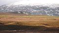
 Meanders on the Spey - geograph.org.uk - 589045.jpg 640 × 479; 41 KB
-
 Old A9 - geograph.org.uk - 658592.jpg 640 × 480; 79 KB
-
 Old A9 - geograph.org.uk - 658599.jpg 640 × 480; 82 KB
-
 Ordan Shuas - geograph.org.uk - 37351.jpg 640 × 480; 56 KB
-
 Ordan Shuas - geograph.org.uk - 518358.jpg 640 × 480; 106 KB
-
 Ordan Shuas - geograph.org.uk - 658369.jpg 627 × 224; 43 KB
-
 Phones Road - geograph.org.uk - 658569.jpg 640 × 480; 61 KB
-
 Ralia Cafe - geograph.org.uk - 433232.jpg 640 × 480; 69 KB
-
 Remains of a cottage - geograph.org.uk - 523060.jpg 640 × 480; 180 KB
-
 River Spey, near Auchmore - geograph.org.uk - 31803.jpg 640 × 480; 216 KB
-
 River Truim at Crubenbeg - geograph.org.uk - 476907.jpg 480 × 640; 122 KB
-
 Road through Glentruim Birch Woods - geograph.org.uk - 117131.jpg 640 × 480; 138 KB
-
 Sgòr Dearg - geograph.org.uk - 660260.jpg 640 × 373; 59 KB
-
 The Falls of Truim - geograph.org.uk - 476912.jpg 480 × 640; 135 KB
-
 The Military Road - geograph.org.uk - 657689.jpg 640 × 480; 80 KB
-
 The Military Road - geograph.org.uk - 658352.jpg 640 × 480; 91 KB
-
 The Military Road, Phones - geograph.org.uk - 658555.jpg 640 × 480; 77 KB
-
 Torr na Truim - geograph.org.uk - 147613.jpg 640 × 480; 65 KB
-
 Young Tree Plantation - geograph.org.uk - 223419.jpg 640 × 480; 102 KB


