Category:Evangelische Gustav-Adolf-Kirche (Rockenberg)
Jump to navigation
Jump to search
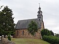
This is the category of the Hessian Kulturdenkmal (cultural monument) with the ID 6736 (Wikidata)
|
| Object location | | View all coordinates using: OpenStreetMap |
|---|
| Upload media | |||||
| Instance of | |||||
|---|---|---|---|---|---|
| Location | Oppershofen, Rockenberg, Wetteraukreis, Darmstadt Government Region, Hesse, Germany | ||||
 | |||||
Media in category "Evangelische Gustav-Adolf-Kirche (Rockenberg)"
The following 8 files are in this category, out of 8 total.
-
 Ev. Gustav-Adolf-Kirche Rockenberg.jpg 3,872 × 2,592; 6.31 MB
-
 Gustav-Adolf-Kirche (Rockenberg) Helm 01.JPG 1,944 × 2,592; 1.31 MB
-
 Gustav-Adolf-Kirche (Rockenberg) von N 01.JPG 2,592 × 1,944; 2.22 MB
-
 Gustav-Adolf-Kirche (Rockenberg) von NW 01.JPG 2,592 × 1,944; 1.91 MB
-
 Gustav-Adolf-Kirche (Rockenberg) von O.JPG 1,944 × 2,592; 1.86 MB
-
 Gustav-Adolf-Kirche (Rockenberg) von SW 01.JPG 1,944 × 2,592; 2.36 MB
-
 Gustav-Adolf-Kirche (Rockenberg) von SW 02.JPG 1,944 × 2,592; 2.49 MB
-
 Gustav-Adolf-Kirche (Rockenberg) Wetterhahn 01.JPG 1,944 × 2,592; 1.16 MB

_Helm_01.JPG)
_von_N_01.JPG)
_von_NW_01.JPG)
_von_O.JPG)
_von_SW_01.JPG)
_von_SW_02.JPG)
_Wetterhahn_01.JPG)