Category:Evangelische Kirche (Oberbieber)
Jump to navigation
Jump to search
| Object location | | View all coordinates using: OpenStreetMap |
|---|
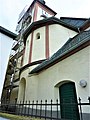
church building in the district of Neuwied Oberbieber 1.JPG) | |||||
| Upload media | |||||
| Instance of | |||||
|---|---|---|---|---|---|
| Named after | |||||
| Dedicated to | |||||
| Location | Neuwied, Rhineland-Palatinate, Germany | ||||
| Heritage designation | |||||
 | |||||
Media in category "Evangelische Kirche (Oberbieber)"
The following 4 files are in this category, out of 4 total.
-
 Evangelische Kirche (Oberbieber)1.JPG 1,579 × 1,424; 563 KB
-
 Evangelische Kirche (Oberbieber)2.JPG 2,048 × 1,536; 610 KB
-
 Evangelische Kirche (Oberbieber)3.JPG 1,536 × 2,048; 807 KB
-
 Kirche Ob 2.jpg 2,048 × 1,536; 448 KB
2.JPG)
3.JPG)
