Category:Evangelische Kirche Bad Goisern
Jump to navigation
Jump to search
| Object location | | View all coordinates using: OpenStreetMap |
|---|
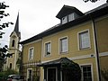
church building in Bad Goisern, Austria  | |||||
| Upload media | |||||
| Instance of | |||||
|---|---|---|---|---|---|
| Location | Bad Goisern am Hallstättersee, Gmunden District, Upper Austria, Austria | ||||
| Street address |
| ||||
| Heritage designation | |||||
 | |||||
Media in category "Evangelische Kirche Bad Goisern"
The following 8 files are in this category, out of 8 total.
-
 Bad Goisern Evangelische Kirche Innenraum.jpg 1,852 × 1,119; 2.05 MB
-
 Bad Goisern, kerk positie1 foto2 2011-07-28 16.05.jpg 4,416 × 3,312; 7.78 MB
-
 Bad Goisern-evang Pfarrhof-2.JPG 3,072 × 2,304; 2.17 MB
-
 Bad Goisern-evang Pfarrkirche.JPG 2,304 × 3,072; 2.1 MB
-
 Bad Goisern-Friedhof christlich Friedhofskapelle.JPG 3,072 × 2,304; 2.9 MB
-
 Evangelische Kirche Bad Goisern Altar.jpg 3,264 × 2,448; 1.1 MB
-
 Evangelische Kirche Bad Goisern Empore.jpg 3,264 × 2,448; 904 KB
-
 Evangelische Pfarrkirche Bad Goisern, gegenüber Ramsauer Strasse 7, 4822 Bad Goisern.jpg 4,000 × 3,000; 2.42 MB


