Category:Förderwagen Grube Virneberg 1858 (Rheinbreitbach)
Jump to navigation
Jump to search
| Object location | | View all coordinates using: OpenStreetMap |
|---|
Media in category "Förderwagen Grube Virneberg 1858 (Rheinbreitbach)"
The following 3 files are in this category, out of 3 total.
-
 Förderwagen 20130828DH.jpg 3,264 × 2,448; 3.37 MB
-
 Grubenwagen Bergwerk Virneberg 1858.jpg 6,000 × 4,000; 9.59 MB
-
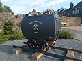
 Rheinbreitbach Renesse-Platz Förderwagen Grube Virneberg.jpg 4,338 × 3,408; 4.19 MB


