Category:FP50 Irby Heath - Montgomery Hill
Jump to navigation
Jump to search

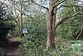
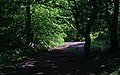
Numbered FP50 on Wirral Council's Definitive List, this footpath runs generally west from Mill Hill Road, crossing Sandy Lane to FP 60 and is 1360m long.
Media in category "FP50 Irby Heath - Montgomery Hill"
The following 7 files are in this category, out of 7 total.
-
 Fenced Off - geograph.org.uk - 669320.jpg 640 × 455; 154 KB
-
 Fingerpost at Irby Heath.jpg 3,411 × 4,548; 17.65 MB
-
 Irby Heath.jpg 4,953 × 3,402; 22.74 MB
-
 Irby Hill - panoramio.jpg 1,620 × 1,080; 1.15 MB
-
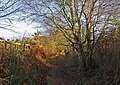 Onwards and Upwards - geograph.org.uk - 669333.jpg 640 × 455; 176 KB
-
 The Darkened Way - geograph.org.uk - 668699.jpg 640 × 398; 104 KB
-
 Uphill Walk - geograph.org.uk - 669281.jpg 446 × 640; 179 KB


