Category:Fagley
Jump to navigation
Jump to search
area in Bradford, West Yorkshire, UK | |||||
| Upload media | |||||
| Instance of | |||||
|---|---|---|---|---|---|
| Location | |||||
 | |||||
Fagley is a locality within the Eccleshill Ward of Bradford, West Yorkshire.
Subcategories
This category has the following 2 subcategories, out of 2 total.
S
Media in category "Fagley"
The following 19 files are in this category, out of 19 total.
-
 337 to 345 Moorside Road, Fagley - geograph.org.uk - 4289952.jpg 1,600 × 1,200; 371 KB
-

-
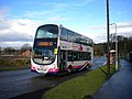 Bus leaving Fagley terminus, Bradford - geograph.org.uk - 3845501.jpg 1,024 × 768; 147 KB
-
 Derelict steam crane, Fagley - geograph.org.uk - 6530355.jpg 427 × 640; 82 KB
-
 Fagley Quarries - geograph.org.uk - 686534.jpg 640 × 428; 92 KB
-
 Fagley rainbow - geograph.org.uk - 302626.jpg 640 × 480; 71 KB
-
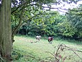 Fagley Wood - geograph.org.uk - 24925.jpg 640 × 480; 149 KB
-
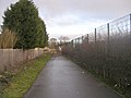 Footpath - Gain Lane - geograph.org.uk - 2195632.jpg 640 × 480; 65 KB
-
 Footpath - Moorside Road, Fagley - geograph.org.uk - 1064831.jpg 480 × 640; 255 KB
-
 Footpath - Woodhall Road to Stone Stile - geograph.org.uk - 789170.jpg 640 × 480; 107 KB
-
 Green Lane - Fagley Lane - geograph.org.uk - 2194179.jpg 640 × 480; 55 KB
-
 Green Lane, Fagley - geograph.org.uk - 1147177.jpg 640 × 480; 72 KB
-
 Play Area - off Flawith Drive - geograph.org.uk - 2194363.jpg 640 × 469; 62 KB
-
 Playground - Flaxton Green, Fagley - geograph.org.uk - 1064769.jpg 640 × 446; 237 KB
-
 St Clare's Presbytery - Moorside Road - geograph.org.uk - 431045.jpg 640 × 460; 65 KB
-

-
 View towards Fagley - geograph.org.uk - 4772455.jpg 1,024 × 768; 190 KB
-
 Woodhall Quarries, Fagley, Bradford - geograph.org.uk - 651717.jpg 640 × 531; 90 KB
-


