Category:Farlington, Hampshire
Jump to navigation
Jump to search
suburb of Portsmouth, Hampshire, England, United Kingdom | |||||
| Upload media | |||||
| Instance of | |||||
|---|---|---|---|---|---|
| Location | Portsmouth, City of Portsmouth, Hampshire, South East England, England | ||||
 | |||||
Subcategories
This category has the following 7 subcategories, out of 7 total.
Media in category "Farlington, Hampshire"
The following 200 files are in this category, out of 200 total.
-
 "Welcome to Portsmouth" at Farlington - geograph.org.uk - 81927.jpg 640 × 426; 308 KB
-
 1950s Offices at Farlington - geograph.org.uk - 639407.jpg 640 × 480; 80 KB
-
 20 mph zone in Farlington Avenue - geograph.org.uk - 991657.jpg 640 × 480; 74 KB
-

-

-
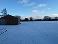
 A snowy East Lodge Playing Field (1) - geograph.org.uk - 2209791.jpg 640 × 480; 100 KB
-
 A snowy East Lodge Playing Field (2) - geograph.org.uk - 2209792.jpg 640 × 480; 79 KB
-

-
-

-
 A snowy Grant Road (1) - geograph.org.uk - 2202418.jpg 640 × 480; 52 KB
-
 A snowy Grant Road (2) - geograph.org.uk - 2202420.jpg 640 × 480; 63 KB
-
 A snowy Grant Road (3) - geograph.org.uk - 2202422.jpg 480 × 640; 48 KB
-
 A snowy Grant Road (4) - geograph.org.uk - 2202425.jpg 640 × 480; 53 KB
-
 A snowy Nevada in Waterworks Road - geograph.org.uk - 2205895.jpg 640 × 480; 47 KB
-
-
 A snowy pavement in Waterworks Road - geograph.org.uk - 2205873.jpg 640 × 480; 79 KB
-

-
 A snowy scene at Scoutland - geograph.org.uk - 2202492.jpg 480 × 640; 44 KB
-
-

-

-
 A snowy scene in Evelegh Road (10) - geograph.org.uk - 2202502.jpg 640 × 480; 62 KB
-
 A snowy scene in Evelegh Road (2) - geograph.org.uk - 2202464.jpg 640 × 480; 60 KB
-
 A snowy scene in Evelegh Road (3) - geograph.org.uk - 2202465.jpg 640 × 480; 55 KB
-
 A snowy scene in Evelegh Road (4) - geograph.org.uk - 2202467.jpg 640 × 480; 82 KB
-
 A snowy scene in Evelegh Road (5) - geograph.org.uk - 2202469.jpg 640 × 480; 61 KB
-
 A snowy scene in Evelegh Road (6) - geograph.org.uk - 2202488.jpg 640 × 480; 62 KB
-
 A snowy scene in Evelegh Road (7) - geograph.org.uk - 2202490.jpg 640 × 480; 60 KB
-
 A snowy scene in Evelegh Road (8) - geograph.org.uk - 2202498.jpg 640 × 462; 78 KB
-
 A snowy scene in Evelegh Road (9) - geograph.org.uk - 2202500.jpg 480 × 640; 72 KB
-
 A snowy scene in Evelegh Road - geograph.org.uk - 2202463.jpg 480 × 640; 54 KB
-
-
-
 A snowy St. Andrew's Road - geograph.org.uk - 2209847.jpg 640 × 480; 124 KB
-
 A snowy Waterworks Road - geograph.org.uk - 2205897.jpg 640 × 480; 55 KB
-
 A27 eastbound - geograph.org.uk - 3052164.jpg 640 × 461; 44 KB
-
 A27 west passing Farlington Marshes - geograph.org.uk - 2864686.jpg 640 × 433; 57 KB
-
 A27, eastbound - geograph.org.uk - 4250134.jpg 640 × 430; 34 KB
-
 Alfred Beuttell Breaking Munitions.png 1,280 × 720; 1.11 MB
-

-

-

-

-

-

-

-
 B2177 Portsdown Hill Road - geograph.org.uk - 5803567.jpg 1,024 × 684; 214 KB
-
 Backwater in Langstone Harbour - geograph.org.uk - 6054432.jpg 1,024 × 683; 214 KB
-

-

-
 Bungalows in Old Rectory Road - geograph.org.uk - 638505.jpg 640 × 480; 49 KB
-
 Bus in Havant Road - geograph.org.uk - 2258223.jpg 640 × 480; 125 KB
-
 Bus stop in a snowy Havant Road - geograph.org.uk - 2209888.jpg 640 × 480; 128 KB
-
 City of Portsmouth , The A27 - geograph.org.uk - 5738955.jpg 6,000 × 4,000; 5.58 MB
-
 City of Portsmouth , The A27 - geograph.org.uk - 5738958.jpg 6,000 × 4,000; 7.76 MB
-
 Colourful door in Fitzherbert Spur - geograph.org.uk - 638597.jpg 640 × 480; 45 KB
-
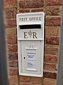 Cream White Post Box, Farlington.jpg 3,456 × 4,608; 6.29 MB
-
-
 Detached house in Portsdown Hill Road - geograph.org.uk - 638219.jpg 640 × 480; 54 KB
-
 Dragon Industrial Estate - geograph.org.uk - 638591.jpg 640 × 480; 65 KB
-
 Durkins - geograph.org.uk - 4750619.jpg 640 × 294; 28 KB
-
 Eastern Road - A27 junction - geograph.org.uk - 150381.jpg 640 × 480; 63 KB
-
 Farlington and North Langstone Harbour.jpg 4,000 × 2,250; 8.65 MB
-
 Farlington Roundabout, A27.jpg 4,000 × 3,000; 5.22 MB
-
 Farlington Water Treatment Works 1.jpg 4,000 × 3,000; 5.36 MB
-
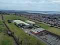 Farlington Water Treatment Works 2.jpg 4,000 × 3,000; 5.37 MB
-
 Farlington, postbox № PO6 191 - geograph.org.uk - 5630031.jpg 476 × 640; 95 KB
-
 Footpath and pedestrian underpass - geograph.org.uk - 5886843.jpg 2,592 × 3,456; 4.41 MB
-
 Fort Purbrook - geograph.org.uk - 5362099.jpg 3,456 × 2,592; 4.22 MB
-
 Gantry on A27 - geograph.org.uk - 4715324.jpg 800 × 420; 75 KB
-

-
 Holiday Inn Express, Portsmouth North.jpg 4,000 × 3,000; 5.06 MB
-
 Horses at East Lodge Farm - geograph.org.uk - 638127.jpg 640 × 480; 56 KB
-
-
 Houses in a snowy Grant Road - geograph.org.uk - 2202188.jpg 640 × 480; 55 KB
-
 Houses in Hoylake Road - geograph.org.uk - 734729.jpg 640 × 480; 80 KB
-

-

-

-

-

-

-
-
-

-

-

-

-

-

-

-
 Looking down a snowy Rectory Avenue - geograph.org.uk - 2201997.jpg 640 × 480; 61 KB
-
 Looking down Farlington Avenue - geograph.org.uk - 734710.jpg 640 × 480; 80 KB
-
 Looking eastwards along Blake Road - geograph.org.uk - 991650.jpg 640 × 480; 52 KB
-
 Looking eastwards along Hoylake Road - geograph.org.uk - 734778.jpg 640 × 480; 63 KB
-
-

-

-

-

-

-

-

-
-
-

-

-

-

-

-

-
-
 Looking north-east on the A2030 - geograph.org.uk - 639390.jpg 640 × 480; 75 KB
-

-

-
 Looking northwards up Galt Road - geograph.org.uk - 639448.jpg 640 × 480; 69 KB
-

-

-
-

-

-
 Looking up a snowy Old Rectory Road - geograph.org.uk - 2258219.jpg 640 × 480; 99 KB
-

-
-
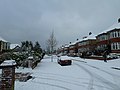
 Mid December snow in Grant Road - geograph.org.uk - 2202183.jpg 640 × 480; 59 KB
-
 Mid section of a snowy Galt Road - geograph.org.uk - 2202435.jpg 480 × 640; 46 KB
-
 Mid section of a snowy Havant Road - geograph.org.uk - 2258209.jpg 640 × 480; 127 KB
-
 Mid section of a snowy St. Andrew's Road - geograph.org.uk - 2209845.jpg 640 × 480; 133 KB
-
 Milestone, Havant Road - geograph.org.uk - 3357590.jpg 640 × 480; 144 KB
-

-
 New flats at Farlington - geograph.org.uk - 638555.jpg 640 × 480; 76 KB
-
 New flats at top of Waterworks Road - geograph.org.uk - 639419.jpg 640 × 480; 49 KB
-

-
 Patent Safety Plate Improved.jpg 3,456 × 4,608; 6.11 MB
-

-

-
 Portsmouth , Portsdown Hill Road - geograph.org.uk - 1980638.jpg 4,288 × 2,848; 4.92 MB
-
 Portsmouth , Rectory Avenue - geograph.org.uk - 1986652.jpg 4,126 × 2,580; 4.4 MB
-
 Portsmouth , Woodfield Avenue - geograph.org.uk - 1986659.jpg 4,288 × 2,848; 6.42 MB
-
 Portsmouth , Woodfield Avenue Houses - geograph.org.uk - 1980630.jpg 4,288 × 2,848; 4.42 MB
-

-

-
 Rear of the Sunshine Inn, Farlington.jpg 4,608 × 3,456; 5.18 MB
-
 Recent snow in Second Avenue (1) - geograph.org.uk - 2205903.jpg 640 × 480; 60 KB
-
 Recent snow in Second Avenue (10) - geograph.org.uk - 2205954.jpg 640 × 480; 73 KB
-
 Recent snow in Second Avenue (11) - geograph.org.uk - 2205961.jpg 640 × 480; 61 KB
-
 Recent snow in Second Avenue (12) - geograph.org.uk - 2205968.jpg 640 × 480; 53 KB
-
 Recent snow in Second Avenue (2) - geograph.org.uk - 2205905.jpg 640 × 480; 50 KB
-
 Recent snow in Second Avenue (3) - geograph.org.uk - 2205907.jpg 640 × 480; 60 KB
-
 Recent snow in Second Avenue (4) - geograph.org.uk - 2205921.jpg 640 × 480; 69 KB
-
 Recent snow in Second Avenue (5) - geograph.org.uk - 2205928.jpg 640 × 480; 62 KB
-
 Recent snow in Second Avenue (6) - geograph.org.uk - 2205931.jpg 640 × 480; 62 KB
-
 Recent snow in Second Avenue (7) - geograph.org.uk - 2205937.jpg 640 × 480; 64 KB
-
 Recent snow in Second Avenue (8) - geograph.org.uk - 2205942.jpg 640 × 480; 71 KB
-
 Recent snow in Second Avenue (9) - geograph.org.uk - 2205939.jpg 480 × 640; 48 KB
-
 Recent snow in Second Avenue - geograph.org.uk - 2209787.jpg 640 × 480; 93 KB
-
 Rectory Avenue - geograph.org.uk - 3357587.jpg 640 × 480; 75 KB
-

-
 Rounding a bend in Beverley Grove - geograph.org.uk - 2201955.jpg 640 × 480; 58 KB
-
 Seat by bus stop - geograph.org.uk - 638066.jpg 640 × 480; 59 KB
-
 Sign gantry over A27 - geograph.org.uk - 3570175.jpg 1,024 × 768; 87 KB
-

-
 Snow in Woodfield Avenue (1) - geograph.org.uk - 2201970.jpg 640 × 480; 71 KB
-
 Snow in Woodfield Avenue (2) - geograph.org.uk - 2202012.jpg 640 × 480; 60 KB
-
 Snow in Woodfield Avenue (3) - geograph.org.uk - 2202016.jpg 640 × 480; 73 KB
-
 Snow in Woodfield Avenue (4) - geograph.org.uk - 2202018.jpg 480 × 640; 68 KB
-
 Snow in Woodfield Avenue (5) - geograph.org.uk - 2202033.jpg 640 × 480; 56 KB
-
 Snow in Woodfield Avenue (6) - geograph.org.uk - 2202036.jpg 480 × 640; 43 KB
-

-

-
 Snowy houses in Beverley Grove - geograph.org.uk - 2201675.jpg 640 × 480; 58 KB
-
 Snowy pavement in Galt Road - geograph.org.uk - 2202430.jpg 480 × 640; 61 KB
-
 St Andrew's Church Hall - geograph.org.uk - 638527.jpg 640 × 480; 55 KB
-

-
 Striking tree in Waterworks Road - geograph.org.uk - 639285.jpg 640 × 480; 91 KB
-
 Superb day for a stroll. - geograph.org.uk - 683684.jpg 640 × 480; 56 KB
-
 The nursery slopes in St. Andrew's Road - geograph.org.uk - 2209856.jpg 640 × 480; 106 KB
-
 The Old Rectory - geograph.org.uk - 638528.jpg 640 × 480; 50 KB
-
 The sliproad from the A27 to Eastern Road - geograph.org.uk - 4218532.jpg 1,500 × 999; 113 KB
-
 The Solent Way (310) - geograph.org.uk - 3138141.jpg 800 × 600; 183 KB
-
 The Solent Way (311) - geograph.org.uk - 3138152.jpg 800 × 600; 189 KB
-
 The Sunshine pub, Farlington.jpg 4,608 × 3,456; 4.44 MB
-
 The Sunshine, Havant Road - geograph.org.uk - 3351914.jpg 640 × 480; 68 KB
-
 Top end of a snowy Gillman Road - geograph.org.uk - 2202124.jpg 640 × 480; 62 KB
-
 Top end of a snowy St. Andrew's Road - geograph.org.uk - 2209881.jpg 640 × 480; 73 KB
-
 Top of Farlington Avenue - geograph.org.uk - 734721.jpg 640 × 480; 74 KB
-
 Traffic gantries on the A27 - geograph.org.uk - 4218529.jpg 1,500 × 999; 87 KB
-
 Troon Crescent - geograph.org.uk - 1028741.jpg 1,799 × 1,190; 2.4 MB
-
 Troon Crescent - geograph.org.uk - 734706.jpg 640 × 480; 113 KB
-
 View over Farlington and beyond - geograph.org.uk - 5367516.jpg 3,456 × 2,592; 4.21 MB
-
 Warning sign in Farlington Avenue - geograph.org.uk - 991641.jpg 640 × 480; 55 KB
-
 Westbound A27 - geograph.org.uk - 3204272.jpg 640 × 428; 63 KB
-

-
 Far end of Fitzherbert Spur - geograph.org.uk - 638602.jpg 640 × 480; 43 KB
-

-
 Farlington Pumping Station - geograph.org.uk - 639478.jpg 640 × 480; 59 KB
-
 Sign rarely obeyed - geograph.org.uk - 638212.jpg 640 × 480; 59 KB
-

-
 Turning circle^ - geograph.org.uk - 638199.jpg 640 × 480; 52 KB


_-_geograph.org.uk_-_2209791.jpg)
_-_geograph.org.uk_-_2209792.jpg)


_-_geograph.org.uk_-_2202418.jpg)
_-_geograph.org.uk_-_2202420.jpg)
_-_geograph.org.uk_-_2202422.jpg)
_-_geograph.org.uk_-_2202425.jpg)


_-_geograph.org.uk_-_2202502.jpg)
_-_geograph.org.uk_-_2202464.jpg)
_-_geograph.org.uk_-_2202465.jpg)
_-_geograph.org.uk_-_2202467.jpg)
_-_geograph.org.uk_-_2202469.jpg)
_-_geograph.org.uk_-_2202488.jpg)
_-_geograph.org.uk_-_2202490.jpg)
_-_geograph.org.uk_-_2202498.jpg)
_-_geograph.org.uk_-_2202500.jpg)

_-_geograph.org.uk_-_2204333.jpg)


_-_geograph.org.uk_-_2201577.jpg)
_-_geograph.org.uk_-_2201674.jpg)


.jpg)


_-_geograph.org.uk_-_2205903.jpg)
_-_geograph.org.uk_-_2205954.jpg)
_-_geograph.org.uk_-_2205961.jpg)
_-_geograph.org.uk_-_2205968.jpg)
_-_geograph.org.uk_-_2205905.jpg)
_-_geograph.org.uk_-_2205907.jpg)
_-_geograph.org.uk_-_2205921.jpg)
_-_geograph.org.uk_-_2205928.jpg)
_-_geograph.org.uk_-_2205931.jpg)
_-_geograph.org.uk_-_2205937.jpg)
_-_geograph.org.uk_-_2205942.jpg)
_-_geograph.org.uk_-_2205939.jpg)


_-_geograph.org.uk_-_2201970.jpg)
_-_geograph.org.uk_-_2202012.jpg)
_-_geograph.org.uk_-_2202016.jpg)
_-_geograph.org.uk_-_2202018.jpg)
_-_geograph.org.uk_-_2202033.jpg)
_-_geograph.org.uk_-_2202036.jpg)


_-_geograph.org.uk_-_3138141.jpg)
_-_geograph.org.uk_-_3138152.jpg)


