Category:Farm in Le Mouret
Jump to navigation
Jump to search
| Object location | | View all coordinates using: OpenStreetMap |
|---|
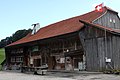
farmhouse in Oberried in the canton of Fribourg, Switzerland  | |||||
| Upload media | |||||
| Instance of | |||||
|---|---|---|---|---|---|
| Part of | |||||
| Location | Oberried, Le Mouret, Sarine District, Canton of Fribourg, Switzerland | ||||
| Street address |
| ||||
| Heritage designation | |||||
 | |||||
Media in category "Farm in Le Mouret"
This category contains only the following file.
-
 Village 91 Oberried Sep 2014.jpg 4,752 × 3,168; 5.61 MB