Category:Farms in County Mayo
Jump to navigation
Jump to search
Subcategories
This category has the following 2 subcategories, out of 2 total.
B
H
- Farmhouses in County Mayo (5 F)
Media in category "Farms in County Mayo"
The following 84 files are in this category, out of 84 total.
-
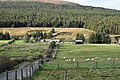
 Barrooskey during the lambing season (March 2018).jpg 6,000 × 4,000; 6.06 MB
-
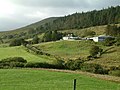
 Barrooskey Village.jpg 6,000 × 4,000; 6.76 MB
-
 Farm above Tourmakeady - geograph.org.uk - 2427394.jpg 640 × 480; 94 KB
-
 Farm across the white wood fence - geograph.org.uk - 2527991.jpg 888 × 561; 194 KB
-
 Farm and field with sheep - geograph.org.uk - 2415699.jpg 640 × 480; 68 KB
-
 Farm and fields at Kinnewry - geograph.org.uk - 2427383.jpg 640 × 480; 119 KB
-
 Farm at Accony - geograph.org.uk - 1393487.jpg 640 × 480; 77 KB
-
 Farm at Annies - geograph.org.uk - 2414945.jpg 640 × 480; 86 KB
-
 Farm at Carrowmore - geograph.org.uk - 1851746.jpg 640 × 480; 90 KB
-
 Farm at Clooneencarra - geograph.org.uk - 2414967.jpg 640 × 480; 98 KB
-
 Farm at Dambaduff - geograph.org.uk - 969233.jpg 640 × 427; 188 KB
-
 Farm at Derrygarve Beag - geograph.org.uk - 238136.jpg 640 × 480; 99 KB
-
 Farm at Dooghmakeon - geograph.org.uk - 1393472.jpg 640 × 480; 116 KB
-
 Farm at Dooncastle - geograph.org.uk - 967621.jpg 640 × 427; 191 KB
-
 Farm at Dooyork-Dumha Dhearc - geograph.org.uk - 1878611.jpg 640 × 480; 81 KB
-
 Farm at Glenturk Mor - geograph.org.uk - 1853265.jpg 640 × 480; 81 KB
-
 Farm at Gortnaclassagh - geograph.org.uk - 968249.jpg 640 × 427; 184 KB
-
 Farm at Lanmore - geograph.org.uk - 2443067.jpg 640 × 480; 97 KB
-
 Farm at Roonith Hill - geograph.org.uk - 1393499.jpg 640 × 480; 81 KB
-
 Farm at Shanvallyard - geograph.org.uk - 2427416.jpg 640 × 480; 102 KB
-
 Farm at Srah - geograph.org.uk - 2428117.jpg 640 × 480; 105 KB
-
 Farm at Teevinish East - geograph.org.uk - 2446460.jpg 640 × 480; 108 KB
-
 Farm building - geograph.org.uk - 3980416.jpg 4,000 × 2,664; 3.17 MB
-
 Farm building south of the N5 - geograph.org.uk - 2710327.jpg 1,024 × 660; 79 KB
-
 Farm buildings - geograph.org.uk - 3982559.jpg 4,000 × 3,000; 2 MB
-

-
 Farm buildings at Kilskeagh - geograph.org.uk - 2414975.jpg 640 × 480; 81 KB
-
 Farm buildings near Newport, Co Mayo - geograph.org.uk - 3476637.jpg 4,000 × 2,298; 6.04 MB
-
 Farm buildings near Newport, Co Mayo - geograph.org.uk - 3476666.jpg 3,300 × 2,475; 6.17 MB
-
 Farm buildings, Glenavenue - geograph.org.uk - 3085416.jpg 640 × 480; 278 KB
-
 Farm life - geograph.org.uk - 4277431.jpg 1,982 × 1,488; 764 KB
-
 Farm near Banagher Point, Westport - geograph.org.uk - 3472664.jpg 3,383 × 2,394; 6.59 MB
-
 Farm near Roycarter - geograph.org.uk - 1878586.jpg 640 × 480; 78 KB
-
 Farm Road near Carrowkennedy - geograph.org.uk - 2423247.jpg 1,280 × 960; 434 KB
-
 Farm Road near Carrowkennedy - geograph.org.uk - 2423264.jpg 1,280 × 960; 316 KB
-
 Farm track at Derrygarve More - geograph.org.uk - 2404855.jpg 1,280 × 960; 374 KB
-
 Farm track near Killeen - geograph.org.uk - 2404877.jpg 1,280 × 960; 384 KB
-
 Farm Track, Killeen - geograph.org.uk - 2404886.jpg 1,280 × 960; 456 KB
-
 Farm with red barn - geograph.org.uk - 2504086.jpg 640 × 480; 95 KB
-
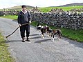 Farmer at Derrycraff - geograph.org.uk - 2443106.jpg 640 × 480; 135 KB
-
 Farmhouse at Cabragh - geograph.org.uk - 1540531.jpg 640 × 480; 79 KB
-
 Farmhouse at Carrownacross - geograph.org.uk - 2721857.jpg 1,024 × 747; 74 KB
-
 Farmland above Lough Nafooey - geograph.org.uk - 2502790.jpg 640 × 480; 94 KB
-
 Farmland east of Aghamore - geograph.org.uk - 4078913.jpg 2,592 × 1,944; 1.17 MB
-
 Farmland near Aghamore - geograph.org.uk - 4058414.jpg 2,592 × 1,944; 1.14 MB
-
 Farmland near Carrowmore - geograph.org.uk - 4081437.jpg 2,592 × 1,944; 1.29 MB
-
 Farmland near Cloonfallagh - geograph.org.uk - 4080337.jpg 2,592 × 1,944; 1.12 MB
-
 Farmland near Drimasloyan - geograph.org.uk - 4280718.jpg 1,581 × 1,186; 657 KB
-
 Farmland north of Aghamore - geograph.org.uk - 4058393.jpg 2,592 × 1,944; 1.55 MB
-
 Farmland north of Aghamore - geograph.org.uk - 4058403.jpg 2,592 × 1,944; 1.6 MB
-
 Farmland south of Kiltimagh - geograph.org.uk - 4055114.jpg 2,592 × 1,944; 1.21 MB
-

-

-
 Fertile grazing land near Carrowkennedy - geograph.org.uk - 2058390.jpg 1,280 × 960; 413 KB
-
 Field above the shore at Glosh - geograph.org.uk - 1854829.jpg 640 × 480; 89 KB
-

-
 Field and wood at Carheen - geograph.org.uk - 2427415.jpg 640 × 480; 123 KB
-
 Field near Killavally - geograph.org.uk - 2427428.jpg 640 × 480; 129 KB
-
 Field of rough grazing at Gortfree - geograph.org.uk - 2427385.jpg 640 × 480; 86 KB
-
 Field with sheep at Derrypark - geograph.org.uk - 2415683.jpg 640 × 480; 64 KB
-
 Fields above Gortbrack - geograph.org.uk - 1851747.jpg 640 × 480; 89 KB
-

-
 Fields and hedgerows at Lynchsacres - geograph.org.uk - 2414964.jpg 640 × 480; 67 KB
-
 Fields at Bartrauve-Barr Thrá - geograph.org.uk - 1880528.jpg 640 × 480; 81 KB
-
 MacEvilly's had a farm ... - geograph.org.uk - 969464.jpg 640 × 427; 210 KB
-
 Making silage at Cabragh - geograph.org.uk - 1540534.jpg 640 × 480; 51 KB
-
 Pastures of Barrooskey, upon which sheep graze and hey is lain out.jpg 6,000 × 4,000; 5.78 MB
-
 Rough Coastal Grazing - geograph.org.uk - 2679194.jpg 3,840 × 2,880; 2.51 MB
-
 Rough field and farm buildings - geograph.org.uk - 2527982.jpg 640 × 496; 120 KB
-
 Rough field meets scrubby wood - geograph.org.uk - 2541539.jpg 640 × 481; 80 KB
-
 Rough grassland at Attavally - geograph.org.uk - 1853247.jpg 640 × 480; 106 KB
-

-
 Rough grazing and forest near Srah - geograph.org.uk - 2428058.jpg 640 × 480; 114 KB
-

-

-

-
 Rough pasture near Carrowmore - geograph.org.uk - 2423197.jpg 1,280 × 960; 453 KB
-

-

-
 Rough Pasture, Glenkeen - geograph.org.uk - 2400931.jpg 1,280 × 960; 255 KB
-

-
 The Pink House, Ross Port Road - geograph.org.uk - 432617.jpg 640 × 480; 94 KB
-
 Traditional Barn at the Hamlet of Barrooskey.jpg 6,000 × 4,000; 5.55 MB
-
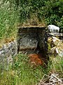 Well at Hennigan's Heritage Centre - geograph.org.uk - 1537082.jpg 480 × 640; 137 KB
.jpg)


