Category:Farms in County Tyrone
Jump to navigation
Jump to search
Subcategories
This category has the following 3 subcategories, out of 3 total.
*
B
- Barns in County Tyrone (9 F)
Media in category "Farms in County Tyrone"
The following 58 files are in this category, out of 58 total.
-
 Abandoned croft - geograph.org.uk - 173775.jpg 640 × 480; 69 KB
-
 Aghaboy Road - geograph.org.uk - 1394412.jpg 640 × 479; 56 KB
-
 Ballycrochan Road, Bangor (2) - geograph.org.uk - 203694.jpg 640 × 426; 139 KB
-
 Ballymacormick Road, Bangor - geograph.org.uk - 204267.jpg 640 × 426; 162 KB
-
 Barrontop Fun Farm, Donemana - geograph.org.uk - 206638.jpg 640 × 274; 21 KB
-
 Brackagh - valley and farmland - geograph.org.uk - 247097.jpg 640 × 480; 177 KB
-
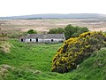
 Deserted farmhouse at Cloghfin - geograph.org.uk - 67910.jpg 640 × 479; 223 KB
-
 Drumragh Townland - geograph.org.uk - 683590.jpg 640 × 480; 48 KB
-
 Farm at Anne's Hill - geograph.org.uk - 111056.jpg 640 × 479; 147 KB
-
 Farm at Ballyblagh - geograph.org.uk - 290600.jpg 640 × 479; 106 KB
-
 Farm at Cavanreagh - geograph.org.uk - 850674.jpg 640 × 479; 65 KB
-
 Farm at Crew Lower - geograph.org.uk - 137472.jpg 640 × 479; 113 KB
-
 Farm at Errigle - geograph.org.uk - 1059037.jpg 640 × 479; 56 KB
-
 Farm Buildings, Laght - geograph.org.uk - 1451453.jpg 640 × 479; 56 KB
-
 Farm near Fort Hill - geograph.org.uk - 894899.jpg 640 × 479; 57 KB
-
 Farm, Aghasessy - geograph.org.uk - 1478445.jpg 640 × 479; 93 KB
-
 Farm, Cloghfin - geograph.org.uk - 1222781.jpg 640 × 479; 63 KB
-
 Farmhouse off the Dromore to Omagh Road - geograph.org.uk - 93346.jpg 640 × 479; 178 KB
-
 Farmland at Aghnamirigan Road - geograph.org.uk - 112115.jpg 640 × 479; 111 KB
-

-
 Inscription, turnip slicer - geograph.org.uk - 1732228.jpg 640 × 480; 62 KB
-
 Maplegrove farm - geograph.org.uk - 67897.jpg 640 × 479; 215 KB
-
 Muddy ground, Aghasessy - geograph.org.uk - 1478441.jpg 640 × 479; 70 KB
-
 Old farm implement, Glenhordial (1) - geograph.org.uk - 1181021.jpg 640 × 479; 86 KB
-
 Old farm implement, Glenhordial (2) - geograph.org.uk - 1181026.jpg 640 × 479; 110 KB
-
 Old farm implement, Glenhordial (3) - geograph.org.uk - 1181031.jpg 640 × 479; 90 KB
-
 Old farm implement, Glenhordial (4) - geograph.org.uk - 1181035.jpg 640 × 479; 104 KB
-
 Old farm implement, Glenhordial (5) - geograph.org.uk - 1181039.jpg 640 × 479; 93 KB
-
 Old farm implement, Glenhordial (6) - geograph.org.uk - 1181045.jpg 640 × 479; 93 KB
-
 Old farm implement, Glenhordial (7) - geograph.org.uk - 1181048.jpg 640 × 479; 100 KB
-
 Old Farmhouse in Muntober - geograph.org.uk - 101899.jpg 640 × 480; 154 KB
-
 Sheep grazing near Knocklayd - geograph.org.uk - 234937.jpg 640 × 426; 157 KB
-
 Slievemore - geograph.org.uk - 144173.jpg 640 × 479; 107 KB
-
 Slievemoyle - geograph.org.uk - 247086.jpg 640 × 480; 194 KB
-
 Spring Lambs - geograph.org.uk - 7300.jpg 640 × 480; 151 KB
-
 Stud farm, Cavan - geograph.org.uk - 1454125.jpg 640 × 479; 62 KB
-
 Tamlaght-Drumnaglough townlands - geograph.org.uk - 97535.jpg 613 × 404; 63 KB
-
 Turnip slicer - geograph.org.uk - 1732216.jpg 640 × 480; 75 KB
-
 Centre of Activity - geograph.org.uk - 118842.jpg 640 × 480; 150 KB
-
 Corbally Townland - geograph.org.uk - 118424.jpg 640 × 479; 120 KB
-
 Countryside near Crumlin - geograph.org.uk - 119374.jpg 640 × 480; 31 KB
-
 Deserted farmhouse at Bantry - geograph.org.uk - 244005.jpg 640 × 479; 69 KB
-
 Farm at Bearney - geograph.org.uk - 141939.jpg 640 × 479; 99 KB
-
 Farm at Croneen - geograph.org.uk - 429550.jpg 640 × 285; 30 KB
-
 Farm at Realtons - geograph.org.uk - 345404.jpg 640 × 479; 84 KB
-
 Farm at Stranadarriff - geograph.org.uk - 466737.jpg 640 × 479; 72 KB
-
 Farm near A26 - geograph.org.uk - 119154.jpg 640 × 480; 32 KB
-
 Farm, Crevenagh , Omagh - geograph.org.uk - 754221.jpg 640 × 419; 49 KB
-
 Farmhouse at Aghadulla - geograph.org.uk - 115380.jpg 640 × 479; 129 KB
-
 Farmhouse at Tattykeel - geograph.org.uk - 76544.jpg 640 × 479; 163 KB
-
 Grazing Land - geograph.org.uk - 95950.jpg 640 × 480; 93 KB
-
 Hillcrest Farm - geograph.org.uk - 103736.jpg 640 × 480; 64 KB
-
 Misty Meadows Farm - geograph.org.uk - 344792.jpg 640 × 280; 33 KB
-

-
 Old farmhouse at Camowen - geograph.org.uk - 76546.jpg 640 × 479; 191 KB
-
 Ruined Farmhouse - geograph.org.uk - 232447.jpg 640 × 427; 48 KB
-
 Small farm - geograph.org.uk - 115381.jpg 640 × 479; 93 KB
-
 Townland of Drumnakilly, Omagh - geograph.org.uk - 65037.jpg 640 × 479; 197 KB


_-_geograph.org.uk_-_203694.jpg)


_-_geograph.org.uk_-_1181021.jpg)
_-_geograph.org.uk_-_1181026.jpg)
_-_geograph.org.uk_-_1181031.jpg)
_-_geograph.org.uk_-_1181035.jpg)
_-_geograph.org.uk_-_1181039.jpg)
_-_geograph.org.uk_-_1181045.jpg)
_-_geograph.org.uk_-_1181048.jpg)


