Category:Faro de Martiño
Jump to navigation
Jump to search
| Object location | | View all coordinates using: OpenStreetMap |
|---|
lighthouse in Lobos island, Spain  | |||||
| Upload media | |||||
| Instance of | |||||
|---|---|---|---|---|---|
| Made from material | |||||
| Location | La Oliva, Las Palmas, Canary Islands, Spain | ||||
| Located in or next to body of water | |||||
| Architect | |||||
| Maintained by |
| ||||
| Inception |
| ||||
| Date of official opening |
| ||||
| Source of energy | |||||
| Height |
| ||||
 | |||||
Media in category "Faro de Martiño"
The following 23 files are in this category, out of 23 total.
-
 Approaching the lighthouse of Lobos island (Faro de Martino) - panoramio.jpg 4,912 × 2,763; 1.47 MB
-
 Corralejo - panoramio - mroszewski (5).jpg 800 × 600; 52 KB
-
 Denkmal Josefina Pla Lobos.jpg 6,000 × 4,000; 14.07 MB
-
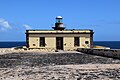
 Faro de Martino 3884.JPG 3,262 × 2,258; 1.21 MB
-
 Faro de Martiño 2018 1.jpg 6,000 × 4,000; 11.85 MB
-
 Faro de Martiño 2018 2.jpg 6,000 × 4,000; 12.38 MB
-
 Faro de Martiño.jpg 3,258 × 2,172; 2.9 MB
-
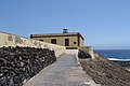
 Faro del islote de Lobos (01).jpg 4,608 × 3,072; 1.2 MB
-
 Faro del islote de Lobos (02).jpg 4,608 × 3,072; 1.01 MB
-
 Faro del islote de Lobos (03).jpg 4,608 × 3,072; 1.31 MB
-
 Fuerteventura, Lobos Island, On the way to lighthouse - panoramio.jpg 1,936 × 2,592; 1.61 MB
-
 Islote de Lobos, faro abandonado.jpg 2,000 × 2,785; 3.66 MB
-
 Light house at Isla de Lobos.jpg 2,304 × 3,072; 2.1 MB
-
 Light house at Lobos.jpg 5,472 × 3,648; 6.78 MB
-
 Light house on a cliff at Isla de Lobos.jpg 2,375 × 1,781; 1.78 MB
-
 Lighthouse (11840140494).jpg 2,000 × 3,000; 3.48 MB
-
 Lobos island lighthouse - panoramio.jpg 4,912 × 2,763; 1.69 MB
-
 Lobos light house.jpg 1,200 × 801; 965 KB
-
 Lobos lighthouse (11839220845).jpg 3,856 × 2,630; 7.24 MB
-
 Lobos lighthouse (11839947146).jpg 3,636 × 2,283; 6.08 MB
-
 Panorama of Lobos as seen from the island's lighthouse - panoramio.jpg 8,192 × 1,856; 1.67 MB
-
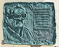 Plaque Josefina Pla Lobos.jpg 4,533 × 3,629; 7.79 MB
-
 Relief et végétation de l'île de Los Lobos.JPG 4,000 × 3,000; 4.93 MB
_-_panoramio.jpg)
.jpg)


.jpg)
.jpg)
.jpg)


.jpg)


.jpg)
.jpg)


Categories:
- Lighthouses in Fuerteventura
- Isla de Lobos (Spain)
- Lighthouses in Spain by name
- Built in the Canary Islands in 1865
- Lighthouses built in 1865
- Stone lighthouses in Spain
- Lighthouses by height, 1 to 10 meters
- Lighthouses with attached keeper's quarters
- La Bocayna
- Lighthouses of the North Atlantic
- Lighthouses by range, 10 to 14 nm
- Lighthouses built by Juan León y Castillo