Category:February 2008 in Norfolk, England
Jump to navigation
Jump to search
Deutsch: Bilder, die im Februar 2008 in Norfolk, England aufgenommen worden sind. Bitte beachten Sie, dass dies weder das Datum des Uploads noch das Datum des Scannens eines Fotos ist.
English: Images/pictures taken in Norfolk, England during February 2008. Note this is not the date of the upload, nor the date a photo was scanned.
Español: Fotografías o imágenes tomadas en Norfolk, England durante febrero 2008. No es la fecha de subida ni escaneo, sino la fecha en que las fotografías o imágenes se crearon.
Esperanto: Bildoj faritaj en Norfolk, England en februaro 2008. Tio ne estas la dato, kiam la bildoj estis alŝutitaj aŭ skanitaj.
Français : Photographies ou images prises en Norfolk, England durant février 2008. Ce n'est pas la date du téléchargement ou du scan.
Galego: Fotografías ou imaxes tomadas en Norfolk, England durante febreiro 2008. Non é a data de subida nin escaneamento, senón a data na que se crearon as fotografías ou imaxes.
Italiano: Fotografie o immagini scattate a Norfolk, England nel febbraio 2008. Nota bene: la data non si riferisce né a quella di upload né a quella in cui la foto è stata digitalizzata.
Norsk bokmål: Bilder tatt i Norfolk, England i løpet av februar 2008. Merk at dette ikke er datoen for opplasting, eller når et bilde har blitt skannet.
Norsk nynorsk: Bilete teke i Norfolk, England i løpet av februar 2008. Merk at dette ikkje er datoen for opplasting, eller når eit bilete har vorte skanna.
Русский: Изображения, сделанные в Norfolk, England в течение февраль 2008 (не дата загрузки изображения).
Українська: Зображення, зроблені в Norfolk, England протягом лютий 2008. Зауважте, що це не дата завантаження чи дата сканування фотографії.
| February 2007 | ← | February 2008 | → | February 2009 | |||||||
| Jan | Feb | Mar | Apr | May | Jun | Jul | Aug | Sep | Oct | Nov | Dec |
| 97 | 243 | 216 | 265 | 348 | 118 | 130 | 336 | 125 | 195 | 181 | 250 |
|---|---|---|---|---|---|---|---|---|---|---|---|
Subcategories
This category has only the following subcategory.
Media in category "February 2008 in Norfolk, England"
The following 200 files are in this category, out of 242 total.
(previous page) (next page)-
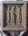
 A kneeler in St. Peter's Church - geograph.org.uk - 701624.jpg 640 × 454; 92 KB
-
 A lane leading off Market Place - geograph.org.uk - 696585.jpg 480 × 640; 80 KB
-
 A network of lines that intersect - geograph.org.uk - 689597.jpg 3,008 × 2,000; 2.63 MB
-
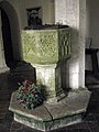 All Saints Church - baptismal font - geograph.org.uk - 696883.jpg 480 × 640; 159 KB
-
 All Saints Church - geograph.org.uk - 696844.jpg 640 × 480; 128 KB
-
 All Saints Church - geograph.org.uk - 696848.jpg 640 × 480; 186 KB
-
 All Saints Church - stained glass window - geograph.org.uk - 696875.jpg 444 × 640; 171 KB
-
 All Saints Church - view east - geograph.org.uk - 696859.jpg 480 × 640; 143 KB
-
 All Saints Church - wall decorations - geograph.org.uk - 696869.jpg 480 × 640; 156 KB
-
 All Saints Keswick - geograph.org.uk - 689372.jpg 480 × 640; 109 KB
-
 All Saints Keswick - geograph.org.uk - 689379.jpg 480 × 640; 179 KB
-
 All Saints Keswick - geograph.org.uk - 689381.jpg 640 × 480; 154 KB
-
 Approaching County School station - geograph.org.uk - 691035.jpg 640 × 480; 119 KB
-
 Attractive thatched cottage - geograph.org.uk - 704104.jpg 480 × 640; 124 KB
-
 Attractive thatched cottage - geograph.org.uk - 704315.jpg 640 × 480; 115 KB
-
 The church of St Mary and St Walstan - geograph.org.uk - 675569.jpg 480 × 640; 158 KB
-
 Beck Farm - geograph.org.uk - 683913.jpg 640 × 480; 172 KB
-
 Beeston Common Lane, Beeston Regis 2 Feb 2008 (1).jpg 2,560 × 1,920; 1.27 MB
-
 Beeston Common Lane, Beeston Regis 2 Feb 2008 (2).jpg 2,560 × 1,920; 1.09 MB
-
 Blocked ford - geograph.org.uk - 687028.jpg 480 × 640; 135 KB
-
 St Margaret's church - geograph.org.uk - 699190.jpg 640 × 458; 177 KB
-
 St Margaret's church - geograph.org.uk - 699195.jpg 480 × 640; 162 KB
-
 St Margaret's church - tower - geograph.org.uk - 699949.jpg 480 × 640; 206 KB
-
 Bus shelter - geograph.org.uk - 679332.jpg 640 × 480; 156 KB
-
 Bus shelter - geograph.org.uk - 685789.jpg 480 × 640; 144 KB
-
 Bus shelter on Hospital Road - geograph.org.uk - 685882.jpg 640 × 480; 139 KB
-
 Caravan Site, Fakenham Racecourse - geograph.org.uk - 690745.jpg 640 × 480; 66 KB
-
 Castle Acre ford - geograph.org.uk - 687908.jpg 640 × 480; 105 KB
-
 Castle Acre ford - geograph.org.uk - 687920.jpg 640 × 480; 98 KB
-
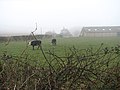 Cattle pasture - geograph.org.uk - 696829.jpg 640 × 480; 169 KB
-
 Church Farm - geograph.org.uk - 696821.jpg 640 × 480; 125 KB
-
 Church Road - geograph.org.uk - 701976.jpg 480 × 640; 124 KB
-
 Churchyard wall - geograph.org.uk - 691656.jpg 480 × 640; 199 KB
-
 City of Norwich School - geograph.org.uk - 695953.jpg 640 × 462; 90 KB
-
 Country lane to Northacre - geograph.org.uk - 702031.jpg 640 × 480; 79 KB
-

-
 Crocuses - geograph.org.uk - 708689.jpg 480 × 640; 189 KB
-
 Crocuses - geograph.org.uk - 708690.jpg 480 × 640; 163 KB
-
 Cromer Lifeboat H F Bailey 1 Feb 2008 (2).JPG 2,560 × 1,920; 893 KB
-
 All Saints Church, Croxton - geograph.org.uk - 688018.jpg 640 × 566; 86 KB
-
 Clock on Church Tower at Croxton - geograph.org.uk - 687913.jpg 425 × 640; 67 KB
-
-
 Fence and drain - geograph.org.uk - 686621.jpg 2,000 × 3,008; 3.63 MB
-
 Fluttering in the wind - geograph.org.uk - 706462.jpg 640 × 480; 198 KB
-

-
 Gargoyle on St. Mary's Church tower. - geograph.org.uk - 687777.jpg 640 × 527; 62 KB
-
 Gatehouse at entrance to Merton Hall - geograph.org.uk - 696783.jpg 640 × 480; 138 KB
-
 Gorleston St Andrew's church - geograph.org.uk - 2192305.jpg 640 × 480; 182 KB
-
 Hedgerow serving as field boundary - geograph.org.uk - 687243.jpg 480 × 640; 145 KB
-
 Henry Blogg 1 Feb 2008 (3).JPG 1,200 × 1,600; 590 KB
-
 Henry Blogg 1 Feb 2008 (5).JPG 1,200 × 1,600; 578 KB
-
 Henry Blogg's Medal's ect 1 Feb 2008 (1).JPG 1,600 × 1,200; 619 KB
-
 HF Bailey III in Cromer Henry Blogg Museum 16 Feb 2007 (5).JPG 2,560 × 1,920; 1.11 MB
-
 Hospital building - geograph.org.uk - 685940.jpg 640 × 480; 132 KB
-
 Dukes head hotel king's lynn.JPG 3,072 × 2,304; 3 MB
-
 Lakenham Primary School - geograph.org.uk - 677679.jpg 640 × 480; 48 KB
-
 Lakenham Primary School - geograph.org.uk - 706426.jpg 640 × 464; 60 KB
-
 Lazar House, Norwich - geograph.org.uk - 706553.jpg 640 × 480; 91 KB
-
 Low tide at Denver - geograph.org.uk - 682168.jpg 640 × 427; 75 KB
-
 Melton Constable Bus Shelter - geograph.org.uk - 690871.jpg 640 × 480; 81 KB
-
 Minor road to Saham Toney - geograph.org.uk - 696817.jpg 480 × 640; 129 KB
-
 Model of the Lifeboat Henry Blogg Henry Blogg museum in Cromer.JPG 1,600 × 1,200; 607 KB
-
 Morning mist - geograph.org.uk - 686808.jpg 640 × 480; 65 KB
-
 Moss on churchyard wall - geograph.org.uk - 691658.jpg 480 × 640; 153 KB
-
 Narford Hall, Norfolk - geograph.org.uk - 694837.jpg 640 × 480; 88 KB
-
 Narford Hall, Norfolk - geograph.org.uk - 694843.jpg 640 × 390; 63 KB
-
 Old Lakenham Hall Drive - geograph.org.uk - 699152.jpg 640 × 480; 75 KB
-
 Old shop buildings, Fakenham - geograph.org.uk - 690763.jpg 640 × 480; 84 KB
-
 Ornate gravestone depicting a pheasant - geograph.org.uk - 685928.jpg 640 × 480; 192 KB
-
 Over the hill and into the distance - geograph.org.uk - 687054.jpg 480 × 640; 52 KB
-
 Parked in the mist - geograph.org.uk - 696826.jpg 640 × 480; 171 KB
-
 Peddars Way sign - geograph.org.uk - 690461.jpg 480 × 640; 85 KB
-
 Pig fields - geograph.org.uk - 684259.jpg 640 × 480; 79 KB
-

-
 Poking over the top - geograph.org.uk - 687968.jpg 480 × 640; 61 KB
-
-
 Postbox encased in brick - geograph.org.uk - 691578.jpg 480 × 640; 147 KB
-
 Red brick cottage - geograph.org.uk - 687157.jpg 480 × 640; 130 KB
-
 Red postbox - geograph.org.uk - 686989.jpg 480 × 640; 129 KB
-
 Remains of an ancient tree - geograph.org.uk - 685917.jpg 640 × 480; 159 KB
-
 Road and runway running parallel - geograph.org.uk - 702167.jpg 640 × 480; 141 KB
-

-
 S Cecilia, West Bilney, Norfolk - geograph.org.uk - 697356.jpg 640 × 438; 60 KB
-
 Salters Lode lock exit - geograph.org.uk - 685674.jpg 427 × 640; 62 KB
-
 Seat at entrance to churchyard - geograph.org.uk - 688061.jpg 640 × 425; 131 KB
-
 Shed on Stud Farm - geograph.org.uk - 677286.jpg 494 × 640; 85 KB
-
 Shrimp Davis 1 Feb 2008 (2).JPG 2,560 × 1,920; 1.1 MB
-
 Snowdrops among graves - geograph.org.uk - 685923.jpg 640 × 480; 145 KB
-
 South Lodge - entrance - geograph.org.uk - 686112.jpg 455 × 640; 145 KB
-
 South Lodge - geograph.org.uk - 686101.jpg 640 × 480; 131 KB
-
 South Lodge - geograph.org.uk - 686107.jpg 640 × 456; 139 KB
-
 South past Meadows Farm - geograph.org.uk - 683923.jpg 620 × 451; 114 KB
-
 Southeast on Littlewood Lane - geograph.org.uk - 691548.jpg 480 × 640; 158 KB
-
 Speed limit on the River Bure - geograph.org.uk - 682856.jpg 480 × 640; 214 KB
-
 Spring has sprung - geograph.org.uk - 687320.jpg 480 × 640; 170 KB
-
 Ss Peter and Paul Burgh Castle 2b geograph. 693391.jpg 480 × 640; 71 KB
-
 St Andrew's Church - baptismal font - geograph.org.uk - 696974.jpg 480 × 640; 154 KB
-
 St Andrew's Church - churchyard - geograph.org.uk - 696968.jpg 480 × 640; 187 KB
-
 St Andrew's Church - geograph.org.uk - 696964.jpg 640 × 467; 183 KB
-
 St Andrew's Church - stained glass - geograph.org.uk - 696983.jpg 480 × 640; 123 KB
-
 St Andrew's Church - wall monument - geograph.org.uk - 696980.jpg 480 × 640; 133 KB
-
 St Andrew's Church - west facade - geograph.org.uk - 696971.jpg 480 × 640; 189 KB
-

-

-
 St Andrew's Church, Longham, Norfolk - geograph.org.uk - 697500.jpg 640 × 450; 60 KB
-
 St Andrew's Church, Longham, Norfolk - geograph.org.uk - 697505.jpg 640 × 480; 95 KB
-

-
-

-
-

-

-

-
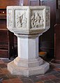
 St Margaret's church - baptismal font - geograph.org.uk - 699208.jpg 480 × 640; 159 KB
-
 St Margaret's church - churchyard - geograph.org.uk - 699174.jpg 640 × 480; 103 KB
-
 St Margaret's church - rood screen - geograph.org.uk - 699202.jpg 616 × 466; 171 KB
-

-
 St Martin's church - baptismal font - geograph.org.uk - 699324.jpg 480 × 640; 160 KB
-
 St Martin's church - churchyard - geograph.org.uk - 699286.jpg 640 × 480; 120 KB
-
 St Martin's church - college stalls - geograph.org.uk - 699319.jpg 480 × 640; 147 KB
-
 St Martin's church - geograph.org.uk - 699276.jpg 640 × 480; 119 KB
-
 St Martin's church - geograph.org.uk - 699281.jpg 640 × 466; 65 KB
-
 St Martin's church - geograph.org.uk - 699283.jpg 640 × 480; 148 KB
-

-
 St Martin's church - rood screen detail - geograph.org.uk - 699315.jpg 480 × 640; 170 KB
-
 St Martin's church - sedilia - geograph.org.uk - 699308.jpg 640 × 480; 104 KB
-

-

-

-
-

-
-

-

-

-

-

-
 St Mary the Virgin, Narford, Norfolk - geograph.org.uk - 694799.jpg 640 × 480; 113 KB
-
 St Mary the Virgin, Narford, Norfolk - geograph.org.uk - 694803.jpg 640 × 480; 81 KB
-
 St Mary the Virgin, Narford, Norfolk - geograph.org.uk - 694805.jpg 640 × 447; 64 KB
-

-
 St Mary's church - churchyard - geograph.org.uk - 696721.jpg 640 × 480; 194 KB
-
 St Mary's church - geograph.org.uk - 696709.jpg 640 × 480; 192 KB
-
 St Mary's church - geograph.org.uk - 696714.jpg 640 × 480; 135 KB
-
 St Mary's church - geograph.org.uk - 696718.jpg 640 × 480; 128 KB
-
 St Mary's church - south aisle - geograph.org.uk - 696746.jpg 480 × 640; 140 KB
-
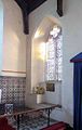
 St Mary's church - the poor box - geograph.org.uk - 696749.jpg 429 × 640; 114 KB
-
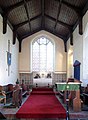
 St Mary's church - view east - geograph.org.uk - 696728.jpg 480 × 640; 144 KB
-
 St Mary's church - view southwest - geograph.org.uk - 696736.jpg 480 × 640; 133 KB
-

-
-

-

-

-

-

-

-
-

-
-
-
-
-
-

-

-
 St Mary, Gayton Thorpe, Norfolk - geograph.org.uk - 697475.jpg 529 × 640; 81 KB
-
-
-

-

-

-
-
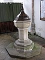
 St Peter's church - baptismal font - geograph.org.uk - 699262.jpg 480 × 640; 133 KB
-
 St Peter's church - churchyard - geograph.org.uk - 691633.jpg 480 × 640; 187 KB
-
 St Peter's church - churchyard - geograph.org.uk - 696775.jpg 640 × 480; 128 KB
-
 St Peter's church - churchyard - geograph.org.uk - 699242.jpg 640 × 480; 98 KB
-
 St Peter's church - geograph.org.uk - 696764.jpg 640 × 480; 137 KB
-
 St Peter's church - geograph.org.uk - 696770.jpg 640 × 480; 148 KB
-
 St Peter's church - geograph.org.uk - 699228.jpg 640 × 480; 179 KB
-
 St Peter's church - geograph.org.uk - 699232.jpg 640 × 480; 101 KB
-
 St Peter's church - geograph.org.uk - 699236.jpg 640 × 480; 138 KB
-
 St Peter's church - rood screen - geograph.org.uk - 699252.jpg 640 × 480; 162 KB
-
 St Peter's church - south porch and tower - geograph.org.uk - 696773.jpg 480 × 640; 141 KB
-
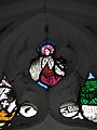
 St Peter's church - stained glass window - geograph.org.uk - 699265.jpg 480 × 640; 185 KB
-
 St Peter's church - tower and south porch - geograph.org.uk - 699239.jpg 480 × 640; 172 KB
-
 St Peter's church - view east - geograph.org.uk - 699248.jpg 468 × 640; 189 KB
-

-
 St Peter's church - view west - geograph.org.uk - 699257.jpg 480 × 640; 154 KB
-
 St Peter, Hoveton - baptismal font - geograph.org.uk - 691798.jpg 480 × 640; 109 KB
-
 St Peter, Hoveton - churchyard - geograph.org.uk - 691800.jpg 480 × 640; 193 KB
-
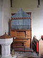
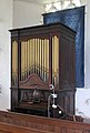
 St Peter, Hoveton - organ - geograph.org.uk - 691796.jpg 480 × 640; 179 KB
-
 St Peter, Hoveton - view northwest - geograph.org.uk - 691785.jpg 480 × 640; 122 KB
-
 St Peter, Hoveton - view southwest - geograph.org.uk - 691789.jpg 480 × 640; 158 KB
-
 St Peter, Hoveton - wall monument - geograph.org.uk - 691793.jpg 480 × 640; 107 KB
-
 Stanford Crescent - geograph.org.uk - 685772.jpg 640 × 480; 109 KB
-
 Strange circular thing - geograph.org.uk - 686486.jpg 3,008 × 2,000; 3.48 MB
-
 Sunset over Bale. - geograph.org.uk - 1529795.jpg 640 × 480; 22 KB
-
 Sunset over Gunton Lake Norfolk - geograph.org.uk - 691794.jpg 640 × 480; 35 KB
-
 Thatched cottage - geograph.org.uk - 702066.jpg 480 × 640; 166 KB


.jpg)
.jpg)


_-_geograph.org.uk_-_688966.jpg)


.JPG)


.JPG)
.JPG)
.JPG)
.JPG)


.JPG)


_-_geograph.org.uk_-_677658.jpg)


