Category:Fodderty (civil parish)
Jump to navigation
Jump to search
Scottish parish in Highland, Scotland, UK | |||||
| Upload media | |||||
| Instance of | |||||
|---|---|---|---|---|---|
| Named after | |||||
| Location |
| ||||
| Population |
| ||||
| Area |
| ||||
 | |||||
Subcategories
This category has the following 6 subcategories, out of 6 total.
Media in category "Fodderty (civil parish)"
The following 200 files are in this category, out of 966 total.
(previous page) (next page)-
 1550 Sweet Chestnut, by Castle Leod - geograph.org.uk - 4028020.jpg 2,850 × 2,351; 2.45 MB
-
 A fine oak dominating the landscape - geograph.org.uk - 4914310.jpg 1,600 × 1,200; 852 KB
-
 A fresh chainsaw sculpture - geograph.org.uk - 2724206.jpg 4,000 × 3,000; 1.84 MB
-
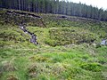
 A plantation near Glensgaich - geograph.org.uk - 3758505.jpg 640 × 427; 430 KB
-
 A train near Glensgaich - geograph.org.uk - 3758484.jpg 640 × 421; 443 KB
-
 A venerable Scots Pine below Knock Farril Hillfort - geograph.org.uk - 5808363.jpg 1,600 × 1,202; 804 KB
-
 A834 at Blairninich - geograph.org.uk - 4382841.jpg 4,608 × 3,456; 5.35 MB
-
 A835 heading for Garve - geograph.org.uk - 4755498.jpg 1,024 × 682; 141 KB
-
 A835 near Inchbie Lodge - geograph.org.uk - 2464465.jpg 3,045 × 2,213; 850 KB
-
 A835 through Garbat Forest - geograph.org.uk - 2229464.jpg 800 × 531; 146 KB
-
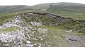
 Abandoned croft at Knockfarrel - geograph.org.uk - 2213687.jpg 640 × 480; 108 KB
-
 Abandoned croft houses at Knockfarrel - geograph.org.uk - 2213760.jpg 640 × 480; 138 KB
-

-
 Abhainn na Glass above Kildermorie - geograph.org.uk - 6188849.jpg 5,184 × 3,888; 6.43 MB
-
 Abhainn Sgitheach River - geograph.org.uk - 5259627.jpg 1,600 × 1,201; 425 KB
-
 Abhainn Srath Rainich below the sluice in Inchbae Forest - geograph.org.uk - 4687794.jpg 4,608 × 3,456; 6.98 MB
-
 Abhainn Srath Rainich north of Garve - geograph.org.uk - 4687765.jpg 4,608 × 3,456; 7.22 MB
-
 Abhainn Strath Rainich 'sluiced' in Inchbae Forest - geograph.org.uk - 6016461.jpg 5,184 × 3,888; 6.37 MB
-
 Abhainn Strath Rainich - geograph.org.uk - 3459175.jpg 3,264 × 2,448; 5.79 MB
-
 Achadh Carn nan Eighean in Inchbae Forest - geograph.org.uk - 6019750.jpg 5,184 × 3,888; 5.88 MB
-

-
 Allt a' Bhealaich Mhoir and An Cabar - geograph.org.uk - 4549558.jpg 1,600 × 1,200; 302 KB
-
 Allt a' Bhealaich Mhoir passes through Garbat Forest - geograph.org.uk - 5723242.jpg 3,000 × 4,000; 4.03 MB
-
 Allt a' Bhealaich Mhòir - geograph.org.uk - 2538900.jpg 640 × 480; 331 KB
-
 Allt a' Bhealaich Mhòir - geograph.org.uk - 5334350.jpg 1,024 × 768; 263 KB
-
 Allt a' Bhealaich Mhòir beside the Beinn Wyvis path - geograph.org.uk - 5702823.jpg 1,600 × 1,202; 1,005 KB
-

-
 Allt a'Gharbh Bhaid - geograph.org.uk - 5190647.jpg 1,600 × 1,201; 1.09 MB
-
 Allt a'Gharbh Bhaid enters Garbat forest - geograph.org.uk - 2956898.jpg 640 × 480; 104 KB
-

-
 Allt an Eilein Ghuirm above Strath Rannoch, Garve - geograph.org.uk - 3740961.jpg 3,648 × 2,736; 4.76 MB
-

-

-

-
 Allt Calltuinne - geograph.org.uk - 3888725.jpg 800 × 600; 134 KB
-
 Allt Coire a' Chundrain in Inchbae Forest - geograph.org.uk - 6016500.jpg 5,184 × 3,888; 6.06 MB
-
 Allt Coire na Feithe Riabhaich - geograph.org.uk - 3867375.jpg 768 × 1,024; 280 KB
-
 Allt Gleann Sgathaich - geograph.org.uk - 3758495.jpg 640 × 427; 433 KB
-
 Allt Gleann Sgathaich - geograph.org.uk - 5250481.jpg 1,600 × 1,201; 705 KB
-
 Allt na Bana-mhorair - geograph.org.uk - 1369487.jpg 640 × 480; 108 KB
-
 Allt Righ na Cloiche above Strath Rannoch, Garve - geograph.org.uk - 3740924.jpg 3,648 × 2,736; 4.76 MB
-
 Allt Righ na Cloiche east of Strath Rannoch near Garve - geograph.org.uk - 3730918.jpg 3,648 × 2,736; 4.74 MB
-
 Allt Toll nam Muc - geograph.org.uk - 3039449.jpg 1,024 × 678; 173 KB
-
 Along the weir to Dunglass Island - geograph.org.uk - 3342746.jpg 3,000 × 2,116; 1.84 MB
-

-
 Ancient Track - geograph.org.uk - 1528798.jpg 640 × 428; 119 KB
-
 Ancient Track - geograph.org.uk - 1528823.jpg 640 × 428; 122 KB
-
 Approach to Inchvannie - geograph.org.uk - 6066037.jpg 1,280 × 857; 1.31 MB
-

-
 Aqueduct, Coire na Fèithe Riabhaich - geograph.org.uk - 3869192.jpg 1,024 × 768; 295 KB
-
 Artwork by Loch Ussie - geograph.org.uk - 5956834.jpg 640 × 480; 101 KB
-
 Artwork by Loch Ussie - geograph.org.uk - 5956840.jpg 640 × 640; 99 KB
-
 Artwork by Loch Ussie - geograph.org.uk - 5957302.jpg 640 × 640; 102 KB
-

-
 ATV track near Meall nam Mullach in Inchbae Forest - geograph.org.uk - 6016549.jpg 5,184 × 3,888; 7.77 MB
-
 Autumn colour near Tollie - geograph.org.uk - 2164641.jpg 640 × 480; 209 KB
-
 Autumn colours - geograph.org.uk - 3735943.jpg 640 × 428; 123 KB
-
 Awaiting residents - geograph.org.uk - 6065953.jpg 1,280 × 857; 844 KB
-
 Back road - geograph.org.uk - 3826742.jpg 800 × 600; 93 KB
-
 Back to Beinn a' Chaisteil - geograph.org.uk - 877922.jpg 640 × 360; 38 KB
-
 Bales in a field by Loch Ussie - geograph.org.uk - 5240463.jpg 1,024 × 768; 89 KB
-
 Bealach Beag - geograph.org.uk - 3888781.jpg 1,024 × 768; 184 KB
-
 Bealach Mòr - geograph.org.uk - 3869180.jpg 1,024 × 768; 167 KB
-
 Beech tree in Broad Wood near Maryburgh - geograph.org.uk - 5547487.jpg 1,200 × 1,600; 902 KB
-
 Beech trees in woodland at Dochmaluag - geograph.org.uk - 4882626.jpg 768 × 1,024; 343 KB
-
 Beinn a Chasteil Hillside - geograph.org.uk - 877878.jpg 640 × 360; 55 KB
-
 Beinn a' Chaisteil hillside - geograph.org.uk - 877926.jpg 640 × 360; 55 KB
-
 Beinn a' Ghuilbein - geograph.org.uk - 3296132.jpg 640 × 427; 242 KB
-
 Beinn Wyvis view from the Knockbain ridge - geograph.org.uk - 5808383.jpg 1,600 × 900; 439 KB
-
 Below Bealach Bhrathan - geograph.org.uk - 4288553.jpg 1,400 × 1,052; 442 KB
-
 Below the 'Cat's Back' - geograph.org.uk - 6367098.jpg 1,280 × 960; 1.18 MB
-
 Ben Wyvis from Little Wyvis - geograph.org.uk - 5939757.jpg 1,600 × 1,060; 438 KB
-
 Ben Wyvis from the west - geograph.org.uk - 5105345.jpg 3,264 × 2,448; 4.4 MB
-
 Ben Wyvis path in Garbat Forest - geograph.org.uk - 4549532.jpg 1,600 × 1,200; 476 KB
-
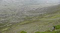
 Ben Wyvis Plateau - geograph.org.uk - 5617718.jpg 640 × 425; 78 KB
-
 Beside Loch Garve - geograph.org.uk - 5592787.jpg 1,600 × 900; 475 KB
-
 Beside the Beinn Wyvis path from Garbat - geograph.org.uk - 5887076.jpg 1,600 × 1,202; 1.29 MB
-
 Beside the Blackmuir Wood car park - geograph.org.uk - 4239050.jpg 1,400 × 1,050; 655 KB
-

-
 Beside the path for Beinn Wyvis - geograph.org.uk - 5702806.jpg 1,600 × 1,202; 794 KB
-
 Beside the track up Ben Wyvis - geograph.org.uk - 4012315.jpg 1,400 × 1,050; 861 KB
-
 Birch in the sheep fank - geograph.org.uk - 5250488.jpg 1,600 × 1,600; 1.06 MB
-
 Birch plantation near Strathrannoch - geograph.org.uk - 4687838.jpg 4,608 × 3,456; 7.64 MB
-
 Birch trees, by Loch Garve - geograph.org.uk - 5472273.jpg 2,722 × 2,200; 2.25 MB
-
 Blackmuir Wood - geograph.org.uk - 5928099.jpg 427 × 640; 283 KB
-
 Blackmuir Wood, near Strathpeffer - geograph.org.uk - 5075839.jpg 4,608 × 3,456; 5.63 MB
-
 Blackwater River - 1987 - geograph.org.uk - 2701275.jpg 2,272 × 1,515; 780 KB
-
 Blackwater River - 1987 - geograph.org.uk - 2701327.jpg 2,272 × 1,514; 766 KB
-
 Blackwater River - 1987 - geograph.org.uk - 2701414.jpg 2,272 × 1,515; 751 KB
-
 Blairninich and Knock Farril - geograph.org.uk - 6052727.jpg 1,600 × 900; 422 KB
-
 Boarded up buildings at Tollie - geograph.org.uk - 2213056.jpg 640 × 480; 90 KB
-
 Boardwalk over ditch at forest's edge - geograph.org.uk - 3869358.jpg 1,024 × 768; 213 KB
-
 Bog lochan in Blackmuir Wood - geograph.org.uk - 4424236.jpg 1,400 × 1,050; 509 KB
-
 Bog lochan in Blackmuir Wood - geograph.org.uk - 4424253.jpg 1,400 × 1,049; 656 KB
-
 Boggy forest stream - geograph.org.uk - 3869366.jpg 1,024 × 768; 167 KB
-
 Boggy ground north of Loch a' Bhealaich - geograph.org.uk - 3296177.jpg 640 × 427; 290 KB
-
 Boggy ground, south of Raven Rock - geograph.org.uk - 3849867.jpg 800 × 600; 115 KB
-
 Boggy pool above Abhainn na Glasa near Kildermorie - geograph.org.uk - 6191020.jpg 5,184 × 3,888; 5.74 MB
-
 Borrow Pit, Strathvaich - geograph.org.uk - 877987.jpg 640 × 360; 78 KB
-

-
 Brahan Golf Club - geograph.org.uk - 3727890.jpg 1,024 × 768; 154 KB
-
 Brahan Golf Course - geograph.org.uk - 5899253.jpg 1,600 × 1,063; 418 KB
-
 Brahan Golf Course - geograph.org.uk - 5957384.jpg 1,600 × 1,000; 341 KB
-
 Brahan Golf Course - geograph.org.uk - 5957447.jpg 640 × 457; 84 KB
-
 Brahan Seer - geograph.org.uk - 4289693.jpg 1,280 × 1,707; 2.22 MB
-
 Brahan Seer - Information plaque - geograph.org.uk - 4289702.jpg 1,280 × 1,707; 1.83 MB
-
 Bridge on Allt Leth-Allt - geograph.org.uk - 3849728.jpg 800 × 600; 99 KB
-
 Bridge on forest track - geograph.org.uk - 3849700.jpg 800 × 600; 128 KB
-
 Bridge over Allt an Achaidh Mhoir - geograph.org.uk - 3811970.jpg 640 × 427; 413 KB
-
 Bridge over Allt Gleann Sgathaich - geograph.org.uk - 3758496.jpg 640 × 427; 380 KB
-
 Bridge over Allt Gleann Sgathaich - geograph.org.uk - 3849826.jpg 800 × 600; 179 KB
-
 Bridge over the River Peffery - geograph.org.uk - 6081610.jpg 1,280 × 857; 1.54 MB
-
 Bridge to Dunglass Island - geograph.org.uk - 3342530.jpg 3,200 × 2,153; 1.73 MB
-
 Bridge to Dunglass Island - geograph.org.uk - 4914353.jpg 1,600 × 1,200; 668 KB
-
 Broom ^ cleared forestry land NW of Cnoc Mor - geograph.org.uk - 4278868.jpg 1,024 × 768; 230 KB
-

-
 Burn flowing to Lubachlaggan - geograph.org.uk - 877868.jpg 360 × 640; 91 KB
-
 Burn running off Meall nam Mullach in Inchbae Forest - geograph.org.uk - 6016575.jpg 5,184 × 3,888; 6.72 MB
-
 By Heights of Docharty - geograph.org.uk - 6294781.jpg 1,600 × 900; 340 KB
-
 By the railway line, Rogie Forest - geograph.org.uk - 6047048.jpg 1,600 × 900; 570 KB
-
 Cafe tables, Strathpeffer Railway Station - geograph.org.uk - 6301179.jpg 1,067 × 1,600; 512 KB
-
 Cairn on Beinn a' Chaisteil - geograph.org.uk - 877903.jpg 640 × 360; 68 KB
-
 Cairn on Beinn a' Chaisteil - geograph.org.uk - 877924.jpg 640 × 360; 55 KB
-
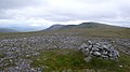
 Cairn on the summit of An Cabar - geograph.org.uk - 4553720.jpg 1,600 × 1,200; 253 KB
-
 Cairn, An Cabar - geograph.org.uk - 5488060.jpg 4,896 × 3,672; 6.69 MB
-
 Carefully constructed section of the path for Ben Wyvis - geograph.org.uk - 4012938.jpg 1,400 × 1,051; 734 KB
-
 Carn Gorm - geograph.org.uk - 3296158.jpg 640 × 427; 310 KB
-
 Castle Leod Driveway - geograph.org.uk - 5819303.jpg 1,024 × 768; 371 KB
-
 Castle Leod Lawn - geograph.org.uk - 5819250.jpg 1,024 × 595; 229 KB
-

-
 Chainsaw Sculptures - geograph.org.uk - 2724223.jpg 4,000 × 3,000; 1.5 MB
-
 Chainsaw Work - geograph.org.uk - 2274853.jpg 2,816 × 1,940; 1.74 MB
-
 Chambered cairn, Heights of Brae - geograph.org.uk - 5075242.jpg 4,608 × 3,456; 5.24 MB
-
 Chambered cairn, Heights of Brae - geograph.org.uk - 5075246.jpg 4,608 × 3,456; 4.34 MB
-
 Children's party at the Touchstone Maze - geograph.org.uk - 5746383.jpg 1,600 × 900; 577 KB
-
 Chimney, antenna and tree - geograph.org.uk - 1380854.jpg 640 × 480; 42 KB
-

-
 Clear felled forestry - geograph.org.uk - 5440486.jpg 640 × 480; 120 KB
-
 Clear felled forestry, Achadh Mor - geograph.org.uk - 3811952.jpg 640 × 427; 381 KB
-
 Cleared area of Broad Wood - geograph.org.uk - 5547243.jpg 1,600 × 900; 566 KB
-
 Cleared area of Contin Forest - geograph.org.uk - 5599075.jpg 1,600 × 900; 264 KB
-
 Cleared compartment of Blackmuir Wood - geograph.org.uk - 4239064.jpg 1,400 × 1,050; 503 KB
-
 Cleared forest below Cnoc na Bana-mhoraire - geograph.org.uk - 5191012.jpg 1,600 × 1,201; 1.06 MB
-
 Cleared hillside above Bottacks - geograph.org.uk - 5259701.jpg 1,600 × 1,201; 1.13 MB
-
 Cleared sector in the Garbat Forest - geograph.org.uk - 1369485.jpg 640 × 480; 112 KB
-
 Cleared segment of Garbat Forest - geograph.org.uk - 5191013.jpg 1,600 × 1,201; 540 KB
-
 Clearfell north of Inchbae Wood near Garve - geograph.org.uk - 3740410.jpg 3,648 × 2,736; 4.7 MB
-

-
 Clearing on the north east slope of Cnoc Mor - geograph.org.uk - 1803563.jpg 1,024 × 768; 137 KB
-
 Cnoc nan Each Beag - geograph.org.uk - 3869216.jpg 1,024 × 768; 188 KB
-
 Cnoc nan Each Mòr - geograph.org.uk - 3867358.jpg 768 × 1,024; 186 KB
-
 Coill' an Achaidh Mhòir - geograph.org.uk - 5984524.jpg 1,024 × 768; 427 KB
-
 Col between Little Wyvis and Tom na Caillich - geograph.org.uk - 3760400.jpg 1,627 × 996; 802 KB
-
 Colour Patchwork - geograph.org.uk - 2462933.jpg 3,648 × 2,736; 2.06 MB
-
 Coming Attractions for Strathpeffer - geograph.org.uk - 2546763.jpg 2,560 × 1,920; 2.45 MB
-
 Concrete collection wall above sluice in Inchbae Forest - geograph.org.uk - 4687774.jpg 4,608 × 3,456; 7.61 MB
-
 Conifer avenue at Lochussie - geograph.org.uk - 5548220.jpg 723 × 1,024; 274 KB
-
 Conon Bridge - geograph.org.uk - 2064569.jpg 3,394 × 2,208; 1.08 MB
-
 Conon Bridges - geograph.org.uk - 3388507.jpg 640 × 424; 56 KB
-
 Consulting Room Exhibit in Strathpeffer Spa Pump Room - geograph.org.uk - 6246377.jpg 1,588 × 1,600; 514 KB
-
 Core footpath towards the Kinellan Viewpoint - geograph.org.uk - 5244203.jpg 1,600 × 1,201; 672 KB
-
 Corner of plantation of birch in Inchbae Forest - geograph.org.uk - 4687895.jpg 4,608 × 3,456; 7.16 MB
-
 Corrie Chundrain - geograph.org.uk - 877911.jpg 640 × 360; 65 KB
-
 Crags above weir in Gleann Beag - geograph.org.uk - 4673924.jpg 3,968 × 2,232; 5.41 MB
-
 Craigvar - geograph.org.uk - 4657269.jpg 640 × 461; 123 KB
-
 Craigvar, Strathpeffer - geograph.org.uk - 6259497.jpg 1,280 × 852; 1.01 MB
-
 Creag Dubh Bheag - geograph.org.uk - 877933.jpg 640 × 360; 76 KB
-
 Croft houses below Knockfarrel - geograph.org.uk - 4294958.jpg 800 × 600; 89 KB
-
 Cromartie Buildings, Strathpeffer - geograph.org.uk - 6000317.jpg 1,280 × 904; 1.52 MB
-
 Cromartie Buildings, Strathpeffer - geograph.org.uk - 6000318.jpg 1,280 × 857; 1.24 MB
-
 Cromartie Sawmill - geograph.org.uk - 3820527.jpg 1,024 × 768; 242 KB
-
 Cropland near Tollie - geograph.org.uk - 2470630.jpg 800 × 600; 145 KB
-
 Culvert on Strathvaich track - geograph.org.uk - 877990.jpg 640 × 360; 63 KB
-
 Cut Barley Field at Keithtown - geograph.org.uk - 5957459.jpg 640 × 457; 75 KB
-
 Dead end road to Dochnaclear - geograph.org.uk - 2015730.jpg 800 × 531; 174 KB
-
 Dead tree at Castle Leod - geograph.org.uk - 6000425.jpg 1,024 × 830; 374 KB
-
 Deanich Lodge - geograph.org.uk - 3039469.jpg 1,024 × 678; 143 KB
-
 Deanich Lodge - geograph.org.uk - 4680683.jpg 1,600 × 900; 296 KB
-

-

-
 Deer fence surrounding Garbat Forest - geograph.org.uk - 5190498.jpg 1,600 × 1,201; 558 KB
-
 Deer fence surrounding Garbat Forest - geograph.org.uk - 5190503.jpg 1,600 × 1,201; 835 KB
-
 Deer fence, Rogie Forest - geograph.org.uk - 3888847.jpg 1,024 × 768; 208 KB
-

-

-
 Dense forestry near Loch Ussie - geograph.org.uk - 5899306.jpg 1,600 × 1,063; 840 KB
-
 Derelict croft at Knockfarrel - geograph.org.uk - 2213060.jpg 640 × 480; 52 KB
-
 Derelict croft house at Lochussie - geograph.org.uk - 4294967.jpg 800 × 600; 81 KB
-
 Derelict house, Glensgaich - geograph.org.uk - 3758488.jpg 640 × 427; 312 KB
-
 Descending the staircase on An Cabar - geograph.org.uk - 4012454.jpg 1,400 × 1,050; 830 KB
-
 Descending to the ford on the track to Garve - geograph.org.uk - 5592466.jpg 1,600 × 900; 589 KB
-
 Descent from Little Wyvis - geograph.org.uk - 5939751.jpg 1,600 × 1,060; 474 KB
-

-
 Dismantled forestry fence in Inchbae Wood near Garve - geograph.org.uk - 3730858.jpg 3,648 × 2,736; 4.8 MB
-
 Dismantled Railway line - geograph.org.uk - 1523296.jpg 428 × 640; 119 KB
-
 Dismantled railway path - geograph.org.uk - 4289024.jpg 1,280 × 960; 1.36 MB
-
 Displays at the Tollie Red Kite Centre - geograph.org.uk - 5891472.jpg 1,600 × 1,202; 810 KB
-
 Disused compound - geograph.org.uk - 6089256.jpg 1,280 × 960; 855 KB
-
 Druim a Chuilein trig - geograph.org.uk - 997640.jpg 640 × 480; 92 KB
-
 Drumlin containing Achadh Carn nan Eighean in Inchbae Forest - geograph.org.uk - 6019756.jpg 5,184 × 3,888; 5.69 MB


&filefrom=Dry+lochan+on+Beinn+a%27+Chaisteil+-+geograph.org.uk+-+877920.jpg#mw-category-media)