Category:Ford near Karsveldervoetpad 1, Waterop
Jump to navigation
Jump to search
| Object location | | View all coordinates using: OpenStreetMap |
|---|
Media in category "Ford near Karsveldervoetpad 1, Waterop"
The following 5 files are in this category, out of 5 total.
-
 Billinghuizen-Voorde Gulp Houbenderheiweg (2).JPG 4,000 × 3,000; 5.42 MB
-
 Billinghuizen-Voorde Gulp Houbenderheiweg (3).JPG 4,000 × 3,000; 5.38 MB
-
 Billinghuizen-Voorde Gulp Houbenderheiweg.JPG 4,000 × 3,000; 5.06 MB
-
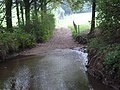
 Waterop-voorde bij Karsveldervoetpad 1 (1).jpg 4,032 × 2,268; 6.55 MB
-
 Waterop-voorde bij Karsveldervoetpad 1 (2).jpg 4,032 × 2,268; 6.89 MB
.JPG)
.JPG)

.jpg)
.jpg)