Category:Former pubs in North Yorkshire
Jump to navigation
Jump to search
Ceremonial counties of England: Bedfordshire · Berkshire · Buckinghamshire · Cambridgeshire · Cheshire · Cornwall · Cumbria · Derbyshire · Devon · Dorset · Durham · East Riding of Yorkshire · East Sussex · Essex · Gloucestershire · Greater London · Greater Manchester · Hampshire · Herefordshire · Hertfordshire · Kent · Lancashire · Leicestershire · Lincolnshire · Merseyside · Norfolk · North Yorkshire · Northamptonshire · Northumberland · Nottinghamshire · Oxfordshire · Rutland · Shropshire · Somerset · South Yorkshire · Staffordshire · Suffolk · Surrey · Tyne and Wear · Warwickshire · West Midlands · West Sussex · West Yorkshire · Wiltshire · Worcestershire
City-counties: City of London
Former historic counties:
Other former counties:
City-counties: City of London
Former historic counties:
Other former counties:
Subcategories
This category has the following 6 subcategories, out of 6 total.
Media in category "Former pubs in North Yorkshire"
The following 21 files are in this category, out of 21 total.
-
 Abbey Road and Star Inn, Knaresborough, Yorkshire, England - pre-1906.jpg 1,562 × 947; 1.36 MB
-
 Former Prince of Wales Pub, Castle Street, Spofforth (28th June 2014).JPG 4,608 × 3,456; 6.43 MB
-
 Former pub at Burn Bridge - geograph.org.uk - 644652.jpg 640 × 480; 77 KB
-
 Former pub at Burn Bridge - geograph.org.uk - 644660.jpg 640 × 480; 121 KB
-
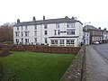
 Former public house at East Witton - geograph.org.uk - 408857.jpg 640 × 480; 87 KB
-
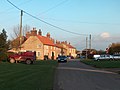
 Former public house at Thornton le Street - geograph.org.uk - 405952.jpg 640 × 480; 100 KB
-

-
 In Barton-le-Willows - geograph.org.uk - 2697296.jpg 2,306 × 1,730; 882 KB
-
 Nelson Arms, Shaw Mills (geograph 4115225).jpg 1,920 × 1,440; 483 KB
-
 Riverside Court - geograph.org.uk - 5980433.jpg 640 × 480; 207 KB
-
 Shell canopy, Cheapside, Settle - geograph.org.uk - 925975.jpg 513 × 640; 83 KB
-
 Skipton, Unicorn Hotel - geograph.org.uk - 1705528.jpg 3,264 × 2,448; 2.17 MB
-
 Snaygill Arms.jpg 500 × 375; 68 KB
-
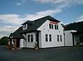 The Aagrah - geograph.org.uk - 44600.jpg 640 × 476; 89 KB
-
 The Buck Inn (as was), Ruffortth (12th June 2013).jpg 3,872 × 2,176; 2.76 MB
-
 The former William IV pub, Church Hill, Spofforth (28th June 2014).JPG 4,608 × 3,456; 6.37 MB
-
 The Shoulder of Mutton, Kirkby Malzeard.jpg 2,688 × 1,520; 2.06 MB
-

-
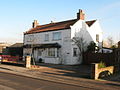
 Former Black Bull Inn, Topcliffe - geograph.org.uk - 643776.jpg 640 × 438; 66 KB
-
 Former Hackfall Inn, Grewelthorpe - geograph.org.uk - 638583.jpg 640 × 470; 80 KB
-
 Former village inn, Sinderby - geograph.org.uk - 687673.jpg 640 × 480; 71 KB

.JPG)


.jpg)


,_Ruffortth_(12th_June_2013).jpg)
.JPG)


