Category:Franz-Schreiner-Hof
Jump to navigation
Jump to search
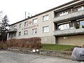
Deutsch: Wiener Gemeindebauten: Franz-Schreiner-Hof

| Object location | | View all coordinates using: OpenStreetMap |
|---|
public housing in Währing  | |||||
| Upload media | |||||
| Instance of | |||||
|---|---|---|---|---|---|
| Location | |||||
| Street address |
| ||||
| Architect | |||||
| Inception |
| ||||
 | |||||
Media in category "Franz-Schreiner-Hof"
The following 2 files are in this category, out of 2 total.
-
 1180 Buchleitengasse 36 - Franz Schreiner-Hof - Franz Schreiner-Gedenkstein IMG 5687.jpg 1,600 × 1,200; 663 KB
-
 Wien Franz-Schreiner-Hof.jpg 4,608 × 3,456; 3.49 MB
