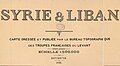
Category:French Service géographique de l'armée, Syrie & Liban
Jump to navigation
Jump to search
map made by the French army, 1936 .jpg) | |||||
| Upload media | |||||
| Instance of | |||||
|---|---|---|---|---|---|
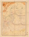
| Depicts | Syria and Lebanon | ||||
| Genre | |||||
| Publisher |
| ||||
| Creator | |||||
| Place of publication | |||||
| Language of work or name | |||||
| Number of parts of this work |
| ||||
| Collection |
| ||||
| Inception |
| ||||
| Publication date |
| ||||
| Width |
| ||||
| Height |
| ||||
| |||||
Subcategories
This category has only the following subcategory.
Media in category "French Service géographique de l'armée, Syrie & Liban"
The following 16 files are in this category, out of 16 total.
-
 French Service géographique de l'armée, Syrie & Liban 01-title (FL13729145 2515089).jpg 8,862 × 12,032; 156.82 MB
-
 French Service géographique de l'armée, Syrie & Liban 01-title (FL13729145 2515089).tif 8,862 × 12,032; 238.82 MB
-
 French Service géographique de l'armée, Syrie & Liban 02-alep (FL13729152 2515089).jpg 9,377 × 11,819; 159.79 MB
-
 French Service géographique de l'armée, Syrie & Liban 02-alep (FL13729152 2515089).tif 9,377 × 11,819; 242.65 MB
-
 French Service géographique de l'armée, Syrie & Liban 03 (FL13729156 2515089).jpg 9,486 × 11,854; 146.08 MB
-
 French Service géographique de l'armée, Syrie & Liban 03 (FL13729156 2515089).tif 9,486 × 11,854; 220.51 MB
-
 French Service géographique de l'armée, Syrie & Liban 04-haifa (FL13729160 2515089).jpg 9,654 × 12,172; 171 MB
-
 French Service géographique de l'armée, Syrie & Liban 04-haifa (FL13729160 2515089).tif 9,654 × 12,172; 259.22 MB
-
 French Service géographique de l'armée, Syrie & Liban 05 (FL13729166 2515089).jpg 9,806 × 12,318; 153.09 MB
-
 French Service géographique de l'armée, Syrie & Liban 05 (FL13729166 2515089).tif 9,806 × 12,318; 229.27 MB
-
 French Service géographique de l'armée, Syrie & Liban 06-legende (FL13729170 2515089).jpg 9,767 × 12,235; 164.23 MB
-
 French Service géographique de l'armée, Syrie & Liban 06-legende (FL13729170 2515089).tif 9,767 × 12,235; 252.75 MB
-
-

-

-

.jpg)
.jpg)
.jpg)
.jpg)
.jpg)
_(cropped).jpg)
_(cropped).jpg)
_(cropped).jpg)
_(cropped).jpg)