Category:Friarton Island
Jump to navigation
Jump to search
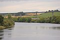
English: Friarton Island or Moncrieffe Island is an island in the River Tay, in Perth, in the council area of Perth and Kinross, Scotland.
river island in the River Tay, Perth and Kinross, Scotland, UK  | |||||
| Upload media | |||||
| Instance of | |||||
|---|---|---|---|---|---|
| Part of | |||||
| Location | Perth and Kinross, Scotland | ||||
| Located in or next to body of water | |||||
 | |||||
Media in category "Friarton Island"
The following 14 files are in this category, out of 14 total.
-
 Allotment path - geograph.org.uk - 1004326.jpg 550 × 640; 167 KB
-
 Allotments viewed from railway bridge - geograph.org.uk - 577562.jpg 640 × 480; 168 KB
-
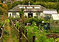 Allotments, Moncreiffe Island - geograph.org.uk - 1004332.jpg 640 × 453; 121 KB
-
 Causeway to Moncreiffe Island - geograph.org.uk - 1076347.jpg 640 × 480; 195 KB
-
 Causeway to Moncreiffe Island - geograph.org.uk - 806830.jpg 640 × 482; 104 KB
-
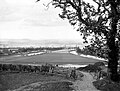
 Friarton or Moncrieffe Island - geograph.org.uk - 564899.jpg 640 × 424; 53 KB
-
 Golf Course - geograph.org.uk - 304142.jpg 640 × 424; 141 KB
-
 King James VI golf course - geograph.org.uk - 394963.jpg 600 × 326; 96 KB
-
 Low tide at Moncreiffe Island - geograph.org.uk - 205031.jpg 640 × 480; 60 KB
-
 Moncreiffe Island.jpeg 1,011 × 768; 391 KB
-
 Moncreiffeisland.jpg 640 × 424; 70 KB
-
 The Tay - geograph.org.uk - 565764.jpg 640 × 424; 28 KB
-
-
 Moncreiffe Island - geograph.org.uk - 6966.jpg 640 × 221; 32 KB


