Category:Funkturm Geisa
Jump to navigation
Jump to search
| Object location | | View all coordinates using: OpenStreetMap |
|---|
Media in category "Funkturm Geisa"
The following 4 files are in this category, out of 4 total.
-
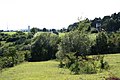
 Anhöhe zwischen Setzelbach, Rasdorf und Wiesenfeld.jpg 3,888 × 2,592; 4.6 MB
-
 Blick vom Rasdorfer Berg südwestwärts auf den ehemaligen Grenzabschnitt bei Point Alpha.jpg 1,936 × 1,288; 1.57 MB
-
 Funkturm Geisa02012019.JPG 3,320 × 4,980; 8.48 MB
-
 Point Alpha, Blick vom Weg der Hoffnung zum Haus auf der Grenze II.jpg 3,888 × 2,592; 2.73 MB


