Category:Gönnsdorfer Höhe
Jump to navigation
Jump to search
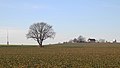
Deutsch: Die Gönnsdorfer Höhe (318 m) ist eine flache Erhebung am Hornweg nordöstlich von Gönnsdorf. An der Stelle der heutigen Sternwarte stand bis 1945 der Friedrich-August-Turm.
| Object location | | View all coordinates using: OpenStreetMap |
|---|
Subcategories
This category has the following 2 subcategories, out of 2 total.
H
- Hornweg (Schönfeld-Weißig) (19 F)
S
- Sternwarte Gönnsdorf (9 F)
Media in category "Gönnsdorfer Höhe"
The following 6 files are in this category, out of 6 total.
-

-
 Gönnsdorfer-Höhe-1.jpg 2,887 × 1,624; 1.58 MB
-
 Gönnsdorfer-Höhe-2.jpg 3,460 × 1,946; 1.94 MB
-
 Gönnsdorfer-Höhe-Blick-1.jpg 3,130 × 1,761; 2.14 MB
-
 Gönnsdorfer-Höhe-Blick-2.jpg 3,022 × 1,700; 2.76 MB
-
 Gönnsdorfer-Höhe-Blick-3.jpg 3,223 × 1,524; 2.68 MB
.jpg)


