Category:Gemeindehaus und ehemaliges jüdisches Schulhaus, Lengnau
Jump to navigation
Jump to search
| Object location | | View all coordinates using: OpenStreetMap |
|---|
| NO WIKIDATA ID FOUND! Search for Gemeindehaus und ehemaliges jüdisches Schulhaus, Lengnau on Wikidata | |
| Upload media |
Media in category "Gemeindehaus und ehemaliges jüdisches Schulhaus, Lengnau"
The following 4 files are in this category, out of 4 total.
-
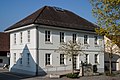 2003-Lengnau-AG-Gemeindehaus.jpg 1,920 × 1,280; 2.05 MB
-
 2013-01-23 Lengnau Gemeindehaus ehemaliges jüdisches Schulhaus (2).jpg 3,888 × 2,592; 3.02 MB
-
 2013-01-23 Lengnau Gemeindehaus ehemaliges jüdisches Schulhaus.jpg 3,888 × 2,592; 3.17 MB
-
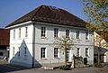 Lengnau Gemeindehaus.jpg 589 × 400; 67 KB

.jpg)

