Category:Geographical Atlas of the Russian Empire, the Kingdom of Poland, and the Grand Duchy of Finland (1820–1827)
Jump to navigation
Jump to search
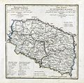
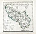
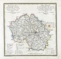
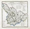
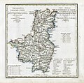
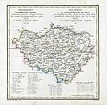
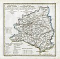
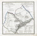
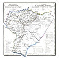
English: Geographical Atlas of the Russian Empire, the Kingdom of Poland, and the Grand Duchy of Finland divided into governorates, in Russian and French. 1820–1827.
Français : Atlas Geografique de L Empire de Russie, du Royaume de Pologne et du Grand Duche de Finlande divise en Gouvernemens. 1820–1827.
Русский: Географический атлас Российской империи, Царства Польского и Великого княжества Финляндского, расположенный по губерниям на русском и французском языках. Ответственный: Подполковник Пядышев, Военно-Картографическое Депо. 1820—1827 годы.
| Upload media | |||||
| |||||
Media in category "Geographical Atlas of the Russian Empire, the Kingdom of Poland, and the Grand Duchy of Finland (1820–1827)"
The following 84 files are in this category, out of 84 total.
-
-000 Geographic atlas of the Russian Empire is located in governorates.jpg 4,688 × 4,744; 7.1 MB
-
-0000 Geographic atlas of the Russian Empire is located in governorates.jpg 4,840 × 4,744; 11.83 MB
-
1820 Виленская Губерния.jpg 4,908 × 4,739; 20.13 MB
-
1820 Гродненская Губерния и Белостокская Область.jpg 4,764 × 4,706; 20.16 MB
-
1820 Царство Польское.jpg 4,840 × 4,744; 19.79 MB
-
1822 Владимирская Губерния.jpg 4,866 × 4,743; 18.77 MB
-
1822 Костромская Губерния.jpg 4,900 × 4,743; 19.21 MB
-
1822 Ярославская Губерния.jpg 4,828 × 4,722; 19.73 MB
-
1825. Tobolsk Governorate.jpg 4,773 × 8,852; 8.42 MB
-
Arkhangelsk Governorate 1824.jpg 8,837 × 4,752; 10.55 MB
-
Arkhangelsk Governorate 1824.png 8,837 × 4,752; 76.61 MB
-
Astrakhan governorate 1823.jpg 4,896 × 4,758; 4.17 MB
-
Astrakhan governorate 1823.png 4,896 × 4,758; 36.69 MB
-
Bessarabia governorate 1821.jpg 4,876 × 4,722; 4.6 MB
-
Chernigov governorate 1821.jpg 4,968 × 4,734; 4.75 MB
-
Congress Poland 1820.jpg 4,840 × 4,744; 4.52 MB
-
Congress Poland 1820.tif 4,840 × 4,744; 40.23 MB
-
Courland governorate 1820.jpg 4,873 × 4,746; 4.41 MB
-
Don Voisko oblast 1823.jpg 4,824 × 4,760; 5.37 MB
-
Ekaterinoslav governorate 1821.jpg 4,986 × 4,746; 4.57 MB
-
Eniseisk governorate 1825.jpg 4,893 × 9,133; 9.27 MB
-
Georgian governorate 1823.jpg 4,920 × 4,764; 5.32 MB
-
Governorate of Estonia 1820.jpg 4,932 × 4,741; 3.98 MB
-
Governorate of Estonia 1820.png 4,932 × 4,741; 35.71 MB
-
Governorate of Livonia 1820.jpg 4,920 × 4,751; 4.65 MB
-
Grand Duchy of Finland 1826.jpg 8,985 × 13,259; 23.12 MB
-
Irkutsk governorate 1826.jpg 4,906 × 4,752; 5.33 MB
-
Kaluga governorate 1822.jpg 4,840 × 4,746; 4.66 MB
-
Kamchatsky okrug and Kuril islands1826.jpg 4,884 × 4,770; 4.56 MB
-
Kaukasian oblast 1825.jpg 4,858 × 4,746; 5.35 MB
-
Kazan governorate 1822.jpg 4,804 × 4,757; 5.65 MB
-
Kharkov governorate 1821.jpg 4,942 × 4,739; 4.33 MB
-
Kherson governorate 1821.jpg 4,830 × 4,734; 4.54 MB
-
Kiev Governorate 1821.jpg 4,908 × 4,721; 7.47 MB
-
Kostroma governorate 1822.jpg 4,900 × 4,743; 4.5 MB
-
Kursk governorate 1822.jpg 4,888 × 4,737; 4.66 MB
-
Map of Yakut oblast.jpg 9,024 × 9,048; 13.27 MB
-
Minsk governorate 1821 (Мінскі павет).jpg 788 × 785; 203 KB
-
Minsk governorate 1821.jpg 4,896 × 4,744; 5.27 MB
-
Mogilev governorate 1821.jpg 4,770 × 4,749; 4.21 MB
-
Moscow governorate 1821.jpg 4,900 × 4,727; 4.72 MB
-
Nizhegorodskaya governorate 1822.jpg 4,858 × 4,752; 5.1 MB
-
Novgorog governorate 1821.jpg 4,852 × 4,754; 4.67 MB
-
Olonetz Governorate 1823.jpg 4,902 × 4,752; 5.5 MB
-
Omsk oblast 1825.jpg 4,866 × 4,756; 4.46 MB
-
Orel governorate 1822.jpg 4,782 × 4,733; 4.76 MB
-
Orenburg governorate 1824.jpg 4,890 × 4,818; 4.62 MB
-
Penza governorate 1822.jpg 4,794 × 4,738; 4.77 MB
-
Perm governorate 1824.jpg 4,894 × 4,774; 5.65 MB
-
Podolia governorate 1820.jpg 4,818 × 4,734; 4.05 MB
-
Poltava governorate 1821.jpg 4,948 × 4,722; 4.14 MB
-
Pskovian governorate 1820.jpg 4,764 × 4,706; 4.42 MB
-
Ryazan governorate 1822.jpg 4,848 × 4,752; 4.29 MB
-
Saint Petersburg Governorate 1820.jpg 4,912 × 4,727; 4.74 MB
-
Saratov governorate 1823.jpg 4,908 × 4,768; 4.35 MB
-
Simbirsk governorate 1822.jpg 4,734 × 4,739; 4.54 MB
-
Smolensk governorate 1821.jpg 4,888 × 4,723; 4.52 MB
-
Smolensk gub 1821.jpg 5,744 × 4,841; 4.23 MB
-
Tambov governorate 1822.jpg 4,770 × 4,746; 5.21 MB
-
Taurida governorate 1822.jpg 4,870 × 4,732; 4.3 MB
-
Tomsk governorate 1825.jpg 4,842 × 4,776; 4.69 MB
-
Tula governorate 1822.jpg 4,822 × 4,746; 4.26 MB
-
Tver governorate 1821.jpg 4,854 × 4,722; 4.28 MB
-
Ujesd Alexandrija 1821.png 1,000 × 1,060; 1.87 MB
-
Vitebsk governorate 1820.jpg 4,794 × 4,706; 4.14 MB
-
Vladimir governorate 1822.jpg 4,866 × 4,743; 4.34 MB
-
Volhynian governorate 1820.jpg 4,698 × 4,706; 4.22 MB
-
Vologda governorate 1823.jpg 9,000 × 4,770; 10 MB
-
Voronezh governorate 1822.jpg 4,782 × 4,746; 5.67 MB
-
Vyatka governorate 1822.jpg 4,834 × 4,758; 5.22 MB
-
Yakutskaya oblast and Okhotskiy okrug 1826.jpg 9,024 × 9,048; 16.03 MB
-
Yaroslavl governorate 1822.jpg 4,828 × 4,722; 4.74 MB
-
Карта Астраханской Губернии.jpg 4,896 × 4,758; 6.46 MB
-
Карта Воронежской Губернии (1822).jpg 4,782 × 4,746; 8.12 MB
-
Карта Вятской Губернии (1822).jpg 4,834 × 4,758; 7.44 MB
-
Карта Енисейской Губернии.jpg 4,893 × 9,133; 13.34 MB
-
Карта Кавказской области и Земли Горских Народов (1821).jpg 4,858 × 4,746; 7.61 MB
-
Карта Курской Губернии.jpg 4,888 × 4,737; 7.61 MB
-
Карта Московской Губернии.jpg 4,900 × 4,727; 7.45 MB
-
Карта Орловской губернии.jpg 4,782 × 4,733; 7.5 MB
-
Карта Саратовской губернии.jpg 4,856 × 4,775; 7.1 MB
-
Минусинский уезд.JPG 1,012 × 855; 214 KB
-
Фрагмент карты Кавказской области и Земли Горских Народов (1821).jpg 1,029 × 1,005; 461 KB
