Category:Geography of Shikokuchuo
Jump to navigation
Jump to search
Subcategories
This category has the following 11 subcategories, out of 11 total.
A
- Mount Akaboshi (8 F)
D
F
- Mount Futatsu (Ehime) (7 F)
H
- Mount Higashiakaishi (12 F)
K
- Mount Kagamashi (3 F)
- Lake Kinsha (5 F)
M
- Maps of Shikokuchuo, Ehime (4 F)
S
- Suiha Plateau (7 F)
T
Media in category "Geography of Shikokuchuo"
The following 18 files are in this category, out of 18 total.
-
 Daio Kaiun.jpg 1,657 × 1,276; 329 KB
-
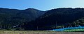
 Doichokitano - panoramio.jpg 2,048 × 1,536; 901 KB
-
 Hiraisiyama 20201025 01.jpg 1,600 × 652; 414 KB
-
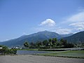
 Kinsei river - panoramio.jpg 2,048 × 1,536; 1.02 MB
-
 Kirinomori20210422 3.jpg 685 × 1,600; 481 KB
-
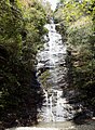 Mizugataki01.jpg 1,151 × 1,571; 623 KB
-
 Mt.Akaboshiyama.jpg 2,304 × 1,728; 968 KB
-
 Mt.Toyouke - panoramio.jpg 2,816 × 2,112; 1.07 MB
-
 Nokogiri Mountain:鋸山 - panoramio.jpg 720 × 480; 66 KB
-
 Sazareo01.jpg 1,600 × 1,249; 408 KB
-
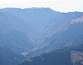
 The foggy mountains(1) - panoramio.jpg 2,816 × 2,112; 1.04 MB
-
 The foggy mountains(2) - panoramio.jpg 2,816 × 2,112; 1.02 MB
-
 八ヶ滝 - panoramio.jpg 1,067 × 1,600; 1.32 MB
-
 戻ヶ嶽 - panoramio.jpg 1,067 × 1,600; 1.64 MB
-
 水ヶ滝 - panoramio.jpg 1,067 × 1,600; 1.5 MB
-
 清瀧 - panoramio.jpg 1,067 × 1,600; 1.89 MB
-
 薬研の滝 - panoramio.jpg 1,067 × 1,600; 1.51 MB
-
 馬瀬法皇之瀧 - panoramio.jpg 1,067 × 1,600; 1.84 MB


_-_panoramio.jpg)
_-_panoramio.jpg)


