Category:German-language maps of Ireland
Jump to navigation
Jump to search
Media in category "German-language maps of Ireland"
The following 4 files are in this category, out of 4 total.
-
 England, Schottland u. Ireland.jpg 3,097 × 3,841; 4.35 MB
-
 Regnorum Magnae Britanniae Et Hiberniae Mappa Geographica.jpg 7,389 × 6,330; 14.99 MB
-
 Verwaltungskarte Ireland.jpg 5,797 × 4,813; 9.53 MB
-
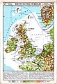 Westermanns Neuer Schulatlas 1928 (16) Britische Inseln.jpg 4,550 × 6,630; 9.17 MB


_Britische_Inseln.jpg)