Category:Grade II listed buildings in the London Borough of Bromley
Jump to navigation
Jump to search
Wikimedia category | |||||
| Upload media | |||||
| Instance of | |||||
|---|---|---|---|---|---|
| Category combines topics | |||||
| London | |||||
capital and largest city of England and the United Kingdom     .svg)   | |||||
| Pronunciation audio | |||||
| Instance of |
| ||||
| Location |
| ||||
| Located in or next to body of water | |||||
| Official language | |||||
| Head of government |
| ||||
| Inception |
| ||||
| Significant event |
| ||||
| Highest point |
| ||||
| Population |
| ||||
| Area |
| ||||
| Elevation above sea level |
| ||||
| Replaces | |||||
| IATA airport code |
| ||||
| Different from | |||||
| official website | |||||
 | |||||
Subcategories
This category has the following 37 subcategories, out of 37 total.
B
- Beckenham Public Hall (6 F)
- Bowie Bandstand (14 F)
C
- Chinese Garage (11 F)
- Coal tax post, Leaves Green (4 F)
E
F
- Folly at Bromley Palace Park (13 F)
G
- Gorilla by David Wynne (13 F)
H
- Hayes Library (5 F)
I
K
- Kelsey Lodge (6 F)
L
- Lodge to the Warren, Hayes (4 F)
O
- Odeon Cinema, Beckenham (6 F)
P
- Penge East railway station (50 F)
- Prince Imperial Monument (20 F)
S
- The Studio, Beckenham (8 F)
T
U
W
- The Warren (Hayes) (4 F)
Media in category "Grade II listed buildings in the London Borough of Bromley"
The following 152 files are in this category, out of 152 total.
-
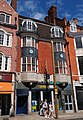
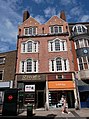
 171, 173, 175, and 177 High Street, Bromley (01).jpg 4,479 × 3,349; 12.57 MB
-
 171, 173, 175, and 177 High Street, Bromley (02).jpg 4,592 × 3,448; 7.72 MB
-
 171, 173, 175, and 177 High Street, Bromley (03).jpg 4,390 × 3,390; 12.21 MB
-
 171, 173, 175, and 177 High Street, Bromley (04).jpg 3,078 × 4,266; 10.52 MB
-
 171, 173, 175, and 177 High Street, Bromley (05).jpg 3,295 × 4,445; 11.85 MB
-
 179 High Street, Bromley (01).jpg 3,016 × 4,359; 11.4 MB
-
 179 High Street, Bromley (02).jpg 3,220 × 4,249; 12.28 MB
-
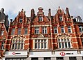
 180 to 184 High Street, Bromley (01).jpg 4,515 × 3,270; 8.9 MB
-
 180 to 184 High Street, Bromley (02).jpg 4,194 × 2,993; 7.65 MB
-
 180 to 184 High Street, Bromley (03).jpg 2,973 × 4,070; 8.3 MB
-
 181 and 179 High Street, Bromley.jpg 3,121 × 4,456; 12.91 MB
-
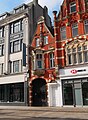
 181 High Street, Bromley (01).jpg 3,359 × 4,503; 11.95 MB
-
 181 High Street, Bromley (02).jpg 4,400 × 3,310; 12 MB
-
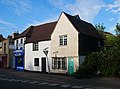
 3 Church Road, Farnborough.jpg 4,313 × 3,136; 8.05 MB
-
 40-50 High Street, St Mary Cray (I).jpg 4,384 × 3,051; 10.66 MB
-
 40-50 High Street, St Mary Cray (II).jpg 4,416 × 3,211; 12.07 MB
-
 87 to 91 High Street, St Mary Cray.jpg 4,180 × 3,234; 10.74 MB
-
 91 High Street, St Mary Cray (II).jpg 4,272 × 3,170; 10.13 MB
-
 91 High Street, St Mary Cray.jpg 4,322 × 3,327; 12.9 MB
-
 Bromley Palace.PNG 491 × 362; 98 KB
-
 Building 1, Biggin Hill - geograph.org.uk - 2642859.jpg 4,288 × 3,216; 6.77 MB
-
 Central Library, Bromley (01).jpg 3,448 × 4,592; 11.62 MB
-
 Chelsfield House, Chelsfield.jpg 4,922 × 2,414; 5.43 MB
-
 Church of Saint Peter and Saint Paul and the National Westminster Bank, Bromley.jpg 4,063 × 2,882; 9.76 MB
-
 Coal Post and pillar box, Old Hill - geograph.org.uk - 741620.jpg 480 × 640; 82 KB
-
 Coal Post at Brittenden Close, Green Street Green.jpg 782 × 1,510; 171 KB
-
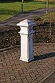
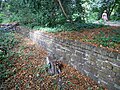
 Coal Tax Post at the Entrance to Recreation Ground near Goddington (01).jpg 3,136 × 4,303; 9.34 MB
-
 Coal Tax Post at the Entrance to Recreation Ground near Goddington (02).jpg 3,268 × 4,244; 8.35 MB
-
 Coal Tax Post at the Entrance to Recreation Ground near Goddington (03).jpg 4,592 × 3,448; 7.87 MB
-
 Coal Tax Post at the Entrance to Recreation Ground near Goddington (04).jpg 4,592 × 3,448; 6.77 MB
-
 Coal Tax Post in Goddington Lane, Orpington (I).jpg 3,448 × 4,592; 16.26 MB
-
 Coal Tax Post in Goddington Lane, Orpington (II).jpg 3,192 × 4,345; 12.8 MB
-
 Coal Tax Post in Goddington Lane, Orpington (III).jpg 4,042 × 3,221; 16.92 MB
-
 Coal Tax Post no 186 - geograph.org.uk - 1729783.jpg 426 × 640; 146 KB
-
 Coal Tax post no 187.jpg 425 × 640; 541 KB
-
 Coal Tax Post no 191 - geograph.org.uk - 1623778.jpg 426 × 640; 104 KB
-
 Coal Tax Post no 194 - geograph.org.uk - 1162630.jpg 426 × 640; 118 KB
-
 Convent of the Holy Trinity near Bromley (01).jpg 4,373 × 3,033; 11.24 MB
-
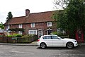
 Court Lodge, Chelsfield.jpg 3,850 × 3,096; 4.07 MB
-
 Cross House Post Office, Chelsfield.jpg 5,184 × 3,456; 8.4 MB
-
 Crosshall, Chelsfield (01).jpg 4,230 × 2,786; 9.91 MB
-
 Crosshall, Chelsfield (02).jpg 4,380 × 3,314; 10.25 MB
-
 Crosshall, Chelsfield (03).jpg 4,424 × 3,151; 9.76 MB
-
 Crosshall, Chelsfield (04).jpg 4,487 × 3,239; 9.42 MB
-
 Crosshall, Chelsfield (05).jpg 4,376 × 3,199; 8.42 MB
-
 Crosshall, Chelsfield.jpg 5,184 × 3,456; 6.81 MB
-
 Cudham Workhouse - geograph.org.uk - 1728622.jpg 640 × 426; 77 KB
-
 Drinking trough and War Memorial - geograph.org.uk - 864874.jpg 640 × 426; 125 KB
-
 Frogpool Manor Farm as seen from Perry Street.jpg 3,948 × 2,576; 7.37 MB
-
 Gate Piers in Perry Street, Chislehurst (01).jpg 4,592 × 3,448; 14.66 MB
-
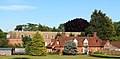
 Goddington House and Goddington Park (01).jpg 4,592 × 3,448; 11.53 MB
-
 High Elms Clock House.jpg 4,608 × 3,456; 6.01 MB
-
 Iron Gates of Queen's Garden, Bromley (01).jpg 4,352 × 3,033; 16.12 MB
-
 Iron Gates of Queen's Garden, Bromley (02).jpg 3,448 × 4,592; 18.33 MB
-
 Iron Gates of Queen's Garden, Bromley (03).jpg 3,448 × 4,592; 13.54 MB
-
 Iron Gates of Queen's Garden, Bromley (04).jpg 4,592 × 3,448; 14.73 MB
-
 Iron Gates of Queen's Garden, Bromley (05).jpg 3,375 × 4,561; 13.86 MB
-
 Iron Gates of Queen's Garden, Bromley (06).jpg 3,189 × 4,418; 11.78 MB
-
 Iron Gates of Queen's Garden, Bromley (07).jpg 3,448 × 4,592; 18.29 MB
-
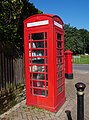
 K-6 Telephone Box in St Paul's Cray (I).jpg 3,268 × 4,372; 14.5 MB
-
 K-6 Telephone Box in St Paul's Cray (II).jpg 3,448 × 4,592; 17.27 MB
-
 K-6 Telephone Box in St Paul's Cray (III).jpg 3,268 × 4,376; 12.91 MB
-
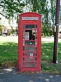
 K2 Telephone Kiosk at College Green, Bromley (01).jpg 4,257 × 3,219; 11.57 MB
-
 K2 Telephone Kiosk at College Green, Bromley (02).jpg 3,448 × 4,592; 8.15 MB
-
 K2 Telephone Kiosk at College Green, Bromley (03).jpg 4,592 × 3,448; 14.92 MB
-
 K2 Telephone Kiosk at College Green, Bromley (04).jpg 4,493 × 3,231; 10.87 MB
-
 K6 Telephone Kiosk along Royal Parade, Chislehurst.jpg 3,271 × 4,421; 11.91 MB
-
 K6 Telephone Kiosk and Victorian Postbox along Royal Parade, Chislehurst.jpg 4,592 × 3,448; 16.46 MB
-
 K6 Telephone Kiosk in Church Road, Chelsfield (01).jpg 3,236 × 4,450; 13.47 MB
-
 K6 Telephone Kiosk in Church Road, Chelsfield (02).jpg 3,448 × 4,592; 13.53 MB
-
 K6 Telephone kiosk, Chelsfield.jpg 3,456 × 5,184; 7.33 MB
-
 K6 Telephone Kiosk, St Pauls Cray (geograph 2526928).jpg 3,072 × 2,304; 2.54 MB
-
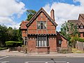 Kelsey Lodge (I).jpg 4,537 × 3,420; 12.93 MB
-
 Kelsey Lodge (III).jpg 3,448 × 4,592; 7.96 MB
-
 Kelsey Lodge (IV).jpg 4,395 × 3,307; 14.75 MB
-
 Kelsey Lodge (V).jpg 3,144 × 4,182; 12.71 MB
-
 Kelsey Lodge (VI).jpg 3,448 × 4,592; 7.81 MB
-
 Klinger Building, Ruxley (01).jpg 4,256 × 3,274; 10.47 MB
-
 Klinger Building, Ruxley (02).jpg 4,471 × 3,211; 11.85 MB
-
 Klinger Building, Ruxley (03).jpg 4,592 × 3,448; 13.38 MB
-
 Klinger Building, Ruxley (04).jpg 3,448 × 4,592; 13.8 MB
-
 Klinger Building, Ruxley (05).jpg 3,448 × 4,592; 14.68 MB
-
 Leaves Green - geograph.org.uk - 1729744.jpg 640 × 433; 88 KB
-
 Lodge of Croydon Road Recreation Ground (01).jpg 4,281 × 3,262; 9.15 MB
-
 Lodge of Croydon Road Recreation Ground (02).jpg 4,460 × 3,258; 10.31 MB
-
 Lodge of Croydon Road Recreation Ground (03).jpg 3,374 × 4,493; 11.74 MB
-
 Lodge opposite Wickham Court, West Wickham.jpg 4,408 × 3,254; 10.8 MB
-
 Lodge to Scadbury Park, Chislehurst.jpg 4,456 × 3,315; 18.12 MB
-
 Main Pumping Station, Bromley (East View - 01).jpg 4,592 × 3,448; 15.35 MB
-
 Main Pumping Station, Bromley (East View - 02).jpg 4,448 × 3,187; 14.81 MB
-
 Milestone along Tubbenden Lane, Orpington (01).jpg 4,348 × 3,187; 14.75 MB
-
 Milestone along Tubbenden Lane, Orpington (02).jpg 3,448 × 4,592; 16.91 MB
-
 Milestone along Tubbenden Lane, Orpington (03).jpg 4,592 × 3,448; 18.12 MB
-
 Milestone along Tubbenden Lane, Orpington (04).jpg 3,448 × 4,592; 16.52 MB
-
 Milestone along Tubbenden Lane, Orpington (05).jpg 3,047 × 4,176; 16.17 MB
-
 Milestone along Tubbenden Lane, Orpington (06).jpg 4,464 × 3,338; 17.56 MB
-
 National Westminster Bank, Bromley (South Face - 01).jpg 4,249 × 3,135; 10.97 MB
-
 National Westminster Bank, Bromley (South Face - 02).jpg 3,284 × 4,419; 12.4 MB
-
 National Westminster Bank, Bromley (Southeast View).jpg 4,488 × 3,262; 12.02 MB
-
 Old Hill - geograph.org.uk - 1606255.jpg 640 × 426; 75 KB
-
 Old Lodge at High Elms.jpg 4,000 × 2,667; 5.83 MB
-
 Plaque on Cudham Workhouse - geograph.org.uk - 1728623.jpg 640 × 429; 145 KB
-
 Pulhamite Fernery in Bromley Palace Park (South Face - 01).jpg 4,592 × 3,448; 14.8 MB
-
 Pulhamite Fernery in Bromley Palace Park (South Face - 02).jpg 4,592 × 3,448; 13.45 MB
-
 Pulhamite Fernery in Bromley Palace Park (South Face - 03).jpg 4,592 × 3,448; 14.06 MB
-
 Pulhamite Fernery in Bromley Palace Park (South Face - 04).jpg 3,448 × 4,592; 14.15 MB
-
 Pulhamite Waterfall in Bromley Palace Park (01).jpg 4,592 × 3,448; 15.11 MB
-
 Pulhamite Waterfall in Bromley Palace Park (02).jpg 3,448 × 4,592; 15.08 MB
-
 Pulhamite Waterfall in Bromley Palace Park (03).jpg 4,592 × 3,448; 16.02 MB
-
 Pulhamite Waterfall in Bromley Palace Park (04).jpg 4,592 × 3,448; 16.29 MB
-
 RAF Biggin Hill Bldg 5.jpg 4,288 × 3,216; 7.28 MB
-
 Ravenscourt School near Bromley (South Face - 01).jpg 4,464 × 3,271; 10.37 MB
-
 Rowlands, St Mary Cray (I).jpg 4,592 × 3,448; 13 MB
-
 Rowlands, St Mary Cray (II).jpg 3,607 × 2,742; 9.37 MB
-
 School House in Perry Street, Chislehurst (West Extension - 01).jpg 4,432 × 3,270; 13.79 MB
-
 South Lodges of Beckenham Place Park (East Lodge - 01).jpg 4,592 × 3,448; 15.46 MB
-
 South Lodges of Beckenham Place Park (East Lodge - 02).jpg 4,471 × 3,270; 13.74 MB
-
 South Lodges of Beckenham Place Park (West Lodge - 01).jpg 4,483 × 3,314; 13.06 MB
-
 Southwest Gate to Croydon Road Recreation Ground (01).jpg 4,515 × 3,385; 15.35 MB
-
 Southwest Gate to Croydon Road Recreation Ground (02).jpg 3,448 × 4,592; 16.8 MB
-
 Southwest Gate to Croydon Road Recreation Ground (03).jpg 3,448 × 4,592; 7.48 MB
-
 Southwest Gate to Croydon Road Recreation Ground (04).jpg 3,184 × 4,323; 13.31 MB
-
 Southwest Gate to Croydon Road Recreation Ground (05).jpg 4,592 × 3,448; 14.64 MB
-
 Southwest Gate to Croydon Road Recreation Ground (06).jpg 4,439 × 3,267; 12.42 MB
-
 Southwest Gate to Croydon Road Recreation Ground (07).jpg 4,439 × 3,215; 13.28 MB
-
 Stotfold - rear garden.jpg 3,072 × 1,728; 996 KB
-
 Stotfold Feb 2018.jpg 2,016 × 1,512; 1.36 MB
-
 Sunnymead, Chislehurst (01).jpg 4,145 × 3,011; 11.79 MB
-
 Sunnymead, Chislehurst (02).jpg 3,657 × 2,796; 10.14 MB
-
 Sunnymead, Chislehurst (03).jpg 4,265 × 3,266; 13.18 MB
-
 The Clock House, High Elms (East Face - 01).jpg 3,639 × 3,001; 13.96 MB
-
 The Clock House, High Elms (Northwest View - 01).jpg 4,111 × 3,417; 8.82 MB
-
 The Ha-Ha at Bromley Palace Park (01).jpg 4,592 × 3,448; 14.04 MB
-
 The Ha-Ha at Bromley Palace Park (02).jpg 4,592 × 3,448; 14.62 MB
-
 The Ice House at Bromley Palace Park (01).jpg 4,592 × 3,448; 8.03 MB
-
 The Ice House at Bromley Palace Park (02).jpg 4,511 × 3,314; 13.95 MB
-
 The Ice House at Bromley Palace Park (03).jpg 4,592 × 3,448; 7.68 MB
-
 The Ice House at Bromley Palace Park (04).jpg 4,592 × 3,448; 7.51 MB
-
 The Old Bakery, Chelsfield (02).jpg 4,592 × 3,448; 10.45 MB
-
 The Old Bakery, Chelsfield.jpg 3,456 × 5,184; 6.46 MB
-
 The Post Office and Cross House, Chelsfield.jpg 4,592 × 3,448; 14.7 MB
-
 The Thatch as seen from Perry Street.jpg 2,951 × 2,033; 7.03 MB
-
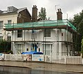
 The White House, Penge (01).jpg 4,318 × 3,257; 7.81 MB
-
 The White house.jpg 1,904 × 1,699; 1.11 MB
-
 Water Trough at Widmore Green (01).jpg 4,592 × 3,448; 8.29 MB
-
 Water Trough at Widmore Green (02).jpg 3,448 × 4,592; 7.89 MB
-
 Water Trough at Widmore Green (03).jpg 4,592 × 3,448; 7.96 MB
-
 Water Trough at Widmore Green (04).jpg 4,592 × 3,448; 8.28 MB
-
 Water Trough at Widmore Green (05).jpg 3,448 × 4,592; 7.74 MB
-
 Watermans Square, High Street, Penge - geograph.org.uk - 494709.jpg 610 × 640; 147 KB
-
 Wychway, Chelsfield.jpg 5,184 × 3,456; 7.93 MB
-
 Wychway, the Post Office, and Cross House, Chelsfield.jpg 4,261 × 2,871; 11.82 MB
.jpg)
.jpg)
.jpg)
.jpg)
.jpg)
.jpg)
.jpg)
.jpg)
.jpg)
.jpg)

.jpg)
.jpg)

.jpg)
.jpg)

.jpg)


.jpg)


.jpg)
.jpg)
.jpg)
.jpg)
.jpg)
.jpg)
.jpg)


.jpg)


.jpg)
.jpg)
.jpg)
.jpg)
.jpg)


.jpg)
.jpg)

.jpg)
.jpg)
.jpg)
.jpg)
.jpg)
.jpg)
.jpg)
.jpg)
.jpg)
.jpg)
.jpg)
.jpg)
.jpg)
.jpg)


.jpg)
.jpg)

.jpg)
.jpg)
.jpg)
.jpg)
.jpg)
.jpg)
.jpg)
.jpg)
.jpg)
.jpg)
.jpg)

.jpg)
.jpg)
.jpg)


.jpg)
.jpg)
.jpg)
.jpg)
.jpg)
.jpg)
.jpg)
.jpg)
.jpg)
.jpg)
.jpg)


.jpg)
.jpg)
.jpg)
.jpg)
.jpg)
.jpg)
.jpg)
.jpg)

.jpg)
.jpg)
.jpg)
.jpg)
.jpg)
.jpg)
.jpg)
.jpg)
.jpg)
.jpg)
.jpg)
.jpg)
.jpg)
.jpg)


.jpg)
.jpg)
.jpg)
.jpg)
.jpg)
.jpg)
.jpg)
.jpg)
.jpg)
.jpg)
.jpg)
.jpg)


.jpg)

.jpg)
.jpg)
.jpg)
.jpg)
.jpg)


