Category:Grafheuvel 45414, Bennekom
Jump to navigation
Jump to search
| Object location | | View all coordinates using: OpenStreetMap |
|---|
 | |||||
| Upload media | |||||
| Instance of | |||||
|---|---|---|---|---|---|
| Location | Bennekom, Ede, Gelderland, Netherlands | ||||
| Heritage designation |
| ||||
 | |||||
|
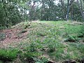
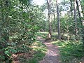
This is a category about rijksmonument number 45414
|
| Address |
|
Media in category "Grafheuvel 45414, Bennekom"
The following 6 files are in this category, out of 6 total.
-
 1e grafheuvel Bennekom (1).JPG 2,592 × 1,944; 2.63 MB
-
 1e grafheuvel Bennekom (2).JPG 2,592 × 1,944; 2.65 MB
-
 1e grafheuvel Bennekom (3).JPG 2,592 × 1,944; 2.58 MB
-
 1e grafheuvel Bennekom (4).JPG 2,592 × 1,944; 2.37 MB
-
 1e grafheuvel Bennekom (5).JPG 2,592 × 1,944; 2.34 MB
-
 20211229 Bennekom Grafheuvel 45414.jpg 3,648 × 2,432; 3.3 MB
.JPG)
.JPG)
.JPG)
.JPG)
.JPG)