Category:Grafheuvels aan de Eelerbergweg
Jump to navigation
Jump to search
| Object location | | View all coordinates using: OpenStreetMap |
|---|
 | |||||
| Upload media | |||||
| Instance of | |||||
|---|---|---|---|---|---|
| Location | Hellendoorn, Overijssel, Netherlands | ||||
| Street address |
| ||||
| Heritage designation |
| ||||
 | |||||
|
This is a category about rijksmonument number 45575
|
| Address |
|
Media in category "Grafheuvels aan de Eelerbergweg"
The following 8 files are in this category, out of 8 total.
-
 Grafheuvels aan de Eelerbergweg, de noordoostelijke heuvel, gezien vanuit het zuidwesten.JPG 4,320 × 3,240; 5.17 MB
-
 Grafheuvels aan de Eelerbergweg, de twee oostelijke heuvels, gezien vanuit het zuiden.JPG 4,320 × 3,240; 5.18 MB
-

-
 Grafheuvels aan de Eelerbergweg, de westelijke heuvel.JPG 4,320 × 3,240; 5.24 MB
-
 Grafheuvels aan de Eelerbergweg, panorama vanuit het zuiden.JPG 4,912 × 1,080; 2.7 MB
-
 Grafheuvels aan de Eelerbergweg, vanaf de Eelerbergweg (het oosten).JPG 4,320 × 3,240; 5.2 MB
-
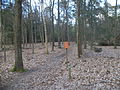
 Grafheuvels aan de Eelerbergweg, de andere zijde van de Eelerbergweg, keuzepunt F28.JPG 4,320 × 3,240; 5.18 MB
-
 Grafheuvels aan de Eelerbergweg, de andere zijde van de Eelerbergweg.JPG 4,320 × 3,240; 5.2 MB


.JPG)

