Category:Grange-over-Sands
town and civil parish in South Lakeland, England, UK  | |||||
| Carica un file multimediale | |||||
| Istanza di | |||||
|---|---|---|---|---|---|
| Luogo | South Lakeland, Cumbria, Nord Ovest dell'Inghilterra, Inghilterra | ||||
| Popolazione |
| ||||
 | |||||
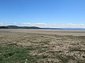
Grange-over-Sands is a town and civil parish located on the north side of Morecambe Bay in Cumbria, England, a few miles south of the Lake District National Park. Historically part of Lancashire, the town was created as an urban district in 1894. Since the 1974 local government re-organisation, it has been of the South Lakeland district of Cumbria, though it remains part of the Duchy of Lancaster.
Travelling by road, Grange-over-Sands is 13.1 miles (21.1 km) to the south of Kendal, 14.9 miles (24.0 km) to the east of Ulverston, 25 miles (40 km) to the east of Barrow-in-Furness and 28.1 miles (45.2 km) to the west of Lancaster.
Sottocategorie
Questa categoria contiene le 14 sottocategorie indicate di seguito, su un totale di 14.
G
- The Grand Hotel, Cumbria (10 F)
- Grange Hotel, Cumbria (3 F)
- Grange-over-Sands Clocktower (13 F)
- Grange-over-Sands Lido (11 F)
H
- Hampsfell Hospice (3 F)
- Holme Island (8 F)
K
N
- Netherwood Hotel (2 F)
P
T
File nella categoria "Grange-over-Sands"
Questa categoria contiene 200 file, indicati di seguito, su un totale di 632.
(pagina precedente) (pagina successiva)-
 'Beacon' on Fell End - geograph.org.uk - 3678789.jpg 3 264 × 2 448; 1,03 MB
-
 2018 at Grange-over-Sands - promenade footbridge.JPG 1 366 × 820; 420 KB
-
 203m summit on Hampsfell - geograph.org.uk - 359128.jpg 640 × 440; 107 KB
-
 31423 on a Manchester to Barrow service passes Grange-over-Sands in July 1990.jpg 4 836 × 3 096; 2,92 MB
-
 A cat on the edge of Lindale - geograph.org.uk - 3108044.jpg 640 × 480; 201 KB
-
 A Prom in spring - geograph.org.uk - 5834251.jpg 4 611 × 3 064; 4,27 MB
-
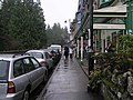
 A view of Main Street, Grange Over Sands, Cumbria.jpg 3 264 × 2 448; 2,21 MB
-
 A view towards Allithwaite - geograph.org.uk - 2314755.jpg 1 600 × 1 200; 1,26 MB
-

-
 Abandoned Water Storage Tank - Eggerslack Wood - geograph.org.uk - 4780802.jpg 4 608 × 3 456; 4,35 MB
-
 AgeUK Grange - panoramio.jpg 1 728 × 3 072; 1,37 MB
-
 Allithwaite Road passing the Miners' Convalescent Home - geograph.org.uk - 5107586.jpg 6 000 × 4 000; 4,31 MB
-
 Apartments, Grange over Sands - geograph.org.uk - 1528476.jpg 640 × 479; 56 KB
-
 Approaching Lindale on the B5271 - geograph.org.uk - 5853593.jpg 800 × 599; 152 KB
-
 Arriving at Grange - geograph.org.uk - 6234440.jpg 3 540 × 2 360; 7,62 MB
-
 B08132.jpg 3 024 × 4 032; 5,56 MB
-
 B5277 Allithwaite Road - geograph.org.uk - 5685031.jpg 640 × 480; 66 KB
-
 B5277 Lindale Road - geograph.org.uk - 5685003.jpg 640 × 480; 75 KB
-
 B5277 The Esplanade - geograph.org.uk - 5685020.jpg 640 × 480; 50 KB
-
 Back of Grange railway station - geograph.org.uk - 5775687.jpg 640 × 480; 414 KB
-
 Back Yewbarrow Terrace, Grange over Sands - geograph.org.uk - 1818359.jpg 1 000 × 735; 511 KB
-
 Bailey's - geograph.org.uk - 5724400.jpg 3 840 × 2 160; 3,44 MB
-
 Banana (^) plants in the Yewbarrow House Garden - geograph.org.uk - 4010898.jpg 1 600 × 1 200; 818 KB
-
 Bandstand in the park - geograph.org.uk - 3880260.jpg 1 536 × 2 048; 761 KB
-
 Bandstand, Grange-over-Sands.jpg 640 × 480; 105 KB
-
 Barclays Bank - panoramio.jpg 3 072 × 1 728; 1,64 MB
-
 Barclays Bank, Grange over Sands - geograph.org.uk - 1835216.jpg 1 000 × 721; 367 KB
-
 Barclays Bank, Grange over Sands - geograph.org.uk - 4011899.jpg 1 600 × 1 200; 320 KB
-
 Barn at Low Fell Gate Farm - geograph.org.uk - 5107596.jpg 6 000 × 4 000; 3,52 MB
-
 Barn next to Thorn Lea - panoramio.jpg 3 888 × 2 588; 2,56 MB
-
 Barn Top - panoramio.jpg 3 888 × 2 588; 1,95 MB
-
 Bay Villa - panoramio.jpg 1 728 × 3 072; 2,46 MB
-
 Bay Villa at Grange-over-Sands - geograph.org.uk - 1516684.jpg 424 × 640; 88 KB
-
 Bay Villa at Grange-over-Sands - geograph.org.uk - 1517544.jpg 470 × 640; 97 KB
-
 Bench on the sea wall - geograph.org.uk - 4884470.jpg 640 × 427; 85 KB
-
 Bird Sculpture Grange Over Sands - geograph.org.uk - 3613586.jpg 534 × 800; 346 KB
-
 Birds in the ornamental gardens - geograph.org.uk - 6664662.jpg 1 024 × 768; 326 KB
-
 Blawith Point - geograph.org.uk - 1924561.jpg 640 × 480; 76 KB
-
 Blossom in the Community Orchard - geograph.org.uk - 5766281.jpg 1 600 × 1 200; 778 KB
-
 Bridge over River Winster - geograph.org.uk - 5188732.jpg 640 × 480; 84 KB
-

-
 Bus stop in the town centre - geograph.org.uk - 4413432.jpg 640 × 480; 87 KB
-
 Car park at Grange-over-Sands - geograph.org.uk - 5775200.jpg 640 × 480; 291 KB
-
 Car park off Main Street, Grange-over-Sands - geograph.org.uk - 6664623.jpg 1 024 × 768; 203 KB
-
 Carter Road - geograph.org.uk - 4884432.jpg 640 × 427; 90 KB
-
 Carter Road meets Cart Lane - geograph.org.uk - 4884447.jpg 640 × 427; 100 KB
-
 Cartmel and the River Eea Valley - geograph.org.uk - 2666804.jpg 800 × 600; 125 KB
-
 Cartmel Grange Nursing Home - geograph.org.uk - 1598050.jpg 640 × 426; 62 KB
-

-
 Channel through the salt marsh - geograph.org.uk - 5775204.jpg 480 × 640; 301 KB
-
 Charney Well - geograph.org.uk - 2668108.jpg 640 × 480; 171 KB
-
 Charney Well - geograph.org.uk - 6664776.jpg 1 024 × 768; 414 KB
-
 Charney Well Lane - geograph.org.uk - 6664769.jpg 1 024 × 768; 339 KB
-
 Charney Well Lane, Grange-over-Sands - geograph.org.uk - 1520744.jpg 640 × 480; 106 KB
-
 Children playing on beach, Grange-over-Sands, Cumbria RMG G03304.tiff 6 452 × 4 458; 82,29 MB
-
-
 Clan Line at Grange Over Sands - geograph.org.uk - 963855.jpg 640 × 433; 149 KB
-
 Clare House Bridge - panoramio (1).jpg 3 072 × 1 728; 2,24 MB
-
 Clare House Bridge - panoramio.jpg 3 072 × 1 728; 1,92 MB
-
 Clare House Lane footbridge - geograph.org.uk - 2587637.jpg 640 × 425; 363 KB
-
 Clare House Lane footbridge - geograph.org.uk - 2589342.jpg 640 × 561; 373 KB
-
 Clare House Lane footbridge - geograph.org.uk - 2589346.jpg 640 × 486; 358 KB
-
 Clare House Lane footbridge - geograph.org.uk - 3880274.jpg 2 048 × 1 536; 1,42 MB
-
 Cockle Shell back - geograph.org.uk - 915018.jpg 640 × 480; 123 KB
-
 Commodore Inn, Grange over Sands - geograph.org.uk - 1835158.jpg 1 000 × 669; 296 KB
-
 Community Orchard, Grange over Sands - geograph.org.uk - 1817588.jpg 1 000 × 669; 509 KB
-
 Community Orchard, Grange over Sands - geograph.org.uk - 1817592.jpg 1 000 × 669; 532 KB
-
 Community Orchard, Grange over Sands - geograph.org.uk - 1817597.jpg 1 000 × 669; 365 KB
-
 Community Orchard, Grange over Sands - geograph.org.uk - 1817602.jpg 1 000 × 669; 499 KB
-
 Community Orchard, Grange-over-Sands - geograph.org.uk - 6664695.jpg 1 024 × 768; 317 KB
-
 Convalescent Home - geograph.org.uk - 6491805.jpg 5 124 × 3 549; 1,64 MB
-
 Cows below Middle Fell Gate - geograph.org.uk - 5107615.jpg 6 000 × 4 000; 3,29 MB
-

-
 Crossing Cottage, Grange-over-Sands - geograph.org.uk - 2589357.jpg 640 × 425; 340 KB
-
 Crown Hill - geograph.org.uk - 2421881.jpg 1 024 × 768; 133 KB
-
 Crown Hill, Grange over Sands - geograph.org.uk - 1835373.jpg 1 000 × 669; 326 KB
-
 Crown Hill, Grange over Sands - geograph.org.uk - 1835379.jpg 1 000 × 687; 238 KB
-
 Cumbria Grand Hotel, Grange over Sands - geograph.org.uk - 1835757.jpg 1 024 × 685; 252 KB
-
-
 Cycle hoops, Main Street, Grange-over-Sands - geograph.org.uk - 6664627.jpg 1 024 × 768; 323 KB
-
 Dangerous footpath - geograph.org.uk - 2331874.jpg 640 × 480; 157 KB
-
 Decorative wood-carving of an acorn in Ornamental Park, Grange Over Sands.jpg 4 032 × 3 024; 9,15 MB
-
 Departing Grange-over-Sands - geograph.org.uk - 2003032.jpg 1 584 × 1 056; 681 KB
-
 Disused Pit - geograph.org.uk - 1351559.jpg 480 × 640; 140 KB
-
 Down Kirkhead Road - geograph.org.uk - 4884408.jpg 640 × 427; 100 KB
-
 Drainage through the saltmarsh - geograph.org.uk - 5107533.jpg 6 000 × 4 000; 4,74 MB
-
 Drive to Yewbarrow House - geograph.org.uk - 6664708.jpg 1 024 × 768; 413 KB
-
 Driveway to Eggerslack House - geograph.org.uk - 4012460.jpg 1 600 × 1 200; 573 KB
-
 Driveway to Holme Farm - geograph.org.uk - 4884479.jpg 640 × 427; 84 KB
-
 Ducks in the ornamental gardens - geograph.org.uk - 6664675.jpg 1 024 × 768; 346 KB
-
 Dusk in the Kent estuary - geograph.org.uk - 5046050.jpg 800 × 600; 80 KB
-
 Early Morning, Grange-over-Sands - geograph.org.uk - 1517836.jpg 640 × 480; 80 KB
-
 Early Morning, Grange-over-Sands - geograph.org.uk - 1517837.jpg 640 × 480; 68 KB
-
 East fron Grange Station.jpg 3 264 × 2 448; 2,48 MB
-
 Ebbing water - geograph.org.uk - 3880308.jpg 2 048 × 1 536; 1,61 MB
-
 Eden Mount - geograph.org.uk - 178170.jpg 640 × 480; 71 KB
-
 Eden Mount Road - geograph.org.uk - 2668112.jpg 640 × 480; 115 KB
-
 Eden Mount substation - geograph.org.uk - 6664763.jpg 1 024 × 768; 310 KB
-
 Eggerslack Terrace - panoramio.jpg 3 072 × 1 728; 1,93 MB
-
 Eggerslack Terrace - plaque - panoramio.jpg 3 072 × 1 728; 2,13 MB
-
 Eggerslack Wood - geograph.org.uk - 1351538.jpg 480 × 640; 147 KB
-
 Eggerslack Wood - geograph.org.uk - 1351548.jpg 480 × 640; 148 KB
-
 Eggerslack Wood - geograph.org.uk - 1351552.jpg 640 × 480; 157 KB
-
 Eggerslack Wood - geograph.org.uk - 3365822.jpg 3 456 × 2 304; 6,2 MB
-
 Eggerslack Woods Bluebells - geograph.org.uk - 381129.jpg 640 × 480; 223 KB
-
 Elton Hotel, Grange-over-Sands - geograph.org.uk - 2348470.jpg 1 600 × 1 036; 544 KB
-
 End Of Promenade, Grange-Over-Sands - geograph.org.uk - 5577839.jpg 3 264 × 2 448; 2,71 MB
-
 Engine room cark cumbia.jpg 3 264 × 2 448; 2,53 MB
-
-
 Euston to Barrow express. - geograph.org.uk - 293176.jpg 520 × 418; 132 KB
-
 Evening sun on the marshes, Grange over Sands - geograph.org.uk - 4367771.jpg 5 184 × 3 456; 4,63 MB
-
 Exploring Together (Unsplash).jpg 4 593 × 3 062; 5,61 MB
-
 Farm - panoramio (38).jpg 3 831 × 2 346; 2,07 MB
-
 Fell End and 'beacon' - geograph.org.uk - 3365900.jpg 3 456 × 2 304; 1,39 MB
-
 Fell End pasture - geograph.org.uk - 3365906.jpg 3 456 × 2 304; 1,76 MB
-
 Female Magellan goose, Chloephaga picta - geograph.org.uk - 2830757.jpg 2 818 × 1 878; 3,56 MB
-
 Fern in Eggerslack Wood - geograph.org.uk - 4012455.jpg 842 × 1 110; 443 KB
-
 Fields below High Farm - geograph.org.uk - 5106268.jpg 6 000 × 4 000; 3,98 MB
-
 Fields near Spring Bank - geograph.org.uk - 5104570.jpg 6 000 × 4 000; 4,5 MB
-
 Fisn 'n'chips, Grange-Over-Sands - geograph.org.uk - 2331811.jpg 462 × 640; 105 KB
-
-
 Flookburgh on the hill.jpg 3 264 × 2 448; 2,27 MB
-
 Footbridge Over Railway, Grange-Over-Sands - geograph.org.uk - 5577835.jpg 3 264 × 2 448; 1,99 MB
-
 Footpath down to Grange - geograph.org.uk - 3365934.jpg 2 304 × 3 456; 3,88 MB
-
 Footpath near Allithwaite - geograph.org.uk - 1814523.jpg 640 × 480; 219 KB
-
 Footpath north of Lime Kiln Wood - geograph.org.uk - 4368937.jpg 640 × 480; 195 KB
-

-
 Footpath sign, Hampsfell Road - geograph.org.uk - 4012429.jpg 1 600 × 1 200; 708 KB
-
 Footpath towards Lime Kiln - geograph.org.uk - 2837633.jpg 3 648 × 2 736; 3,92 MB
-
 Footpath Under Fell End - geograph.org.uk - 76400.jpg 640 × 480; 99 KB
-
 Former Butchers - panoramio.jpg 3 888 × 2 588; 1,43 MB
-
 Former Chapel of Rest - panoramio.jpg 3 888 × 2 588; 2,29 MB
-
 Former Eden Mount quarry, Yewbarrow wood - geograph.org.uk - 6664751.jpg 1 024 × 768; 433 KB
-
 Former Rectory - panoramio.jpg 3 888 × 2 588; 1,87 MB
-
 Furness Line from Clare House Lane Bridge - panoramio (1).jpg 1 728 × 3 072; 2,64 MB
-
 Furness Line from Clare House Lane Bridge - panoramio.jpg 1 728 × 3 072; 2,32 MB
-
 Garden statue - geograph.org.uk - 2330157.jpg 480 × 640; 186 KB
-
 Gate in Eggerslack Wood - geograph.org.uk - 3678465.jpg 3 264 × 2 448; 3,16 MB
-
-
 George braddyll bigland.jpg 2 448 × 3 264; 2,21 MB
-
 Gezicht op tennisbanen en een groundsman in Grange-over-Sands, RP-F-F01135-AU.jpg 2 795 × 2 090; 744 KB
-
 Grange Bakery - panoramio.jpg 3 072 × 1 728; 1,6 MB
-
 Grange Fell Allotments - geograph.org.uk - 5104152.jpg 6 000 × 4 000; 5,62 MB
-
 Grange Fell Cemetery - geograph.org.uk - 5104140.jpg 6 000 × 4 000; 5,96 MB
-
 Grange Fell golf course - geograph.org.uk - 2666336.jpg 640 × 480; 74 KB
-
 Grange Fell Golf Course - geograph.org.uk - 3365917.jpg 3 456 × 2 304; 3,39 MB
-
 Grange Fell Road, Grange over Sands - geograph.org.uk - 1835329.jpg 1 000 × 691; 314 KB
-
 Grange Fell Road, Grange-Over-Sands - geograph.org.uk - 2331803.jpg 640 × 474; 119 KB
-
 Grange fire station - geograph.org.uk - 2022743.jpg 640 × 427; 218 KB
-
 Grange foreshore, but no sands for sure - geograph.org.uk - 3332047.jpg 3 456 × 2 304; 3,15 MB
-
 Grange from over the sands - geograph.org.uk - 372893.jpg 640 × 384; 68 KB
-
 Grange old fire station - geograph.org.uk - 2022747.jpg 640 × 427; 216 KB
-
 Grange old fire station - geograph.org.uk - 2022751.jpg 640 × 427; 271 KB
-
 Grange over Sands - geograph.org.uk - 2159664.jpg 1 000 × 926; 233 KB
-
 Grange over Sands - geograph.org.uk - 6491808.jpg 6 000 × 3 334; 1,92 MB
-
 Grange over Sands - geograph.org.uk - 6491864.jpg 5 019 × 4 000; 1,97 MB
-
 Grange Over Sands golf course - geograph.org.uk - 2668115.jpg 640 × 480; 84 KB
-
 Grange Over Sands Golf Course - geograph.org.uk - 3588613.jpg 800 × 534; 244 KB
-
 Grange Over Sands Golf Course - geograph.org.uk - 3588647.jpg 800 × 534; 231 KB
-
 Grange over Sands Golf Course - geograph.org.uk - 5765755.jpg 1 600 × 1 200; 623 KB
-
 Grange Over Sands Golf Course Clubhouse - geograph.org.uk - 3588621.jpg 800 × 534; 270 KB
-
 Grange Over Sands Golf Course Clubhouse - geograph.org.uk - 3588629.jpg 800 × 534; 242 KB
-

-

-
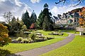
 Grange park.jpg 3 264 × 2 448; 4,17 MB
-
 Grange Public Lake - geograph.org.uk - 2035650.jpg 800 × 533; 203 KB
-
 Grange Saltings - geograph.org.uk - 4887154.jpg 640 × 389; 69 KB
-
 Grange sands park.jpg 3 264 × 2 448; 4,59 MB
-
 Grange-over Sands - geograph.org.uk - 1528468.jpg 640 × 479; 69 KB
-
 Grange-over Sands - geograph.org.uk - 1528473.jpg 640 × 479; 54 KB
-
 Grange-over-Sands (51231586737).jpg 3 648 × 2 736; 1,88 MB
-
 Grange-over-Sands (51232289991).jpg 3 648 × 2 736; 3,17 MB
-
 Grange-over-Sands (51232498763).jpg 3 648 × 2 736; 6,01 MB
-
 Grange-over-Sands (51232499728).jpg 3 648 × 2 736; 3,14 MB
-
 Grange-over-Sands (51232501393).jpg 3 648 × 2 736; 3,14 MB
-
 Grange-over-Sands (51233063969).jpg 3 648 × 2 736; 3,3 MB
-
 Grange-over-Sands (51233067274).jpg 3 648 × 2 736; 2,21 MB
-
 Grange-over-Sands (51233347125).jpg 3 648 × 2 736; 3,4 MB
-
 Grange-over-Sands (51233353950).jpg 3 648 × 2 736; 3,34 MB
-
 Grange-Over-Sands , Age UK Superstore - geograph.org.uk - 6305515.jpg 6 000 × 4 000; 6,1 MB
-
 Grange-Over-Sands , Allithwaite Road B5277 - geograph.org.uk - 6305542.jpg 6 000 × 4 000; 6,32 MB
-
 Grange-Over-Sands , Allithwaite Road B5277 - geograph.org.uk - 6305547.jpg 6 000 × 4 000; 5,65 MB
-
 Grange-Over-Sands , Alnat Industrial Park - geograph.org.uk - 6305619.jpg 6 000 × 4 000; 7,05 MB
-
 Grange-Over-Sands , Back Yewbarrow Terrace - geograph.org.uk - 6305610.jpg 6 000 × 4 000; 7,18 MB
-
 Grange-Over-Sands , Berry Bank Road - geograph.org.uk - 6305538.jpg 6 000 × 4 000; 6,49 MB
-
 Grange-Over-Sands , Blawith Cottage - geograph.org.uk - 6305494.jpg 6 000 × 4 000; 7 MB
-
 Grange-Over-Sands , Car Park - geograph.org.uk - 6305517.jpg 6 000 × 4 000; 6,3 MB
-
 Grange-Over-Sands , Cart Lane - geograph.org.uk - 6305526.jpg 6 000 × 4 000; 6,88 MB
-
 Grange-Over-Sands , Cartmel Road - geograph.org.uk - 6305601.jpg 6 000 × 4 000; 5,71 MB
-
 Grange-Over-Sands , Cedric Walk - geograph.org.uk - 6305524.jpg 6 000 × 4 000; 6,51 MB
-
 Grange-Over-Sands , Clare House - geograph.org.uk - 6305523.jpg 6 000 × 4 000; 6,71 MB
-
 Grange-Over-Sands , Driveway - geograph.org.uk - 6305598.jpg 6 000 × 4 000; 7,52 MB
-
 Grange-Over-Sands , Fernhill Road - geograph.org.uk - 6305604.jpg 6 000 × 4 000; 7,13 MB
-
 Grange-Over-Sands , Footpath - geograph.org.uk - 6305607.jpg 4 000 × 6 000; 6,05 MB
-
 Grange-Over-Sands , Grassy Field - geograph.org.uk - 6305506.jpg 6 000 × 4 000; 6,75 MB
-
 Grange-Over-Sands , Greystones - geograph.org.uk - 6305602.jpg 6 000 × 4 000; 7,02 MB
-
 Grange-Over-Sands , Kents Bank Road B5277 - geograph.org.uk - 6357855.jpg 6 000 × 4 000; 6,51 MB
-
 Grange-Over-Sands , Kents Bank Station - geograph.org.uk - 6357852.jpg 6 000 × 4 000; 5,24 MB
-
 Grange-Over-Sands , Kentsford Road - geograph.org.uk - 6357853.jpg 6 000 × 4 000; 6,44 MB
-
 Grange-Over-Sands , Kentsford Road - geograph.org.uk - 6357854.jpg 6 000 × 4 000; 6,93 MB


_plants_in_the_Yewbarrow_House_Garden_-_geograph.org.uk_-_4010898.jpg)


.jpg)


.jpg)
.jpg)


.jpg)


.jpg)
.jpg)
.jpg)
.jpg)
.jpg)
.jpg)
.jpg)
.jpg)
.jpg)


