Category:Great and Little Leighs
Jump to navigation
Jump to search
English: Great and Little Leighs is a civil parish in the Chelmsford district, in the county of Essex, England.
civil parish in Essex, England, UK | |||||
| Upload media | |||||
| Instance of | |||||
|---|---|---|---|---|---|
| Location | Chelmsford, Essex, East of England, England | ||||
 | |||||
Subcategories
This category has the following 5 subcategories, out of 5 total.
Media in category "Great and Little Leighs"
The following 115 files are in this category, out of 115 total.
-
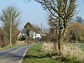
 A glimpse of Hole Farm - geograph.org.uk - 6316124.jpg 1,024 × 684; 302 KB
-
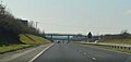
 A131 bridge over Blackley Lane - geograph.org.uk - 3358839.jpg 640 × 480; 131 KB
-
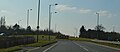
 A131, southbound - geograph.org.uk - 4964188.jpg 640 × 303; 25 KB
-
 A131, southbound - geograph.org.uk - 4971549.jpg 640 × 320; 35 KB
-
 Barn at Wakerings Farm - geograph.org.uk - 6316111.jpg 1,024 × 768; 316 KB
-
 Battery production on Mill Lane - geograph.org.uk - 3358867.jpg 640 × 428; 107 KB
-
 Blackley Lane - geograph.org.uk - 6314742.jpg 1,024 × 684; 319 KB
-
 Blackley Lane - geograph.org.uk - 6315001.jpg 1,024 × 768; 482 KB
-
 Blackley Quarry and Great Leighs Racecourse - geograph.org.uk - 6314916.jpg 1,024 × 768; 256 KB
-
 Blackley Quarry and Great Leighs Racecourse - geograph.org.uk - 6314925.jpg 1,024 × 768; 262 KB
-
 Blocked field entrance - geograph.org.uk - 3358276.jpg 640 × 480; 177 KB
-
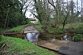
 Bridge over Straw Brook - geograph.org.uk - 2110505.jpg 2,000 × 1,333; 1.24 MB
-
 Bridge Stone - geograph.org.uk - 2110511.jpg 2,314 × 3,096; 2.53 MB
-
 Buildings in corner of plot on Banters Lane - geograph.org.uk - 6315887.jpg 1,024 × 768; 324 KB
-
 Bus stop on Main Road, Great Leighs - geograph.org.uk - 5947222.jpg 3,776 × 2,520; 4.06 MB
-
 Church gates commemorating 1953 Coronation - geograph.org.uk - 4611995.jpg 4,320 × 3,240; 2.97 MB
-
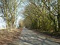
 Church Lane, Little Leighs - geograph.org.uk - 3358366.jpg 640 × 480; 225 KB
-
 Church Lane, Little Leighs - geograph.org.uk - 6315752.jpg 1,024 × 768; 446 KB
-
 Church of St John the Evangelist, Little Leighs - geograph.org.uk - 5947202.jpg 3,776 × 2,520; 3.27 MB
-
 Collecting litter on the A131 - geograph.org.uk - 3358402.jpg 640 × 480; 107 KB
-
 Entering Chartham Green, A131 - geograph.org.uk - 4970493.jpg 640 × 302; 31 KB
-
 Essex Way South of Little Leighs - geograph.org.uk - 5943532.jpg 5,184 × 3,456; 5.49 MB
-
 Essex Way under the A131 - geograph.org.uk - 5943555.jpg 5,184 × 3,456; 7.67 MB
-

-
 Field edge south of Blackley Lane - geograph.org.uk - 6314749.jpg 1,024 × 768; 456 KB
-
 Field south of Moulsham Hall Lane - geograph.org.uk - 6315874.jpg 1,024 × 768; 393 KB
-
 Field west of Paulk Hall Lane - geograph.org.uk - 6316005.jpg 1,024 × 768; 329 KB
-
 Field west of Rank's Green - geograph.org.uk - 6314146.jpg 1,024 × 768; 250 KB
-
 Field yet to be ploughed - geograph.org.uk - 3358262.jpg 640 × 480; 126 KB
-
 Footpath to Thistley Green - geograph.org.uk - 3358610.jpg 640 × 480; 163 KB
-
 Fording the River Ter, 1985 - geograph.org.uk - 2187959.jpg 640 × 428; 153 KB
-
 Garage at junction - geograph.org.uk - 6315882.jpg 1,024 × 768; 367 KB
-
 Goodmans Lane - geograph.org.uk - 6316134.jpg 1,024 × 768; 489 KB
-
 Great and Little Leighs sign - geograph.org.uk - 4207823.jpg 4,320 × 3,240; 3.45 MB
-
 Great Leighs Ford - geograph.org.uk - 3415591.jpg 3,872 × 2,592; 2.36 MB
-
 Great Leighs Racecourse - geograph.org.uk - 2134065.jpg 1,024 × 683; 184 KB
-
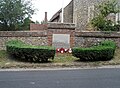 Great War memorial, Great leighs - geograph.org.uk - 4611986.jpg 4,232 × 3,120; 6.3 MB
-
 Hedgerow with tree - geograph.org.uk - 3358172.jpg 640 × 480; 136 KB
-
 Hedgerow with trees - geograph.org.uk - 3358207.jpg 640 × 480; 148 KB
-
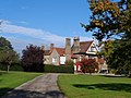
 Hole Farm and seventeenth century barn - geograph.org.uk - 4611919.jpg 4,320 × 3,240; 4.56 MB
-

-
 Houses at Hornells Corner - geograph.org.uk - 6315813.jpg 1,024 × 684; 274 KB
-
 Houses on School Lane, Great Leighs - geograph.org.uk - 6315736.jpg 1,024 × 684; 205 KB
-
 Houses, Little Leighs - geograph.org.uk - 3358330.jpg 640 × 480; 168 KB
-
 Junction of Mill Lane and Banters Lane - geograph.org.uk - 3358238.jpg 640 × 480; 114 KB
-
 Land between Church Lane and River Ter - geograph.org.uk - 6315748.jpg 1,024 × 768; 548 KB
-
 Lane towards Leez Priory - geograph.org.uk - 6315465.jpg 1,024 × 768; 331 KB
-
 Lane towards Leez Priory - geograph.org.uk - 6315477.jpg 1,024 × 684; 252 KB
-
 Lane towards Leez Priory - geograph.org.uk - 6315481.jpg 1,024 × 768; 411 KB
-
 Lavender Bridge - geograph.org.uk - 3358295.jpg 640 × 480; 200 KB
-
 Lavender Bridge - geograph.org.uk - 6315758.jpg 1,024 × 768; 404 KB
-
 Leighs Road meets Boreham Road - geograph.org.uk - 6316118.jpg 1,024 × 768; 403 KB
-
 Longs Lane - geograph.org.uk - 3358127.jpg 640 × 480; 164 KB
-
 Lyons Hall, Great Leighs - geograph.org.uk - 4207758.jpg 4,320 × 3,240; 5.22 MB
-
 Meadow by the River Ter - geograph.org.uk - 1319413.jpg 640 × 425; 104 KB
-
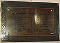
 Memorial Plaque to Captain Alan George Tritton - geograph.org.uk - 3926898.jpg 1,709 × 909; 278 KB
-
 Memorial Plaque to Captain William Montagu Hughes~Hughes - geograph.org.uk - 3910729.jpg 2,003 × 1,260; 511 KB
-
 Mill Lane - geograph.org.uk - 6314243.jpg 1,024 × 768; 362 KB
-
 Moulsham Hall Lane roundabout - geograph.org.uk - 2946742.jpg 1,600 × 1,200; 567 KB
-
 Moulsham Hall Lane roundabout - geograph.org.uk - 2947695.jpg 1,600 × 1,200; 532 KB
-
 Moulsham Hall Lane Roundabout, A131 - geograph.org.uk - 4964186.jpg 640 × 275; 25 KB
-
 On the Essex Way, W of Fuller Street - geograph.org.uk - 4647170.jpg 1,024 × 768; 179 KB
-
 Path in Moat Wood - geograph.org.uk - 4039092.jpg 3,648 × 2,736; 4.82 MB
-
 Paulk Hall Lane - geograph.org.uk - 6315896.jpg 1,024 × 768; 587 KB
-
 Paulk Hall Lane - geograph.org.uk - 6316012.jpg 1,024 × 768; 525 KB
-
 Ploughed field by Blackley Lane - geograph.org.uk - 3358825.jpg 640 × 480; 143 KB
-
 Ploughed field west of Rank's Green - geograph.org.uk - 6314147.jpg 1,024 × 768; 425 KB
-
 Pond by Noakes Lane - geograph.org.uk - 3295062.jpg 640 × 480; 219 KB
-
 Power pole near Rectory Lane - geograph.org.uk - 3358443.jpg 640 × 480; 137 KB
-
 Public footpath to Mill Lane, Great Leighs - geograph.org.uk - 4039095.jpg 3,648 × 2,736; 3.62 MB
-
 Rectory Lane joins Felsted Road - geograph.org.uk - 6315731.jpg 1,024 × 768; 329 KB
-
 Rectory Lane, Little Leighs - geograph.org.uk - 5943545.jpg 5,184 × 3,456; 5.34 MB
-
 Rectory Lane, Little Leighs - geograph.org.uk - 6315700.jpg 1,024 × 768; 384 KB
-
 River Ter upstream of Lavender Bridge - geograph.org.uk - 6315761.jpg 768 × 1,024; 490 KB
-
 Road towards Rank's Green - geograph.org.uk - 6314153.jpg 1,024 × 768; 424 KB
-
 Roundabout on the A131, Little Leighs - geograph.org.uk - 2946182.jpg 1,600 × 1,200; 516 KB
-
 Roundabout on the A131, Little Leighs - geograph.org.uk - 2946737.jpg 1,600 × 1,200; 486 KB
-
 Roundabout, A131 - geograph.org.uk - 4970472.jpg 640 × 326; 31 KB
-
 School Lane Bridge, A131 - geograph.org.uk - 4964190.jpg 640 × 269; 23 KB
-
 Silage and horses - geograph.org.uk - 6314236.jpg 1,024 × 684; 229 KB
-
 Small plantation SE of Willows Green - geograph.org.uk - 6314999.jpg 1,024 × 684; 288 KB
-
 Small wood west of Rectory Lane - geograph.org.uk - 6315722.jpg 1,024 × 768; 363 KB
-
 Spring by Essex Way at Great Leighs - geograph.org.uk - 2110523.jpg 3,141 × 2,232; 5.86 MB
-
 St Anne's Castle, Great Leighs - geograph.org.uk - 4207836.jpg 4,320 × 3,240; 4.29 MB
-
 St. John the Evangelist Church, Little Leighs - geograph.org.uk - 5943507.jpg 5,184 × 3,456; 7.19 MB
-

-
 Start of footpath off Blackley Lane - geograph.org.uk - 6314718.jpg 1,024 × 768; 299 KB
-
 Straw Brook - geograph.org.uk - 6316129.jpg 1,024 × 768; 569 KB
-
 The Castle Inn, Great Leighs - geograph.org.uk - 5943593.jpg 5,184 × 3,456; 5.42 MB
-
 The edge of Sandylay Wood - geograph.org.uk - 4039088.jpg 3,648 × 2,736; 4.97 MB
-
 The Essex Way 63, Little Leighs - geograph.org.uk - 1904821.jpg 640 × 426; 75 KB
-
 The Essex Way 64, Cottage Garden - geograph.org.uk - 2068117.jpg 640 × 426; 139 KB
-
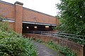
 The Essex Way 65, Underpass - geograph.org.uk - 2068119.jpg 640 × 484; 114 KB
-
 The Essex Way 66 - geograph.org.uk - 2068123.jpg 640 × 426; 76 KB
-
 The Essex Way 67 - geograph.org.uk - 2068126.jpg 640 × 425; 76 KB
-
 The Essex Way 68 - geograph.org.uk - 2068135.jpg 640 × 425; 69 KB
-

-
 The Essex Way passing underneath the A131 - geograph.org.uk - 5947212.jpg 3,776 × 2,520; 4.09 MB
-
 Tree at the Corner of Leighs Road and Boreham Road - geograph.org.uk - 4207735.jpg 3,420 × 2,634; 4.42 MB
-
 Tree in ploughed field - geograph.org.uk - 3358186.jpg 640 × 480; 203 KB
-
 Trees along Felsted Road - geograph.org.uk - 6315830.jpg 1,024 × 684; 276 KB
-
 Trees by River Ter - geograph.org.uk - 6315763.jpg 1,024 × 768; 353 KB
-
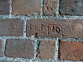 Victorian graffiti (2), St Mary the Virgin - geograph.org.uk - 4207800.jpg 4,320 × 3,240; 5.64 MB
-
 Victorian graffiti, St Mary the Virgin (3) - geograph.org.uk - 4207802.jpg 4,320 × 3,240; 5.27 MB
-
 Victorian graffiti, St Mary the Virgin - geograph.org.uk - 4207797.jpg 4,320 × 3,240; 5.3 MB
-
 View towards plantation north of Hornells Corner - geograph.org.uk - 6315871.jpg 1,024 × 768; 256 KB
-
 Wakerings Cottage on Leighs Road - geograph.org.uk - 6316112.jpg 1,024 × 768; 409 KB
-
 Wakerings Farmhouse - geograph.org.uk - 4207713.jpg 4,320 × 3,240; 4.54 MB
-
-
 Whites Lane - geograph.org.uk - 5943562.jpg 5,184 × 3,456; 5.59 MB
-
 Whites Lane Bridge, A131 - geograph.org.uk - 4970465.jpg 640 × 398; 28 KB
-
 Whites Lane leading to Great Leighs - geograph.org.uk - 5947204.jpg 3,776 × 2,520; 3.08 MB
-
 Willows Green, Felsted - geograph.org.uk - 2279992.jpg 640 × 472; 43 KB
-
 Woodland path in Phyllis Currie Nature Reserve - geograph.org.uk - 4039076.jpg 2,736 × 2,736; 3.89 MB
-
 Woodland path in Phyllis Currie Nature Reserve - geograph.org.uk - 4039081.jpg 3,648 × 2,736; 5.21 MB


,_St_Mary_the_Virgin_-_geograph.org.uk_-_4207800.jpg)
_-_geograph.org.uk_-_4207802.jpg)


