Category:Greenwich (district of London)
둘러보기로 이동
검색으로 이동
town in south-east London, England  | |||||
| 미디어 올리기 | |||||
| 다음 종류에 속함 | |||||
|---|---|---|---|---|---|
| 위치 |
| ||||
| 다음 유역을 끼고 있음 | |||||
| 면적 |
| ||||
| 다음과 다름 | |||||
 | |||||
하위 분류
다음은 이 분류에 속하는 하위 분류 58개 가운데 58개입니다.
B
- Burney Street (9 F)
C
- Circus Street, Greenwich (4 F)
- Cutty Sark DLR station (27 F)
D
- Diamond Terrace (6 F)
F
- Feathers Place, Greenwich (5 F)
G
- Gloucester Circus (23 F)
- Greenwich Pier (37 F)
- Greenwich South Street (11 F)
H
K
L
- Lassell Street, Greenwich (7 F)
M
- Manna Mead (2 F)
N
- Nevada Street, Greenwich (8 F)
O
P
- Paragon House, Greenwich (2 F)
Q
R
T
W
- West Grove, Greenwich (10 F)
"Greenwich (district of London)" 분류에 속하는 미디어
다음은 이 분류에 속하는 파일 110개 가운데 110개입니다.
-
 19990911 27 Greenwich, London.jpg 1,800 × 1,174; 280 KB
-
 A102 heading to Blackwall Tunnel. - geograph.org.uk - 377581.jpg 640 × 480; 102 KB
-
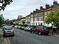 Ashburnham Grove, Greenwich - geograph.org.uk - 4450007.jpg 2,272 × 1,704; 825 KB
-
 Ashburnham Retreat, play street - geograph.org.uk - 1954933.jpg 640 × 480; 98 KB
-
 Azof St - geograph.org.uk - 2929227.jpg 640 × 430; 64 KB
-
 Azof St - geograph.org.uk - 2929244.jpg 640 × 413; 62 KB
-
 Azof Street, North Greenwich - geograph.org.uk - 1163980.jpg 640 × 480; 144 KB
-
 Ballast Quay - geograph.org.uk - 1343139.jpg 640 × 457; 321 KB
-
 Bellot memorial in Greenwich. View from the Thames.jpg 4,677 × 3,900; 13.84 MB
-
 Caradoc Street, Greenwich - geograph.org.uk - 3850518.jpg 3,488 × 2,616; 2.18 MB
-
 Chimneys on Ashburnham Grove - geograph.org.uk - 1954922.jpg 640 × 480; 114 KB
-
 Christchurch Way, Greenwich - geograph.org.uk - 3850572.jpg 3,488 × 2,616; 2.16 MB
-
 Churchfields, Greenwich - geograph.org.uk - 4451572.jpg 2,272 × 1,704; 790 KB
-
 Crooms Hill Grove - geograph.org.uk - 3050296.jpg 1,024 × 768; 312 KB
-
De-Greenwich.ogg 1.7 s; 17 KB
-
 Devonshire Drive, Greenwich - geograph.org.uk - 4449997.jpg 2,272 × 1,704; 770 KB
-
 Earlswood Street, Greenwich - geograph.org.uk - 3850539.jpg 3,488 × 2,616; 1.82 MB
-
 Egerton Drive, Greenwich - geograph.org.uk - 4449989.jpg 2,272 × 1,704; 786 KB
-
En-uk-Greenwich.ogg 1.9 s; 33 KB
-
 Enderby St - geograph.org.uk - 2935673.jpg 640 × 430; 67 KB
-
 Erectile function (36428628665).jpg 2,662 × 4,002; 5.4 MB
-
 Farmdale Road, Greenwich - geograph.org.uk - 4191151.jpg 3,488 × 2,616; 2.2 MB
-
 Gate and Ripples (4902853107).jpg 3,120 × 4,680; 4.26 MB
-
 Gibson Street, Greenwich - geograph.org.uk - 3850501.jpg 3,488 × 2,616; 2.21 MB
-
-
 Gravestone Eyes (4902812851).jpg 4,752 × 3,168; 5.67 MB
-
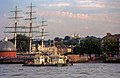
 GreatRiverRace09.JPG 2,048 × 1,536; 1.21 MB
-
 Greenwich - geograph.org.uk - 1953467.jpg 1,024 × 768; 235 KB
-
 Greenwich - Romney Road - View South on Devonport House.jpg 5,984 × 3,988; 20.91 MB
-
 Greenwich Church Street as seen from the side of the Cutty Sark.jpg 5,284 × 3,533; 3.94 MB
-
 Greenwich London June 2016.jpg 4,320 × 2,700; 3.89 MB
-
 Greenwich Pleasaunce.jpg 5,184 × 3,456; 8.21 MB
-
 Greenwich Police Station, London.png 1,090 × 728; 1.26 MB
-
 Greenwich Shopping Park - geograph.org.uk - 2079806.jpg 2,048 × 1,536; 1.11 MB
-
-
 Greenwich, Walnut Tree Road - geograph.org.uk - 2999634.jpg 3,456 × 2,304; 4.61 MB
-
 Greenwich, with London in the distance. Engraving by E. Find Wellcome V0013249.jpg 3,396 × 2,244; 3.8 MB
-
 Greenwich, with London in the distance. Lithograph by or aft Wellcome V0013240.jpg 3,000 × 2,386; 3.4 MB
-
 Greenwich, with trees in the foreground, London in the dista Wellcome V0013329.jpg 3,100 × 2,352; 3.55 MB
-
 Guildford Grove, Greenwich - geograph.org.uk - 4449983.jpg 2,272 × 1,704; 701 KB
-
 Guildford Grove, Greenwich - geograph.org.uk - 4449993.jpg 2,272 × 1,704; 762 KB
-
 Haddo Street, Greenwich - geograph.org.uk - 4703965.jpg 3,264 × 2,448; 1.9 MB
-
 Hardy Cottages, Eastney Street, Greenwich - geograph.org.uk - 2701223.jpg 1,024 × 768; 317 KB
-
 Horseferry Place, Greenwich - geograph.org.uk - 4703962.jpg 3,264 × 2,448; 1.81 MB
-
 Houses opposite St Alfege's - geograph.org.uk - 4160494.jpg 640 × 443; 88 KB
-
 Hyde Vale conduit head.jpg 2,448 × 3,264; 3.84 MB
-
 Langdale Road - geograph.org.uk - 4300883.jpg 1,024 × 768; 156 KB
-
 Langdale Road, Greenwich - geograph.org.uk - 4450022.jpg 2,272 × 1,704; 777 KB
-
 Lassell Street, Greenwich - geograph.org.uk - 3850497.jpg 3,488 × 2,616; 1.67 MB
-
 Lindsell Street, Greenwich - geograph.org.uk - 4449968.jpg 2,272 × 1,704; 763 KB
-
 Listed road surface, Pelton Road - geograph.org.uk - 3488653.jpg 1,024 × 768; 297 KB
-
 London 5970.jpg 1,280 × 800; 1.02 MB
-
 Mauritius Road, Greenwich - geograph.org.uk - 3850581.jpg 3,488 × 2,616; 2.17 MB
-
 Mauritius Road, North Greenwich - geograph.org.uk - 1163962.jpg 640 × 480; 120 KB
-
 Narrow side street - Greenwich - geograph.org.uk - 1899170.jpg 1,600 × 1,200; 542 KB
-
 No entry except cycles - geograph.org.uk - 3488659.jpg 1,024 × 768; 316 KB
-
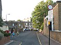
 Norman Road, Greenwich High Road - geograph.org.uk - 2192319.jpg 800 × 600; 218 KB
-
 Old Pearson Street, Greenwich - geograph.org.uk - 3339731.jpg 640 × 480; 106 KB
-
 Old Royal Naval College, central building.jpg 5,470 × 3,656; 6.6 MB
-
 Orlop Street from the east end - geograph.org.uk - 3405536.jpg 1,024 × 768; 265 KB
-
 Orlop Street from the west end - geograph.org.uk - 3405527.jpg 1,024 × 768; 194 KB
-
 Pelton Road - geograph.org.uk - 3405612.jpg 800 × 600; 167 KB
-
 Pelton Road, Greenwich - geograph.org.uk - 3850528.jpg 3,488 × 2,616; 2.18 MB
-
 Pelton Road, looking east - geograph.org.uk - 3488673.jpg 1,024 × 768; 290 KB
-
 Plumbridge Street, Greenwich - geograph.org.uk - 4449964.jpg 2,272 × 1,704; 737 KB
-
 Point Hill, downwards - geograph.org.uk - 3051773.jpg 1,024 × 768; 132 KB
-
 Point Hill, Greenwich - geograph.org.uk - 4230286.jpg 5,400 × 3,600; 1.71 MB
-
 Point Hill, upwards - geograph.org.uk - 3051781.jpg 1,024 × 768; 171 KB
-
 Prince of Orange Lane, Greenwich - geograph.org.uk - 4162183.jpg 3,488 × 2,616; 2.62 MB
-
 Prior Street, Greenwich - geograph.org.uk - 4450033.jpg 2,272 × 1,704; 777 KB
-
 Prior Street, Greenwich - geograph.org.uk - 4451554.jpg 2,272 × 1,704; 759 KB
-
 Queen Elizabeth's College, Greenwich High Road.jpg 5,470 × 3,656; 8.21 MB
-
 Randall Place, Greenwich - geograph.org.uk - 4451579.jpg 2,272 × 1,704; 746 KB
-
 River Thames, looking west from Greenwich (29613879092).jpg 2,048 × 1,367; 933 KB
-
 Riverside walk in Greenwich - geograph.org.uk - 3515001.jpg 1,500 × 1,000; 134 KB
-
 Roan Street, Greenwich - geograph.org.uk - 2661920.jpg 640 × 480; 76 KB
-
 Roan Street, Greenwich - geograph.org.uk - 4451585.jpg 2,272 × 1,704; 786 KB
-
 Roan Street, Greenwich - geograph.org.uk - 4703976.jpg 3,264 × 2,448; 1.47 MB
-
 Roan Street, looking east - geograph.org.uk - 3375800.jpg 1,024 × 768; 177 KB
-

-
 Royal Naval College, Queen Anne Court - geograph.org.uk - 3624018.jpg 640 × 481; 228 KB
-

-
 Royal Place, Greenwich - geograph.org.uk - 4450058.jpg 2,272 × 1,704; 831 KB
-
 Rush hour on the A102 - geograph.org.uk - 205323.jpg 618 × 445; 164 KB
-
 Scene around the Cutty Sark - geograph.org.uk - 3588056.jpg 1,600 × 1,064; 336 KB
-
 Shops on Royal Hill - geograph.org.uk - 2792586.jpg 1,024 × 768; 225 KB
-
 Sitting by the Thames Path - geograph.org.uk - 2190967.jpg 3,440 × 2,532; 1.5 MB
-
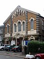 South Street Baptist Chapel.jpg 3,456 × 4,608; 2.68 MB
-
 Straightsmouth, Greenwich - geograph.org.uk - 4300910.jpg 1,024 × 768; 110 KB
-
 Straightsmouth, Greenwich - geograph.org.uk - 4451570.jpg 2,272 × 1,704; 691 KB
-
 Sunset over Greenwich.jpg 4,032 × 3,024; 1.55 MB
-
 Take a seat in Greenwich (37052370306).jpg 2,484 × 2,484; 4.18 MB
-
 Tea time.jpg 2,420 × 2,112; 718 KB
-
-

-
 Terraced houses, Pelton St - geograph.org.uk - 2935663.jpg 640 × 430; 59 KB
-
 Thames Path - geograph.org.uk - 3272520.jpg 640 × 480; 95 KB
-
 Thames Path to Greenwich - geograph.org.uk - 3499896.jpg 1,500 × 1,000; 140 KB
-

-
 The Good Old Days - Aug 2019 - Greenwich Waterfront.jpg 4,630 × 2,990; 3.3 MB
-
 The Jack in the Green by the River Thames.jpg 4,896 × 2,752; 7.5 MB
-
 The Queen and Adm Jonathon Band in 2006.JPG 800 × 594; 150 KB
-
 The Thames Path by Greenwich Power Station - geograph.org.uk - 3871740.jpg 1,500 × 999; 162 KB
-
 The Trafalgar Tavern - geograph.org.uk - 3588030.jpg 1,600 × 1,064; 351 KB
-
 Thomas Rowlandson - Greenwich - Google Art Project.jpg 6,604 × 4,005; 7.73 MB
-
 Through the Pillars (4903432058).jpg 3,168 × 4,752; 4.9 MB
-
 View over Greenwich. - geograph.org.uk - 2030238.jpg 1,024 × 768; 198 KB
-
 View west from Shooter's Hill.jpg 6,000 × 4,000; 4.02 MB
-
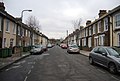
 Westerdale Road, Greenwich - geograph.org.uk - 4191138.jpg 3,488 × 2,616; 2.21 MB
-
 Wired - panoramio.jpg 2,032 × 1,356; 855 KB


.jpg)

.jpg)


.jpg)


.jpg)


.jpg)


.jpg)


