Category:Groenburgwal 38, Amsterdam
Jump to navigation
Jump to search
| Object location | | View all coordinates using: OpenStreetMap |
|---|
 | |||||
| Upload media | |||||
| Instance of |
| ||||
|---|---|---|---|---|---|
| Location | Amsterdam, North Holland, Netherlands | ||||
| Street address |
| ||||
| Located on street | |||||
| Heritage designation |
| ||||
 | |||||
|
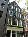
This is a category about rijksmonument number 1267
|
| Address |
|
Media in category "Groenburgwal 38, Amsterdam"
The following 3 files are in this category, out of 3 total.
-
 Amsterdam - Groenburgwal 38.JPG 2,736 × 3,648; 4.16 MB
-
 Groenburgwal met Engelse Episc.Kerk - Amsterdam - 20016958 - RCE.jpg 1,200 × 871; 290 KB
-
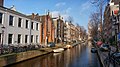 Nieuwmarkt en Lastage, Amsterdam, Netherlands - panoramio (22).jpg 2,048 × 1,148; 526 KB

.jpg)