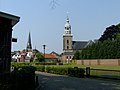
Category:Grote Kerk, Almelo
Jump to navigation
Jump to search
| Object location | | View all coordinates using: OpenStreetMap |
|---|
 | |||||
| Upload media | |||||
| Instance of |
| ||||
|---|---|---|---|---|---|
| Location | Almelo, Overijssel, Netherlands | ||||
| Street address |
| ||||
| Heritage designation |
| ||||
 | |||||
Nederlands: Grote Kerk - anno 1493
Kerk
|
This is a category about rijksmonument number 7487
|
Toren
|
This is a category about rijksmonument number 7488
|
| Address |
|
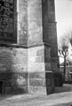
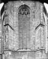
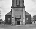
Media in category "Grote Kerk, Almelo"
The following 50 files are in this category, out of 50 total.
-
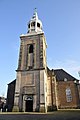
 Almelo-Church.JPG 2,272 × 1,704; 745 KB
-
 Bezetters in hun bedden in de kerk, Bestanddeelnr 930-4511.jpg 3,664 × 2,436; 1.44 MB
-

-
 Boven ingang - Almelo - 20006977 - RCE.jpg 1,200 × 807; 256 KB
-
 De Grote Kerk in Almelo, Bestanddeelnr 930-4227.jpg 2,442 × 3,682; 1.39 MB
-
 Detail - Almelo - 20006978 - RCE.jpg 808 × 1,200; 198 KB
-
 Exterieur - Almelo - 20006964 - RCE.jpg 820 × 1,200; 245 KB
-
 Exterieur KOOR, NOORDGEVEL - Almelo - 20276053 - RCE.jpg 1,200 × 951; 280 KB
-
-
 Exterieur KOOR, ZUIDZIJDE (LATERE TOEVOEGING) - Almelo - 20276055 - RCE.jpg 1,200 × 960; 257 KB
-
 Exterieur KOOR, ZUIDZIJDE (LATERE TOEVOEGING) - Almelo - 20276056 - RCE.jpg 1,200 × 960; 289 KB
-
 Exterieur NOORDGEVEL - Almelo - 20276050 - RCE.jpg 1,200 × 946; 264 KB
-
 Exterieur NOORDGEVEL, INGANGSPARTIJ - Almelo - 20276052 - RCE.jpg 960 × 1,200; 352 KB
-
 Exterieur TOREN, SCHIP, NOORDGEVEL - Almelo - 20276051 - RCE.jpg 947 × 1,200; 273 KB
-
 Exterieur TOREN, WESTGEVEL - Almelo - 20276049 - RCE.jpg 969 × 1,200; 281 KB
-
 Exterieur TOREN, WESTGEVEL, INGANGSPARTIJ - Almelo - 20276048 - RCE.jpg 953 × 1,200; 297 KB
-
 Exterieur WESTGEVEL - Almelo - 20276047 - RCE.jpg 1,200 × 947; 230 KB
-
 Exterieur ZUIDGEVEL, INGANGSPARTIJ - Almelo - 20276057 - RCE.jpg 960 × 1,200; 344 KB
-
 Gezicht op Nederlands Hervormde Toren - Almelo - 20006933 - RCE.jpg 1,200 × 802; 226 KB
-
 Grote Kerk Almelo (4150486721).jpg 680 × 1,024; 185 KB
-
 Grote Kerk Almelo.JPG 1,952 × 2,576; 1.51 MB
-
 Grote Kerk church Almelo 2019.jpg 3,264 × 4,928; 6.54 MB
-
 Ingangspartij - Almelo - 20006972 - RCE.jpg 894 × 1,200; 295 KB
-
 Ingangspartij kerk - Almelo - 20006971 - RCE.jpg 807 × 1,200; 204 KB
-

-
 Interieur, aanzicht orgel, orgelnummer 36 - Almelo - 20359289 - RCE.jpg 958 × 1,200; 177 KB
-
 Interieur, epitaaf van Carel August van Rechteren - Almelo - 20006967 - RCE.jpg 1,200 × 854; 217 KB
-
 Interieur, grafmonument - Almelo - 20006965 - RCE.jpg 891 × 1,200; 128 KB
-

-
 Interieur, herenbank - Almelo - 20006969 - RCE.jpg 1,200 × 849; 130 KB
-
 INTERIEUR, KOOR, GRAFMONUMENT - Almelo - 20276064 - RCE.jpg 958 × 1,200; 138 KB
-
 INTERIEUR, KOOR, ZUIDGEVEL, ROUWBORD (1779) - Almelo - 20276065 - RCE.jpg 1,192 × 1,200; 219 KB
-
 Interieur, naar de voorgevel - Almelo - 20276013 - RCE.jpg 960 × 1,200; 188 KB
-
 INTERIEUR, NOORDWEST GEVEL, HERENBANK - Almelo - 20276062 - RCE.jpg 951 × 1,200; 187 KB
-
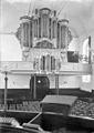 Interieur, orgel - Almelo - 20006968 - RCE.jpg 850 × 1,200; 164 KB
-
 INTERIEUR, ORGEL - Almelo - 20276059 - RCE.jpg 1,190 × 1,200; 225 KB
-
 INTERIEUR, ORGEL - Almelo - 20276063 - RCE.jpg 951 × 1,200; 202 KB
-
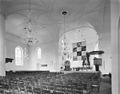 INTERIEUR, OVERZICHT NAAR HET NOORDOOSTEN - Almelo - 20276060 - RCE.jpg 1,200 × 944; 177 KB
-
 INTERIEUR, OVERZICHT NAAR HET NOORDWESTEN - Almelo - 20276058 - RCE.jpg 1,200 × 953; 186 KB
-
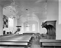 INTERIEUR, OVERZICHT NAAR HET ZUIDEN - Almelo - 20276061 - RCE.jpg 1,200 × 960; 168 KB
-
 Kerk - Almelo - 20006970 - RCE.jpg 804 × 1,200; 161 KB
-
 Klokkenvordering-ornament-Almelo-NHKerk-RCE.jpg 1,314 × 982; 449 KB
-
 Met Kerkstraat - Almelo - 20006976 - RCE.jpg 816 × 1,200; 193 KB
-
 Oost-zijde - Almelo - 20006975 - RCE.jpg 1,200 × 813; 379 KB
-
 Toren naar het noordoosten gezien - Almelo - 20006961 - RCE.jpg 886 × 1,200; 188 KB
-

-
 West ingang - Almelo - 20006963 - RCE.jpg 822 × 1,200; 290 KB
-
 Westgevel met toren - Almelo - 20006973 - RCE.jpg 894 × 1,200; 200 KB
-
 Zuid-ingang - Almelo - 20006962 - RCE.jpg 846 × 1,200; 250 KB
-
 Zuid-oost zijde - Almelo - 20006974 - RCE.jpg 820 × 1,200; 230 KB


_-_Almelo_-_20276055_-_RCE.jpg)
_-_Almelo_-_20276056_-_RCE.jpg)


.jpg)


_-_Almelo_-_20276065_-_RCE.jpg)


