Category:Grote Markt 38 (Groningen)
Jump to navigation
Jump to search
| Object location | | View all coordinates using: OpenStreetMap |
|---|
 | |||||
| Upload media | |||||
| Instance of |
| ||||
|---|---|---|---|---|---|
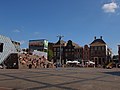
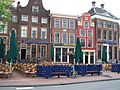
| Location | Groningen, Netherlands | ||||
| Street address |
| ||||
| Heritage designation |
| ||||
 | |||||
|
This is a category about rijksmonument number 18471
|
| Address |
|
Media in category "Grote Markt 38 (Groningen)"
The following 10 files are in this category, out of 10 total.
-
 Drie gezusters Groningen.jpg 3,648 × 2,736; 4.61 MB
-
 Groningen (2769885805).jpg 3,888 × 2,592; 4.07 MB
-
 Grooningen3sisters.jpg 2,576 × 1,932; 1.4 MB
-
 Grote Markt - horeca.jpg 4,896 × 3,264; 10.25 MB
-
 Grote Markt 38.JPG 2,448 × 3,264; 2.37 MB
-
 Grote markt zuidzijde.jpg 2,560 × 1,920; 1.65 MB
-
 Grote Markt zuidzijde.jpg 2,816 × 2,112; 1.64 MB
-
 Voorgevels - Groningen - 20093819 - RCE.jpg 809 × 1,200; 196 KB
-
 Wand - Groningen - 20093769 - RCE.jpg 1,200 × 802; 203 KB
-
 Zuid-zijde hotel de Doelen - Groningen - 20093766 - RCE.jpg 1,200 × 828; 177 KB

.jpg)


