Category:Grotekerksbuurt 2, Dordrecht
Jump to navigation
Jump to search
| Object location | | View all coordinates using: OpenStreetMap |
|---|
.jpg) | |||||
| Upload media | |||||
| Instance of |
| ||||
|---|---|---|---|---|---|
| Location | Dordrecht, South Holland, Netherlands | ||||
| Street address |
| ||||
| Located on street | |||||
| Heritage designation |
| ||||
 | |||||
|
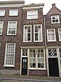
This is a category about rijksmonument number 13393
|
| Address |
|
Media in category "Grotekerksbuurt 2, Dordrecht"
The following 5 files are in this category, out of 5 total.
-
 Bij Raadhuisplein weggebroken achterzijde - Dordrecht - 20061935 - RCE.jpg 1,200 × 960; 238 KB
-
 Groenmarkt, 3311 Dordrecht, Netherlands - panoramio (27).jpg 4,896 × 3,264; 2.69 MB
-
 Overzicht - Dordrecht - 20061945 - RCE.jpg 1,200 × 804; 168 KB
-
 RM13393 Dordrecht - Grotekerksbuurt 2.jpg 2,448 × 3,264; 2.08 MB
-


.jpg)

